| Revision as of 10:44, 11 March 2024 editMarkussep (talk | contribs)Autopatrolled, Extended confirmed users, Page movers, Pending changes reviewers, Template editors558,191 editsmNo edit summary← Previous edit |
Latest revision as of 02:02, 27 October 2024 edit undoMonkbot (talk | contribs)Bots3,695,952 editsm Task 20: replace {lang-??} templates with {langx|??} ‹See Tfd› (Replaced 1);Tag: AWB |
| (2 intermediate revisions by one other user not shown) |
| Line 8: |
Line 8: |
|
|periphunit = ] |
|
|periphunit = ] |
|
|municipality = ] |
|
|municipality = ] |
|
|pop_municunit = 4088 |
|
|pop_municunit = 3468 |
|
|pop_community = 750 |
|
|pop_community = 606 |
|
|population_as_of = 2011 |
|
|population_as_of = 2021 |
|
|population_ref = |
|
|population_ref = |
|
|area_municunit = 101.4 |
|
|area_municunit = 101.4 |
| Line 25: |
Line 25: |
|
|districts = |
|
|districts = |
|
}} |
|
}} |
|
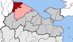
'''Evrostina''' ({{lang-el|Ευρωστίνα}}) is a village and a former municipality in ], ], ]. Since the 2011 local government reform it is part of the municipality ], of which it is a municipal unit.<ref name=Kallikratis>{{Cite web|url=http://www.et.gr/idocs-nph/search/pdfViewerForm.html?args=5C7QrtC22wGYK2xFpSwMnXdtvSoClrL81-32jgAMSfbnMRVjyfnPUeJInJ48_97uHrMts-zFzeyCiBSQOpYnT00MHhcXFRTsb2fGphpq4MKX2ZkaHobySNnvZCNHXvYVvlf80XevW0Q.|title=ΦΕΚ B 1292/2010, Kallikratis reform municipalities|language=el|publisher=]}}</ref> The municipal unit has an area of 101.415 km<sup>2</sup>.<ref name=stat01>{{cite web |url=http://dlib.statistics.gr/Book/GRESYE_02_0101_00098%20.pdf |publisher=National Statistical Service of Greece |title=Population & housing census 2001 (incl. area and average elevation) |language=el |url-status=dead |archiveurl=https://web.archive.org/web/20150921212047/http://dlib.statistics.gr/Book/GRESYE_02_0101_00098%20.pdf |archivedate=2015-09-21 }}</ref> The seat of administration of the former municipality was the town ]. |
|
'''Evrostina''' ({{langx|el|Ευρωστίνα}}) is a village and a former municipality in ], ], ]. Since the 2011 local government reform it is part of the municipality ], of which it is a municipal unit.<ref name=Kallikratis>{{Cite web|url=http://www.et.gr/idocs-nph/search/pdfViewerForm.html?args=5C7QrtC22wGYK2xFpSwMnXdtvSoClrL81-32jgAMSfbnMRVjyfnPUeJInJ48_97uHrMts-zFzeyCiBSQOpYnT00MHhcXFRTsb2fGphpq4MKX2ZkaHobySNnvZCNHXvYVvlf80XevW0Q.|title=ΦΕΚ B 1292/2010, Kallikratis reform municipalities|language=el|publisher=]}}</ref> The municipal unit has an area of 101.415 km<sup>2</sup>.<ref name=stat01>{{cite web |url=http://dlib.statistics.gr/Book/GRESYE_02_0101_00098%20.pdf |publisher=National Statistical Service of Greece |title=Population & housing census 2001 (incl. area and average elevation) |language=el |url-status=dead |archiveurl=https://web.archive.org/web/20150921212047/http://dlib.statistics.gr/Book/GRESYE_02_0101_00098%20.pdf |archivedate=2015-09-21 }}</ref> The seat of administration of the former municipality was the town ]. |
|
|
|
|
|
==Geography== |
|
==Geography== |
| Line 37: |
Line 37: |
|
*] (Kallithea, Skoupaiika) |
|
*] (Kallithea, Skoupaiika) |
|
*] |
|
*] |
|
*] |
|
*] |
|
*] |
|
*] |
|
*] (Sarantapicho, Sarantapichiotika) |
|
*] (Sarantapicho, Sarantapichiotika) |
| Line 55: |
Line 55: |
|
|- |
|
|- |
|
| 2011 || 750 || 4,088 |
|
| 2011 || 750 || 4,088 |
|
|
|- |
|
|
| 2021 || 606 || 3,468 |
|
|} |
|
|} |
|
|
|
|
|
==See also== |
|
==See also== |
|
|
|
|
*] |
|
*] |
|
|
|
|
Evrostina is a mountain village, situated at about 650 m elevation between the mountain Mavro oros (elevation 1757 m) to the south and the mountain Evrostina (elevation 1208 m) to the northwest. The most populous village of the municipal unit, Derveni, is 7 km to the north on the coast of the Gulf of Corinth. Evrostina is 20 km west of Xylokastro and 50 km west of Corinth.
The municipal unit Evrostina is subdivided into the following communities (constituent villages in brackets):

