| Revision as of 02:10, 20 October 2006 editOniows (talk | contribs)1,000 editsm →Government and politics: link Ket. blvd← Previous edit | Revision as of 19:34, 20 October 2006 edit undoRan (talk | contribs)17,293 edits the only way the fair use logo can be allowed as part of this article is if it is in article space.Next edit → | ||
| Line 1: | Line 1: | ||
| :''This article is about the capital city of the {{flagicon|Republic of China}} ]. For the county, see ].'' | :''This article is about the capital city of the {{flagicon|Republic of China}} ]. For the county, see ].'' | ||
| {| border="1" cellpadding="2" cellspacing="0" align="right" width="300px" style="float: right; margin-left: 2em; margin-bottom: 1ex; width: 300px;" | |||
| {{taipei infobox}} | |||
| !colspan="2" bgcolor="BBDDFF" | <big><big>Taipei City (臺北市) | |||
| |-bgcolor="#FFFFFF" | |||
| |- | |||
| | align="center" colspan=2 | | |||
| <table border="0" cellpadding="2" cellspacing="0"> | |||
| <tr><td align="center" width="140px">] | |||
| </td><td align="center" width="140px">] | |||
| </td></tr> | |||
| <tr><td align="center" width="140px">'''City ]'''</td> | |||
| <td align="center" width="140px">'''City ]'''</td> | |||
| </tr> | |||
| </table> | |||
| </td></tr></tr> | |||
| <tr><td align="center" colspan=2 style="border-bottom:3px solid gray; border-top:3px solid gray;"><font size="-1"> | |||
| ''']''': ''the City of ]s'' | |||
| |- | |||
| !colspan="2" bgcolor="BBDDFF" | Government | |||
| |-bgcolor="#FFFFFF" | |||
| <tr><td>'''Official Website'''</td><td> | |||
| </font></td></tr> | |||
| <tr><td>''']'''</td><td>]</td></tr> | |||
| <tr><td>'''] District'''</td><td>]</td></tr> <tr> | |||
| !colspan="2" bgcolor="BBDDFF" | Geographical characteristics | |||
| |-bgcolor="#FFFFFF" | |||
| <td>''']'''<br> | |||
| - '''Total'''<br> - '''% water''' | |||
| </td> | |||
| <td>]<br> | |||
| ] (104.9])<br>1.0% | |||
| </td></tr><tr> | |||
| <td>''']'''<br> | |||
| - '''Total'''<br> | |||
| '''( ], ] )'''<br> | |||
| - ''']'''</td> | |||
| <td>]<br> | |||
| 2,625,757<br><br> | |||
| 9660.6/]</td> | |||
| <tr><td>''']s'''</td><td>12</td></tr> | |||
| <tr><td>''']'''</td><td>{{coor dm|25|02|N|121|38|E|type:city(2,625,757)_region:TW}}</td></tr> | |||
| <tr><td>''']'''</td><td>] (])</td></tr> | |||
| !colspan="2" bgcolor="BBDDFF" | Symbols | |||
| |-bgcolor="#FFFFFF" | |||
| <tr><td>'''City ]'''</td><td> ]<br>(Rhododendron nudiflorum)</td></tr> | |||
| <tr><td>'''City ]'''</td><td>]<br>(India laurel fig '''or''' Ficus microcarpaBanyan)</td></tr> | |||
| <tr><td>'''City ]'''</td><td>]<br>(Urocissa caerulea)</td></tr> | |||
| <tr><th colspan="2"></th> | |||
| |- | |||
| | colspan=2 align=right | <small class="editlink noprint plainlinksneverexpand"></small> | |||
| ] | |||
| |- | |||
| !colspan="2" bgcolor="BBDDFF" | Location in ] | |||
| |-bgcolor="#FFFFFF" | |||
| | colspan=2 align=right | <small class="editlink noprint plainlinksneverexpand"></small> | |||
| [[Image:Taipei-map.jpg|center|Locator map of Taipei city, Republic of China( TAIWAN | |||
| )]] | |||
| |} | |||
| '''Taipei City''' ({{zh-tsht|s=台北市|t=臺北市 or 台北市|hp=Táiběi Shì|tp=Táiběi Shìh}}; ]: Tâi-pak-chhī) is the ] ] city of the ] on ]. It is ]'s center of politics, commercial, mass media, education, and pop culture, and today also is widely considered to be one of the "'']''". | '''Taipei City''' ({{zh-tsht|s=台北市|t=臺北市 or 台北市|hp=Táiběi Shì|tp=Táiběi Shìh}}; ]: Tâi-pak-chhī) is the ] ] city of the ] on ]. It is ]'s center of politics, commercial, mass media, education, and pop culture, and today also is widely considered to be one of the "'']''". | ||
Revision as of 19:34, 20 October 2006
- This article is about the capital city of the
 Republic of China (Taiwan). For the county, see Taipei County.
| Taipei City (臺北市) | |||||
|---|---|---|---|---|---|
| |||||
| Government | |||||
| Official Website | City of Taipei | ||||
| Mayor | Ma Ying-jeou | ||||
| Capital District | Xinyi | ||||
| Geographical characteristics | |||||
| Area - Total |
Ranked 16 of 25 271.7997 km² (104.9sq mi) | ||||
| Population - Density |
Ranked 2 of 25 2,625,757 |
||||
| Districts | 12 | ||||
| Coordinates | 25°02′N 121°38′E / 25.033°N 121.633°E / 25.033; 121.633 | ||||
| Time zone | CST (UTC+8) | ||||
| Symbols | |||||
| City Flower | Azalea (Rhododendron nudiflorum) | ||||
| City Tree | Banyan (India laurel fig or Ficus microcarpaBanyan) | ||||
| City Bird | Formosan Blue Magpie (Urocissa caerulea) | ||||
| edit
| |||||
| Location in Taiwan | |||||
edit
 | |||||
Taipei City (simplified Chinese: 台北市; traditional Chinese: 臺北市 or 台北市; Hanyu Pinyin: Táiběi Shì; Tongyong Pinyin: Táiběi Shìh; Taiwanese: Tâi-pak-chhī) is the de facto capital city of the Republic of China on Taiwan. It is Republic of China's center of politics, commercial, mass media, education, and pop culture, and today also is widely considered to be one of the "Gamma world cities".
The City of Taipei, Taipei County surrounding it, and nearby Keelung City form Taipei metropolitan area but are administered under different local government bodies. Taipei City is a special municipality administered directly under the ROC central government, while Taipei County and Keelung City are administered as part of Taiwan Province. Therefore, although Taipei is used to refer the whole metropolitan area, Taipei City specifically means the city proper only.
According to the census data collected in July 2006, the total population in Taipei City (excluding Taipei County) is 2,625,757. The major industries in the city include electrical and electronic equipment, textiles, metals, ship-building, and motorcycles.
Administrative divisions
Taipei City administers twelve districts (區):
| Hanyu Pinyin | Hanzi | Wade-Giles | Tongyong Pinyin |
|---|---|---|---|
| Sōngshān | 松山區 | Sung-shan | Songshan |
| Xìnyì | 信義區 | Hsin-yi | Sinyi |
| Dà'ān | 大安區 | Ta-an | Da-an |
| Zhōngshān | 中山區 | Chung-shan | Jhongshan |
| Zhōngzhèng | 中正區 | Chung-cheng | Jhongjheng |
| Dàtóng | 大同區 | Ta-t'ung | Datong |
| Wànhuá | 萬華區 | Wan-hua | Wanhua |
| Wénshān | 文山區 | Wen-shan | Wunshan |
| Nángǎng | 南港區 | Nan-kang | Nangang |
| Nèihú | 內湖區 | Nei-hu | Neihu |
| Shìlín | 士林區 | Shih-lin | Shihlin |
| Běitóu | 北投區 | Pei-t'ou | Beitou |
Geography
Taipei City is located in the Taipei Basin (台北盆地) in northern Taiwan and is bordered on the south by the Sindian (Hsintien) River (新店溪), and the Danshuei (Tamsui) River (淡水河) on the west. The northern districts of Shilin and Beitou extend north of the Keelung River (基隆河) and are bordered by Yangmingshan National Park (陽明山國家公園).
Because of its location in a valley, the city commonly experiences high temperatures and humidity during the summer months, a problem enhanced by the high population density and the use of air conditioning. The climate is subtropical.
History


The region known as the Taipei basin was home to Ketagalan tribes before the 18th century. Han Chinese began to settle in Taipei Basin in 1709.
In the late 19th century, the Taipei area, where the major Han settlements in northern Taiwan and one of the designated foreign trade port, Tamsui, were located, gained economic importance due to the boosting foreign trade, especially that of tea exportation. In 1875, the northern part of Taiwan was separated from Taiwan Prefecture (臺灣府) and incorporated into the new Taipei Prefecture (臺北府). Having been established adjoining the flourishing townships of Bangkah and Toa-tiu-tiann, the new prefectural capital was known as Chengnei (城內), "the inner city", and government buildings were erected there. From 1875 (during the Qing Dynasty) until the beginning of Japanese rule in 1895, Taipei was part of Danshui County (淡水縣) of Taipei Prefecture and the prefectural capital. Taipei remained a temporary provincial capital before it officially became the capital of Taiwan in 1894.
As settlement for losing the Sino-Japanese War, China ceded the entire island of Taiwan to Japan in 1895. After the Japanese take-over, Taipei, called Taihoku in Japanese, emerged as the political center of the Japanese Colonial Government. Much of the architecture of Taipei dates from the period of Japanese rule, including the Presidential Building which was the Office of the Taiwan Governor-General (台灣總督府). See Taihoku Prefecture.
During the Japanese rule, Taihoku was incorporated in 1920 as part of Taihoku Prefecture (台北州). It included Bangka, Dadaocheng, and Chengnei among other small settlements. The eastern village Matsuyama (松山庄) was annexed into Taihoku City in 1938. Upon the Japanese defeat in the Pacific War and its consequent surrender in August 1945, Taiwan was taken over by Chinese troops. Subsequently, a temporary Office of the Taiwan Province Administrative Governor (臺灣省行政長官公署) was established in Taipei City.
In 1949, the Communists forced the Kuomintang government under Chiang Kai-shek to flee mainland China and establish Taipei as the provisional capital of the ROC. Taipei was also the capital of Taiwan Province (臺灣省) until the 1960s when the provincial administration was moved to Jhongsing Village (中興新村) in central Taiwan. (The PRC does not recognize this move and still regards Taipei as the provincial capital of Taiwan.)
As approved on December 30, 1966 by Executive Yuan, Taipei became a centrally administered municipality on July 1, 1967. In the following year, Taipei City expanded again by annexing Shilin, Beitou, Neihu, Nangang, Jingmei, and Muzha. In 1990, 16 districts in Taipei City were consolidated into the current 12 districts.
Government and politics
See also: Politics of the Republic of China
The current mayor of Taipei City is Ma Ying-jeou (馬英九), who is also the chairperson of the Central Committee of the Kuomintang (中國國民黨; KMT) and widely regarded as the strongest candidate for his party to run in the next presidential election in 2008.
The mayor of Taipei City had been an appointed position since Taipei's conversion to a centrally-administered municipality in 1967 until the first public election was held in 1994. The position is of a four-year term. The first elected mayor was Chen Shui-bian (陳水扁) of Democratic Progressive Party (民主進步黨; DPP), who is currently the president of Republic of China. Ma Ying-Jeou took the office in 1998 and is now in his second term as mayor.
Based on the outcomes of previous elections in the past decade, the vote of the overall constituency of Taipei City shows a slight inclination towards the pro-KMT camp (so-called the "Blue" camp); however, the supporters of the pro-DPP camp (so-called the "Green" camp) also represent a considerable section of the whole constituency.
As the city that hosts the presidential office, the central legislature, and other major administrations, Taipei is intermittently tormented with the frequent occurrence of large-scale political campaigns and fortuitous clashes between supporters of different camps. The mass movement and consequent disorder on Ketagalan Boulevard in front of the presidential office building after the 2004 presidential election is a representative instance that reflects such a political tension.
Festivities and events


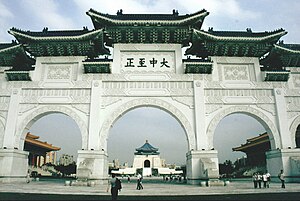
There are many yearly festivals that commonly are held in Taipei including the Lantern Festival and Double Tenth Day. A common location for festivities in Taipei is the square in front of the Chiang Kai-shek Memorial Hall. Recently, some of the major festivals normally held in Taipei (specifically, the Double Tenth Day fireworks) have been moved to others cities in Taiwan.
Education
See also: Education in the Republic of China and List of universities in TaiwanUniversities
Taipei currently has eighteen universities:
- National Taiwan University
- National Chengchi University
- National Taipei University
- National Yang Ming University
- National Taiwan Normal University
- National Taiwan University of Science and Technology
- National Taipei University of Technology
- National Taipei University of Education
- Taipei Municipal University of Education
- Taipei National University of the Arts
- Ming Chuan University
- Chinese Culture University
- Shih Chien University
- Shih Hsin University
- Soochow University
- Taipei Medical University
- Tatung University
- China University of Technology
Colleges
In addition, there are six colleges:
- National Taipei College of Nursing
- National Taipei College of Business
- China Institute of Technology
- Northern Taiwan Institute of Science and Technology
- Taipei Physical Education College
- Takming College
fjsdkfjsdklfskf
Chinese Language schools
Major Chinese Language schools:
- International Chinese Language Program (ICLP), formerly Stanford Center and Inter-University Center (IUP), at National Taiwan University
- Center for Chinese Language and Cultural Studies (CCLC), formerly Mandarin Training Center (MTC), at National Taiwan Normal University
Museums
- National Palace Museum
- Nation Museum of History
- Shung Ye Museum of Formosan Aborigines
- Su Ho Memorial Paper Museum
- Taipei Fine Arts Museum
- Taipei Museum of Puppetry
- Taipei Astrology Museum
- Taipei Museum of Hot Springs
- Taipei Post Museum
- National Taiwan Museum
- Taipei 228 Memorial Museum
Libraries
Transportation
All scheduled international flights are served by Taiwan Taoyuan International Airport in nearby Taoyuan County. And Songshan Airport at the heart of the city serves mostly domestic flights, with the exception of some charter flights.


Taipei's public transport system MRT (Mass Rapid Transit), now also known as Metro Taipei, incorporates a light rail system based on VAL technology with its conventional metro. Both are currently undergoing significant expansion. Unlike most rail transport in Taiwan which follow the Japanese practice and have trains running on the left, the Taipei public transport system runs its trains on the right.
Taipei Main Station is the largest Taiwanese railway station and also functions as the nexus for the MRT system.
An extensive city bus system runs throughout the city to serve areas not covered by the MRT system. Sometimes buses require payment upon boarding, sometimes upon exiting. Many routes, due to their length, could require payment upon both boarding and exiting. Riders of the city MRT system are able to use their MRT passes on buses, making the bus system effectively an extension of the MRT system. The pass, known as an Easy Card, contain credits that are deducted each time a ride is taken. The Easy Card, Taipei's equivalent to Hong Kong's Octopus Card, is extremely convenient since it is read via proximity sensory panels on buses and in MRT stations, thus eliminating the need for the passenger to remove the card from his or her wallet or purse.
A quintessential form of transportation in Taipei (and much of Taiwan) is the ubiquitous motor-scooter, somewhat analogous to the motorcycles found in other industrialized nations. However, motor-scooters are not subject to all conventional traffic laws, and generally thread between cars and occasionally through oncoming traffic. A loophole in Taipei's motor vehicle laws ensures that in any accident between a motor-scooter and another vehicle, the other vehicle is at fault. For these reasons, scooters are perhaps the most convenient way for locals to navigate through their city.
Tourism
While Taipei is not a major tourist destination and is visited principally by business travelers, there are a number of attractions for the visitor within Taipei City:

- The Taipei 101 (台北101) is a new financial center in Taipei. The Guinness Book of Records certified it as the world's tallest building in October 2003.
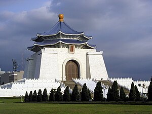
- The Chiang Kai-shek Memorial Hall (中正紀念堂)
- The Sun Yat-sen Memorial Hall (國父紀念館)
- The National Palace Museum (故宮博物院)
- The Grand Hotel (圓山飯店)
- The Presidential Building of the Republic of China(中華民國總統府)
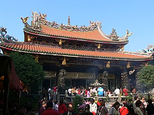
- The Longshan Temple (龍山寺)
- The Shilin Night Market (士林夜市)
- The Yangmingshan National Park (陽明山國家公園)
- The Taipei Zoo (台北木柵動物園)
- The Taipei Underground Market (台北地下街)
- The Taipei Taiwan Temple(台北聖殿) of The Church of Jesus Christ of Latter-day Saints
- The Di-Hua Street (迪化街)
- The East District "Dong Qu" (東區)
- The West Gate Distirct "Ximenting or Shimenting" (西門町)
The suburbs of Taipei City (in Taipei County)
Pronunciation note
The spelling Taipei derives from the Wade-Giles romanization T'ai-pei, in which "p" is pronounced like the English "p" in the word "spay" (the unaspirated "p" may sound like a "b" to the layman).
Both Hanyu Pinyin, which is used both in the PRC and is mandated by KMT Taipei City government, and Tongyong Pinyin, which is mandated by the DPP central government, reflect this pronunciation, romanizing Taipei as Taibei, a spelling that is closer to the Mandarin pronunciation. However, this romanization is very rarely seen.
Though Taipei City has converted many of its street signs to Hanyu Pinyin, it has retained the original spelling of "Taipei" as an exception since this form has been well-known and heavily used.
Sister cities and regions relationships
The following places are sister cities to Taipei City:
The large number of sister cities, possibly the most of any city, may be due to the Republic of China's lack of formal diplomatic relations with most states in the world, necessitating international relations to be performed at the municipal level.
See also
- Kaohsiung City
- List of cities in the Republic of China
- List of districts of Taipei by area
- List of districts of Taipei by population
- List of districts of Taipei by population density
- Political divisions of the Republic of China
External links
Template:Wikitravel Template:Geolinks-cityscale
- Taipei City Government Official Website
- Taipei Travel Net
- Taipei Atis Web
- Taipei e-services
- Discovery Taipei
- Healthy Taipei City
- Taipei City Police Department
- List of Sister Cities from the official site
- Taipei City Council


| Preceded byChongqing | Capital of the Republic of China 1949-present |
Succeeded bypresent capital |
| Administrative divisions of Taiwan | |||||
|---|---|---|---|---|---|
| Special municipalities (6) | |||||
| "Provinces [zh]" |
| ||||
| Districts under special municipalities / cities Cities / townships under counties | List of townships/cities and districts in Taiwan | ||||
| |||||
| Districts in Taiwan | |||||||||||||
|---|---|---|---|---|---|---|---|---|---|---|---|---|---|
| List of townships/cities and districts in Taiwan | |||||||||||||
| Special municipalities |
| ||||||||||||
| Cities |
| ||||||||||||
| ¹ — Mountain indigenous district | |||||||||||||