| Revision as of 07:43, 22 March 2016 editBG19bot (talk | contribs)1,005,055 editsm →Genealogical resources: Remove blank line(s) between list items per WP:LISTGAP to fix an accessibility issue for users of screen readers. Do WP:GENFIXES and cleanup if needed. Discuss this at [[Misplaced Pages talk:WikiProject Accessibility#L...← Previous edit | Revision as of 10:32, 21 December 2019 edit undoAkul59 (talk | contribs)Extended confirmed users1,507 edits infobox, webNext edit → | ||
| Line 1: | Line 1: | ||
| {{Unreferenced|date=December 2009}} | {{Unreferenced|date=December 2009}} | ||
| {{Infobox settlement | |||
| ]]] | |||
| | name = Horné Mladonice | |||
| | native_name = | |||
| | other_name = | |||
| | settlement_type = Municipality | |||
| <!-- images, nickname, motto --> | |||
| | image_skyline = | |||
| | image_caption = | |||
| | image_flag = | |||
| | image_shield = | |||
| | motto = | |||
| | nickname = | |||
| | etymology = | |||
| <!-- location --> | |||
| | subdivision_type = ] | |||
| | subdivision_name = {{SVK}} | |||
| | subdivision_type1 = | |||
| | subdivision_name1 = | |||
| | subdivision_type2 = ] | |||
| | subdivision_name2 = ] | |||
| | subdivision_type3 = ] | |||
| | subdivision_name3 = ] | |||
| | subdivision_type4 = | |||
| | subdivision_name4 = | |||
| <!-- maps and coordinates --> | |||
| | image_map = | |||
| | map_caption = | |||
| | pushpin_map = Slovakia Banská Bystrica Region#Slovakia | |||
| | pushpin_relief = 1 | |||
| | pushpin_map_caption = Location of Horné Mladonice in the ]##Location of Horné Mladonice in Slovakia | |||
| ⚫ | | coordinates = {{Coord|48|21|N|19|09|E|display=inline,title}} | ||
| | coordinates_footnotes = | |||
| <!-- established --> | |||
| | established_title = First mentioned | |||
| | established_date = 1470 | |||
| <!-- area --> | |||
| | area_footnotes = | |||
| | area_total_km2 = 11,83 | |||
| | area_total_sq_mi = | |||
| | area_land_sq_mi = | |||
| | area_water_sq_mi = | |||
| <!-- elevation --> | |||
| | elevation_footnotes = | |||
| | elevation_m = 480 | |||
| | elevation_ft = | |||
| <!-- population --> | |||
| | population_as_of = | |||
| | population_footnotes = | |||
| | population_total = | |||
| | population_density_km2 = auto | |||
| | population_density_sq_mi= | |||
| | population_demonym = | |||
| <!-- time zone(s) --> | |||
| | timezone1 = | |||
| | utc_offset1 = | |||
| | timezone1_DST = | |||
| | utc_offset1_DST = | |||
| <!-- postal codes, area code --> | |||
| | postal_code_type = Postal code | |||
| | postal_code = 962 43 (pošta Senohrad) | |||
| | area_code_type = | |||
| | area_code = +421-45 | |||
| | geocode = | |||
| | iso_code = | |||
| | blank_name = ] | |||
| | blank_info = KA | |||
| <!-- website, footnotes --> | |||
| | website = | |||
| | footnotes = | |||
| }} | |||
| '''Horné Mladonice''' is a ] and ] in the ] of the ] of ]. | '''Horné Mladonice''' is a ] and ] in the ] of the ] of ]. | ||
| Line 17: | Line 86: | ||
| ==External links== | ==External links== | ||
| * {{Official website}} | |||
| * | * | ||
| {{Krupina District}} | {{Krupina District}} | ||
| ⚫ | {{Coord|48|21|N|19|09|E |
||
| {{DEFAULTSORT:Horne Mladonice}} | {{DEFAULTSORT:Horne Mladonice}} | ||
Revision as of 10:32, 21 December 2019
| This article does not cite any sources. Please help improve this article by adding citations to reliable sources. Unsourced material may be challenged and removed. Find sources: "Horné Mladonice" – news · newspapers · books · scholar · JSTOR (December 2009) (Learn how and when to remove this message) |
| Horné Mladonice | |
|---|---|
| Municipality | |
  | |
| Coordinates: 48°21′N 19°09′E / 48.350°N 19.150°E / 48.350; 19.150 | |
| Country | |
| Region | Banská Bystrica |
| District | Krupina |
| First mentioned | 1470 |
| Area | |
| • Total | 1,183 km (457 sq mi) |
| Elevation | 480 m (1,570 ft) |
| Postal code | 962 43 (pošta Senohrad) |
| Area code | +421-45 |
| Car plate | KA |
| Website | www.hornemladonice.sk |
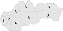
Horné Mladonice is a village and municipality in the Krupina District of the Banská Bystrica Region of Slovakia.

Genealogical resources
The records for genealogical research are available at the state archive "Statny Archiv in Banska Bystrica, Slovakia"
- Roman Catholic church records (births/marriages/deaths): 1792-1890 (parish B)
- Lutheran church records (births/marriages/deaths): 1757-1873 (parish B)
See also
External links
This Banská Bystrica Region geography article is a stub. You can help Misplaced Pages by expanding it. |