This is an old revision of this page, as edited by Bzuk (talk | contribs) at 17:50, 1 April 2012 (ref/cite links). The present address (URL) is a permanent link to this revision, which may differ significantly from the current revision.
Revision as of 17:50, 1 April 2012 by Bzuk (talk | contribs) (ref/cite links)(diff) ← Previous revision | Latest revision (diff) | Newer revision → (diff)Unincorporated community in Montana, United States
| Cat Creek | |
|---|---|
| Unincorporated community | |
| Country | United States |
| State | Montana |
| County | Petroleum |
| Elevation | 2,907 ft (886 m) |
| Time zone | UTC-7 (Mountain (MST)) |
| • Summer (DST) | UTC-6 (MDT) |
| ZIP codes | 59087 |
| Area code | 406 |
| GNIS feature ID | 805516 |
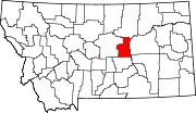
Cat Creek (also Frantz or Frantzville) is an unincorporated community in eastern Petroleum County, Montana, United States. It lies along local roads east of the town of Winnett, the county seat of Petroleum County. Its elevation is 2,907 feet (886 m).Due to its isolation, Broadband high speed satellite Internet access delivered by WildBlue Internet only recently arrived in Cat Creek. For years, the rural town was forced to use dial-up service.
Geography
According to the United States Census Bureau, Cat Creek has a total area of 1,674 square miles. 1,653.9 square miles of it is land and 20.11 square miles (1.2%) of it is water.
Demographics
As of the census of 2000, there were 493 people and 292 households in the city. The average household size was 2.34 persons. The racial makeup of the city was 99.18% White, 0% Black or African American, 0% Asian, 0% Pacific Islander, 1.21% Hispanic or Latino, and 2% from other races.
Industry
An estimated 23 million barrels of oil have been produced in Cat Creek's 54-year oil production history.
History
After exploration in 1919, the first major oil field discovery in Montana was at the West Dome of the Cat Creek field, Eastern Fergus County, at a depth of 1,015 ft. The oil was considered "the highest grade of oil known to any oil fields." The discovery well was showing oil in November 1919 and put into full use by the Frantz Corporation in February 18, 1920. By May 1920, production from one well was up to 200 barrels a day. In April 1921, 30 producing wells were at work.
As many as 300 men lived in the area in tar paper shacks with only a post office, church, school and cemetery. A post office was active in Cat Creek from 1922 to 1963. The area is very isolated and supplies were hauled to site from Winnett, 20 miles to the West of the area. Winnett also became the supply depot and pumped oil was piped to the railhead there and shipped by rail to Wyoming refineries.
References
- Notes
- ^ "Cat Creek, Montana". Geographic Names Information System. United States Geological Survey, United States Department of the Interior.
- Rand McNally. The Road Atlas '08. Chicago: Rand McNally, 2008, p. 61.
- "Wild Blue Internet Cat Creek, MT".
- "Cat Creek, MT".
- "Cat Creek, MT".
- ^ Cheney 1983, p. 243.
- "Cat Creek." Montana's Official State Travel Site. Retrieved: April 1, 2012.
- Stout 1921, p. 877.
- Stout 1921, p. 716.
- Stout 1921, p. 387.
- Stout 1921, pp. 716–717.
- "Montana Oil". Montana Pioneer and Classic Auto Club. Retrieved March 23, 2012.
- U.S. Geological Survey Geographic Names Information System: Cat Creek Post Office
- Cheney 1983, p. 38.
- Bibliography
- Cheney, Roberta Carkeek. Names on the Face of Montana: The Story of Montana's Place Name. Missoula Montana: Montana Press, 1983. ISBN 978-0878421503.
- Stout, Tom, ed. Montana: Its Story and Biography, A History of Aboriginal and Territorial Montana and Three Decades of Statehood, Volume 1 Chicago: American Historical Association, 1921.
| Municipalities and communities of Petroleum County, Montana, United States | ||
|---|---|---|
| County seat: Winnett | ||
| Town |  | |
| Unincorporated communities | ||
This Montana state location article is a stub. You can help Misplaced Pages by expanding it. |