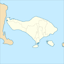
  Show map of Bali Show map of Bali  Show map of Indonesia Show map of Indonesia | |
| UTC time | 2021-10-15 20:18:20 |
|---|---|
| ISC event | 621204453 |
| USGS-ANSS | ComCat |
| Local date | 16 October 2021 (2021-10-16) |
| Local time | 04:18 WITA |
| Magnitude | 4.7 Mw |
| Depth | 10.0 km (6.2 mi) |
| Epicentre | 8°20′53″S 115°27′40″E / 8.348°S 115.461°E / -8.348; 115.461 |
| Type | Strike-slip |
| Areas affected | Indonesia |
| Max. intensity | MMI IV (Light) (BMKG) |
| Landslides | Yes |
| Casualties | 4 dead, 73 injured |
The 2021 Bali earthquake struck at 04:18 local time (UTC+08:00) when people were still sleeping on 15 October 2021. It resulted in 4 deaths and 73 more injured, despite having a moment magnitude of 4.7.
Tectonic setting
The island of Bali forms part of the Sunda Arc, which formed above the convergent boundary where the Australian plate is subducting beneath the Sunda plate. The rate of convergence across the line of the Sunda–Java Trench is 7.5 cm per year. Eastwards from Bali, the Sunda Arc is also being thrust over the Bali and Flores back-arc basins on a series of south-dipping thrusts. Focal mechanisms of earthquakes near Bali are dominantly thrust sense on both the subduction interface and the system of thrust faults to the north. In July and August 2018, a series of earthquakes, the strongest reaching 6.9 on the moment magnitude scale, killed nearly 600 people in the neighbouring island of Lombok. In January 1917, an earthquake measuring 6.6 killed more than 1,500 people, 80% of which from landslides.
Earthquake
According to officials at the Meteorology, Climatology, and Geophysical Agency (BMKG), the earthquake, which was centred at the sloped of the volcanoes Mount Agung and Mount Batur, occurred on a shallow local fault. Rupture along the fault was caused by the migration of magma in the crust, triggering fault activity. The BMKG has ruled out the Flores back-arc thrust fault as the source of the quake due to the strike-slip focal mechanism indicated by the seismological data.
Instrumental seismic intensities measured by the BMKG suggest the quake only caused light shaking in Bali, but was felt as far as Lombok. At Denpasar, Karangasem, and northern Lombok the earthquake was felt lightly by residents at IV on the Mercalli intensity scale.
Impact
Most of the damage was observed in the Ban Village, Kubu District, Ppatan Village, Rendang District and Karangasem Regency. Many religious and historical structures were mildly to severely damaged. Four people were confirmed dead, one of them being a three-year-old girl who was hit by falling debris. The other three deaths were from a landslide. Seventy-three people were injured, suffering head injuries or broken bones. Most of the injured were treated at the Kubu Pratama and Karangasem hospitals where they were discharged. Three remained hospitalized for their serious injuries. At least 762 buildings were damaged, 101 of which were religious.
See also
- List of earthquakes in 2021
- List of earthquakes in Indonesia
- 1976 Bali earthquake
- 1815 Bali earthquake
References
- ^ "Pusat gempa berada di darat 8 km barat laut Karangasem". Meteorology, Climatology, and Geophysical Agency. 16 October 2021. Retrieved 16 October 2021.
- ^ "Risklayer Explorer". risklayer.com.
- "M 4.7 – Bali region, Indonesia". United States Geological Survey. 16 October 2021. Retrieved 16 October 2021.
- McCaffrey, R.; Nabelek J. (1987). "Earthquakes, gravity, and the origin of the Bali Basin: an example of a nascent continental fold-and-thrust belt" (PDF). Journal of Geophysical Research. 92 (B1): 441–460. Bibcode:1987JGR....92..441M. doi:10.1029/jb092ib01p00441. Archived from the original (PDF) on 11 December 2013. Retrieved 10 November 2012.
- "M 6.4 – 5 km WNW of Obelobel, Indonesia". United States Geological Survey. Retrieved 15 October 2021.
- "M 6.9 – 0 km SW of Loloan, Indonesia". United States Geological Survey. Retrieved 15 October 2021.
- "M 5.9 – 3 km SE of Todo, Indonesia". United States Geological Survey. Retrieved 15 October 2021.
- "M 6.3 – 6 km NE of Sembalunlawang, Indonesia". United States Geological Survey. Retrieved 15 October 2021.
- "M 6.9 – 2 km S of Belanting, Indonesia". United States Geological Survey. Retrieved 15 October 2021.
- Reza Yunanto (16 October 2021). "Analisis Penyebab Gempa Bali Hari Ini, Dipicu Aktivitas Sesar Patahan Lokal" [Analysis of the Causes of the Bali Earthquake Today, Triggered by Local Fault Activity]. iNewsBali.id. Retrieved 16 October 2021.
- "Memperhatikan mekanisme sumber Gempa Bali M4,8 yang merusak pagi ini, tampak bahwa gempa yang terjadi diakibatkan oleh aktivitas sesar/patahan aktif lokal, bukan akibat aktivitas Sesar Naik Flores (Flores Back Aec Thrusting)". @DaryonoBMKG. Retrieved 16 October 2021 – via Twitter.
- Rizal Setyo Nugroho, ed. (16 October 2021). "Gempa Bali M 4,8 Dirasakan hingga Lombok" [Bali Earthquake M 4.8 Felt to Lombok]. Kompas. Retrieved 16 October 2021.
- "Earthquake of magnitude 4.8 strikes Bali, kills three". Reuters. Retrieved 15 October 2021.
- "Gempa Karangasem, 1 Meninggal Dunia, 71 Korban Luka, Ratusan Rumah di Desa Ban Rusak Berat" (in Indonesian). Bali Factual News. 16 October 2021. Retrieved 16 October 2021.
| ← Earthquakes in 2021 → | |
|---|---|
| January |
|
| February |
|
| March |
|
| April |
|
| May |
|
| June |
|
| July |
|
| August |
|
| September |
|
| October |
|
| November |
|
| December |
|
| |