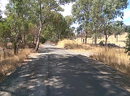
| Amy Gillett Bikeway | |
|---|---|
 Amy Gillett Bikeway scene Amy Gillett Bikeway scene | |
| Length | 17 km (11 mi) |
| Location | Adelaide Hills, South Australia |
| Established | 2010 |
| Trailheads | Oakbank, Mount Torrens |
| Use | Cycling, Hiking, jogging, horse riding |
| Elevation change | 114 m (374 ft) |
| Highest point | 498 m (1,634 ft) |
| Lowest point | 371 m (1,217 ft) |
| Grade | gentle |
| Difficulty | easy |
| Waymark |  |
| Surface | asphalt |
| Right of way | Mount Pleasant railway line |
| Website | http://www.adelaidehillsrailtrail.org.au/ |
| Trail map | |
The Amy Gillett Bikeway or Amy Gillett Rail Trail or Amy Gillett Pathway is a shared path in the Adelaide Hills on part of the alignment of the former Mount Pleasant railway line. It is a 17 kilometres (11 mi) sealed path suitable for recreational cycling, walking and horse riding. The trail is named after Australian track cyclist and rower Amy Gillett.
Stage 1 was opened in January 2010 by Patrick Conlon, then the South Australian Minister for Transport, Energy and Infrastructure. Stage 1 extended 4 kilometres (2.5 mi) between Oakbank and Woodside, with kerbside bike lanes on Onkaparinga Valley Road continuing south from the trailhead through Oakbank. Stage 2 extended it through Charleston and Stage 3 opened in May 2014 added 7 kilometres (4.3 mi) to Mount Torrens. Future work could extend it another 15 kilometres (9.3 mi) through Birdwood to Mount Pleasant.
Funding for Stage 4 was secured in 2024, with the Adelaide Hills Council agreeing to contribute $500,000. This stage is expected to be completed by mid-2025. The final stage, to linking the bikeway to the existing Barossa Trail, was still under negotiation in April 2024.
There are also several side loop trails available to interesting destinations off the main path.
References
- "Amy Gillett Rail Trail (Stage 1) Official Opening (SA)". Rail Trails Australia. Retrieved 8 January 2015.
- "Adelaide Hills Amy Gillett Rail Trail - Trail Description". Rail Trails Australia. Retrieved 8 January 2015.
- "Amy Gillett Bikeway - a path to safer cycling". Amy Gillett Foundation. 14 May 2014. Archived from the original on 8 January 2015. Retrieved 8 January 2015.
- Dandeniya, Nethma (6 April 2024). "Former Olympian Amy Gillett's mother urges drivers to use 'Dutch Reach' to protect cyclists". ABC News. Retrieved 5 April 2024.
- "Adelaide Hills Rail Trail". Adelaide Hills Rail Trail. 2012. Archived from the original on 26 February 2015. Retrieved 8 January 2015.
External links
This South Australia geography article is a stub. You can help Misplaced Pages by expanding it. |
This trail or long-distance path-related article is a stub. You can help Misplaced Pages by expanding it. |