| Bearpaw Lake | |
|---|---|
 Bearpaw Lake Bearpaw Lake | |
  | |
| Location | Grand Teton National Park, Teton County, Wyoming, US |
| Coordinates | 43°49′47″N 110°43′47″W / 43.82972°N 110.72972°W / 43.82972; -110.72972 |
| Lake type | Glacial Lake |
| Basin countries | United States |
| Max. length | .20 mi (0.32 km) |
| Max. width | .10 mi (0.16 km) |
| Surface elevation | 6,848 ft (2,087 m) |
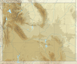
Bearpaw Lake is located in Grand Teton National Park, in the U. S. state of Wyoming. Bearpaw Lake is south of Trapper Lake and north of Leigh Lake. Bearpaw Lake is an easy to moderate 9.2-mile (14.8 km) (to Trapper Lake, which is somewhat further) round trip hike along the Leigh Lake Trail. The trail starts at the String Lake trailhead and wanders north along the east shores of Leigh Lake with a 460 feet (140 m) elevation gain. Bearpaw Lake is nestled at the eastern base of Mount Moran and snow and glacier meltwaters off Skillet Glacier eventually feed into the lake. There are three backcountry camping sites with designated tent pads at the lake and a backcountry permit is required to use these sites.
References
- "Bearpaw Lake". Geographic Names Information System. United States Geological Survey, United States Department of the Interior. Retrieved August 25, 2022.
- Bearpaw Bay Topo Map in Teton County WY (Map). Topozone (USGS Quads). Retrieved August 25, 2022.
- ^ "Bearpaw and Trapper Lakes". National Park Service. May 17, 2022. Retrieved August 25, 2022.
- Timblin, Stephen (July 2011). The Rough Guide to Yellowstone & Grand Teton. Rough Guides. p. 137. ISBN 9781848368613.
- "Backcountry Camping" (PDF). National Park Service. Retrieved August 25, 2022.
This article about a location in Wyoming is a stub. You can help Misplaced Pages by expanding it. |