| Beinn Mhic Chasgaig | |
|---|---|
 Beinn Mhic Chasgaig Beinn Mhic Chasgaig | |
| Highest point | |
| Elevation | 864 m (2,835 ft) |
| Prominence | 166 m (545 ft) |
| Listing | Corbett, Marilyn |
| Coordinates | 56°36′35″N 4°54′00″W / 56.6097°N 4.9000°W / 56.6097; -4.9000 |
| Geography | |
| Location | Highland, Scotland |
| Parent range | Grampian Mountains |
| OS grid | NN221502 |
| Topo map | OS Landranger 41 |
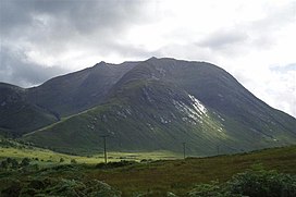
Beinn Mhic Chasgaig (864 m) is a mountain in the Grampian Mountains of Scotland. It lies near the head of Glen Etive in Highland.
A steep and craggy peak, it is surrounded by high Munros and provides a very steep and challenging climb to its summit. Climbs start from Glen Etive.
References
- "Beinn Mhic Chasgaig". hill-bagging.co.uk. Retrieved 30 May 2019.
- "walkhighlands Beinn Mhic Chasgaig". walkhighlands.co.uk. Retrieved 30 May 2019.
This Scottish location article is a stub. You can help Misplaced Pages by expanding it. |