| Billa بلا | |
|---|---|
| Municipality | |
 | |
| Coordinates: 34°16′59″N 35°53′53″E / 34.2829326°N 35.8980341°E / 34.2829326; 35.8980341 | |
| Country | |
| Governorate | North Governorate |
| District | Bsharri District |
| Elevation | 1,221 m (4,006 ft) |
| Time zone | UTC+2 (EET) |
| • Summer (DST) | UTC+3 (EEST) |
| Dialing code | +06 |
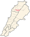
Billa (Arabic: بلا) is a municipality in the Bsharri District, North Governorate of Lebanon. The village is located near the towns of Barhalyoun and Aabdine. In 2014, there were 429 voters with 220 males and 209 females.
References
- "GeoNames.org". www.geonames.org. Retrieved 2023-02-28.
- "معلومات عن بلدة المغر وبلا - Billa، قضاء بشري في محافظة الشمال، حسب لوائح الناخبين الرسمية الصادرة عن وزارة الداخلية اللبنانية لسنة ٢٠١٤". إعْرَفْ لبنان. Retrieved 2023-02-28.
| Capital: Bsharri | ||
| Towns and villages |  | |
| Notable landmarks | ||
| Notable people | ||
This Lebanon location article is a stub. You can help Misplaced Pages by expanding it. |