| Bolanden | |
|---|---|
| Municipality | |
 Coat of arms Coat of arms | |
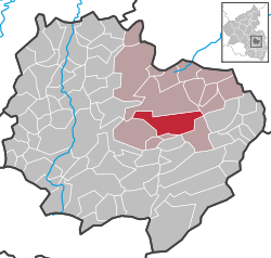
Location of Bolanden within Donnersbergkreis district
 | |
  | |
| Coordinates: 49°38′22.40″N 8°0′32.66″E / 49.6395556°N 8.0090722°E / 49.6395556; 8.0090722 | |
| Country | Germany |
| State | Rhineland-Palatinate |
| District | Donnersbergkreis |
| Municipal assoc. | Kirchheimbolanden |
| Subdivisions | 2 |
| Government | |
| • Mayor (2019–24) | Armin Juchem (FW) |
| Area | |
| • Total | 17.44 km (6.73 sq mi) |
| Elevation | 226 m (741 ft) |
| Population | |
| • Total | 2,488 |
| • Density | 140/km (370/sq mi) |
| Time zone | UTC+01:00 (CET) |
| • Summer (DST) | UTC+02:00 (CEST) |
| Postal codes | 67295 |
| Dialling codes | 06352 |
| Vehicle registration | KIB |
| Website | kirchheimbolanden.de |
Bolanden is a municipality in the Donnersbergkreis district, in Rhineland-Palatinate, Germany.
Sights
- New Bolanden Castle ruins
References
- Direktwahlen 2019, Donnersbergkreis, Landeswahlleiter Rheinland-Pfalz, accessed 9 August 2021.
- "Bevölkerungsstand 2022, Kreise, Gemeinden, Verbandsgemeinden" (PDF) (in German). Statistisches Landesamt Rheinland-Pfalz. 2023.
This Donnersbergkreis location article is a stub. You can help Misplaced Pages by expanding it. |
