| Botnedalen | |
|---|---|
  | |
| Floor elevation | 798 m (2,618 ft) |
| Geology | |
| Type | River valley |
| Geography | |
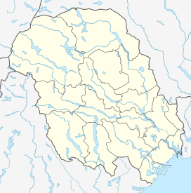
| Location | Telemark, Norway |
| Coordinates | 59°29′34″N 7°44′16″E / 59.49264°N 7.73785°E / 59.49264; 7.73785 |
Botnedalen is a valley in Tokke Municipality in Telemark county, Norway. The valley used to be the site a number of mountain farms that are no longer in use. The river that runs through the valley was dammed, creating the lake Botnedalsvatn. The lake is as a reservoir for the nearby Byrte Hydroelectric Power Station. Botnedalen is known for the occurrence of various minerals, including hausmannite, jacobsite, braunite, bustamite, and rhodonite.
References
- Evensen, Knut Harald, ed. (2010). NAF Veibok 2010–2012 (in Norwegian) (29 ed.). Oslo: Norges Automobil-Forbund. pp. 27, 224.
- Godal, Anne Marit (ed.). "hausmannitt". Store norske leksikon (in Norwegian). Oslo: Norsk nettleksikon. Retrieved 4 July 2012.
- Godal, Anne Marit (ed.). "jacobsitt". Store norske leksikon (in Norwegian). Oslo: Norsk nettleksikon. Retrieved 4 July 2012.
- Godal, Anne Marit (ed.). "braunitt". Store norske leksikon (in Norwegian). Oslo: Norsk nettleksikon. Retrieved 4 July 2012.
- Godal, Anne Marit (ed.). "bustamitt". Store norske leksikon (in Norwegian). Oslo: Norsk nettleksikon. Retrieved 4 July 2012.
- Godal, Anne Marit (ed.). "rhodonitt". Store norske leksikon (in Norwegian). Oslo: Norsk nettleksikon. Retrieved 4 July 2012.
Further reading
- Botnedalen. Tokke historielag. 1984.
This Telemark location article is a stub. You can help Misplaced Pages by expanding it. |