Image
Landmark name
Location
City or town
Summary
Upload Photo
288
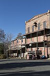
Altaville
State Hwy 49 & Hwy 438°04′46″N 120°33′18″W / 38.079583°N 120.555133°W / 38.079583; -120.555133 (Altaville) Altaville
Angels Camp 287
Angels Camp
Historic district38°04′07″N 120°32′22″W / 38.06850°N 120.53944°W / 38.06850; -120.53944 (Angels Camp) Angels Camp
Angels Hotel 734
Angels Hotel
Main St. and Birds Way38°04′07″N 120°32′21″W / 38.06871°N 120.53908°W / 38.06871; -120.53908 (Angels Hotel) Angels Camp Also on the NRHP list as NPS-72000220
Big Bar (Amador County, California) 41
Big Bar (Amador County, California)
38°18′43″N 120°43′12″W / 38.311944°N 120.72°W / 38.311944; -120.72 (Big Bar (Amador County, California)) Jackson Big Bar mine is in both Calaveras County and Amador County
Upload Photo
769
Birthplace of Archie Stevenot
State Hwy 4, 3.7 miles south of Angels Camp38°01′40″N 120°30′24″W / 38.02765°N 120.506667°W / 38.02765; -120.506667 (Birthplace of Archie Stevenot) Angels Camp
Upload Photo
465
Old mining camp of Brownsville
Pennsylvania Gulch Rd.38°07′43″N 120°26′31″W / 38.128667°N 120.44195°W / 38.128667; -120.44195 (Old mining camp of Brownsville) Murphys
Upload Photo
255
Calaveritas
Historic district38°09′28″N 120°36′44″W / 38.157778°N 120.612222°W / 38.157778; -120.612222 (Calaveritas) Calaveritas
Upload Photo
254
Camanche
Historic district38°12′48″N 120°56′07″W / 38.213333°N 120.935278°W / 38.213333; -120.935278 (Camanche) Camanche
Upload Photo
257
Campo Seco
Historic district38°13′38″N 120°51′12″W / 38.227222°N 120.853333°W / 38.227222; -120.853333 (Campo Seco) Campo Seco
California Caverns 956
California Caverns
Cave City Rd.38°12′10″N 120°30′32″W / 38.202872°N 120.508847°W / 38.202872; -120.508847 (California Caverns) Cave City
Upload Photo
274
Carson Hill
Historic district38°01′42″N 120°30′24″W / 38.028333°N 120.506667°W / 38.028333; -120.506667 (Carson Hill) Carson Hill
Upload Photo
265
Chili Gulch
Double Springs Rd.38°12′58″N 120°42′27″W / 38.216029°N 120.707433°W / 38.216029; -120.707433 (Chili Gulch) Mokelumne Hill
Congregational Church 261
Congregational Church
Northeast corner of Main and Church Sts.38°18′00″N 120°42′23″W / 38.299992°N 120.706488°W / 38.299992; -120.706488 (Congregational Church) Mokelumne Hill
Copperopolis 296
Copperopolis
Historic district37°58′41″N 120°38′18″W / 37.977967°N 120.638433°W / 37.977967; -120.638433 (Copperopolis) Copperopolis
Courthouse of Calaveras County and the Léger Hotel 663
Courthouse of Calaveras County and the Léger Hotel
Corner of Main & Lafayette Sts.38°18′04″N 120°42′21″W / 38.301067°N 120.705783°W / 38.301067; -120.705783 (Courthouse of Calaveras County and the Léger Hotel) Mokelumne Hill This was the county courthouse from 1852-1866
Double Springs 264
Double Springs
Double Springs Rd.38°12′19″N 120°47′28″W / 38.205183°N 120.79115°W / 38.205183; -120.79115 (Double Springs) Valley Springs
Douglas Flat 272
Douglas Flat
Historic district38°06′52″N 120°27′18″W / 38.114444°N 120.455°W / 38.114444; -120.455 (Douglas Flat) Douglas Flat
Upload Photo
282
El Dorado
Mountain Ranch Rd. & Whiskey Slide Rd.38°13′42″N 120°32′27″W / 38.228333°N 120.540833°W / 38.228333; -120.540833 (El Dorado) Mountain Ranch
Upload Photo
258
Fourth Crossing
Historic district38°07′53″N 120°38′05″W / 38.131389°N 120.634722°W / 38.131389; -120.634722 (Fourth Crossing) Fourth Crossing
Upload Photo
280
Glencoe
Historic district38°21′15″N 120°35′06″W / 38.354167°N 120.585°W / 38.354167; -120.585 (Glencoe) Glencoe
I.O.O.F. Hall 256
I.O.O.F. Hall
Northeast corner of Main and Center Sts.38°18′08″N 120°42′22″W / 38.302158°N 120.705978°W / 38.302158; -120.705978 (I.O.O.F. Hall) Mokelumne Hill
Upload Photo
266
Jenny Lind
38°05′42″N 120°52′12″W / 38.095°N 120.87°W / 38.095; -120.87 (Jenny Lind) Jenny Lind
Upload Photo
284
Jesus Maria
Historic district38°17′08″N 120°38′51″W / 38.285556°N 120.6475°W / 38.285556; -120.6475 (Jesus Maria) Jesus Maria
Upload Photo
262
Milton
Historic district38°01′55″N 120°51′08″W / 38.031944°N 120.852222°W / 38.031944; -120.852222 (Milton) Milton
Mokelumne Hill 269
Mokelumne Hill
38°18′02″N 120°42′23″W / 38.300556°N 120.706389°W / 38.300556; -120.706389 (Mokelumne Hill) Mokelumne Hill
Murphys 275
Murphys
Historic district38°08′15″N 120°27′35″W / 38.1375°N 120.459722°W / 38.1375; -120.459722 (Murphys) Murphys
Murphys Hotel 267
Murphys Hotel
457 Main at Algiers St.38°08′16″N 120°27′54″W / 38.1377°N 120.464983°W / 38.1377; -120.464983 (Murphys Hotel) Murphys Also known as Mitchler Hotel. Also on the NRHP list as NPS-71000134
O'Byrne Ferry 281
O'Byrne Ferry
O'Byrne Ferry Rd.37°53′49″N 120°34′34″W / 37.896933°N 120.576117°W / 37.896933; -120.576117 (O'Byrne Ferry) Copperopolis
Upload Photo
295
Paloma
Paloma Rd. & Edster St.38°15′33″N 120°45′42″W / 38.259133°N 120.76155°W / 38.259133; -120.76155 (Paloma) Paloma
Upload Photo
466
Peter L. Traver Building
470 Main St.38°08′16″N 120°27′54″W / 38.1378°N 120.4651°W / 38.1378; -120.4651 (Peter L. Traver Building) Murphys
Upload Photo
271
Pioneer Cemetery
State Hwy 12, .7 miles west of State Hwy 49 junction38°12′31″N 120°42′29″W / 38.208613°N 120.707967°W / 38.208613; -120.707967 (Pioneer Cemetery) San Andreas
Upload Photo
735
Prince-Garibaldi Building
298 S. Main St.38°04′46″N 120°33′15″W / 38.079317°N 120.554167°W / 38.079317; -120.554167 (Prince-Garibaldi Building) Altaville
Upload Photo
286
Rail Road Flat
Historic district38°20′36″N 120°30′44″W / 38.343333°N 120.512222°W / 38.343333; -120.512222 (Rail Road Flat) Rail Road Flat
Red Brick Grammar School 499
Red Brick Grammar School
125 N. Main St.38°04′59″N 120°33′43″W / 38.082977°N 120.561869°W / 38.082977; -120.561869 (Red Brick Grammar School) Altaville Also on the NRHP list as NPS-79000471
Upload Photo
276
Robinson's Ferry
Vista point on State Hwy 4938°00′33″N 120°30′17″W / 38.009083°N 120.50475°W / 38.009083; -120.50475 (Robinson's Ferry) Angels Camp
San Andreas 252
San Andreas
Historic district38°11′46″N 120°40′50″W / 38.196111°N 120.680556°W / 38.196111; -120.680556 (San Andreas) San Andreas
Sandy Gulch 253
Sandy Gulch
Historic district38°22′49″N 120°31′58″W / 38.380278°N 120.532778°W / 38.380278; -120.532778 (Sandy Gulch) Sandy Gulch
Stone Corral 263
Stone Corral
Stone Corral Ranch, Hwy 26,38°06′06″N 120°55′35″W / 38.101604°N 120.926384°W / 38.101604; -120.926384 (Stone Corral) Rancho Calaveras
Upload Photo
273
Vallecito
Historic district38°05′25″N 120°28′25″W / 38.090278°N 120.473611°W / 38.090278; -120.473611 (Vallecito) Vallecito
Vallecito Bell Monument 370
Vallecito Bell Monument
Church St. & Cemetery Ln.38°05′11″N 120°28′27″W / 38.086367°N 120.474133°W / 38.086367; -120.474133 (Vallecito Bell Monument) Vallecito
Upload Photo
251
Valley Springs
Historic district38°11′30″N 120°49′45″W / 38.191667°N 120.829167°W / 38.191667; -120.829167 (Valley Springs) Valley Springs
Upload Photo
268
West Point
Historic district38°23′57″N 120°31′39″W / 38.399167°N 120.5275°W / 38.399167; -120.5275 (West Point) West Point


