Human settlement in Wales
| Cwmllynfell | |
|---|---|
 | |
| Population | 1,172 (2011 census) |
| OS grid reference | SN747127 |
| Principal area | |
| Preserved county | |
| Country | Wales |
| Sovereign state | United Kingdom |
| Post town | SWANSEA |
| Postcode district | SA9 |
| Dialling code | 01639 |
| Police | South Wales |
| Fire | Mid and West Wales |
| Ambulance | Welsh |
| UK Parliament | |
| Senedd Cymru – Welsh Parliament | |
| Councillors |
|
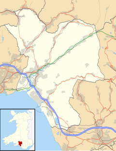
51°47′56″N 3°49′06″W / 51.79887°N 3.81847°W / 51.79887; -3.81847  Map of the community | |
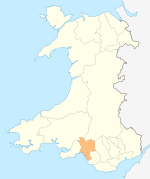
Cwmllynfell (Welsh pronunciation) is a village, community and electoral ward in Neath Port Talbot county borough, Wales.
Amenities
Cwmllynfell has its own local rugby union team - Cwmllynfell RFC. Also, a bilingual primary school, supermarket, post office, village hall, church and chapels. Nearby there is the Black Mountain which supplies views to the village.
Electoral ward
The electoral ward consists of some or all of the following areas: Blaen-nant, Bryn-Melyn, Celliwarog, Cwmllynfell, Rhiw-fawr in the parliamentary constituency of Neath. Cwmllynfell is bounded by the wards of Quarter Bach of Carmarthenshire to the northeast; Cwmtwrch of Powys to the east; Ystalyfera to the southeast; Pontardawe to the southwest; Gwaun-Cae-Gurwen to the west and Lower Brynamman to the northwest.
In the 2017 local council elections the results were:
| Candidate | Party | Votes | Status |
|---|---|---|---|
| Hugh Jones | Plaid Cymru | 283 | Plaid Cymru gain |
| Kris Lloyd | Labour | 194 |
In the 2012 local council elections the turn out was 49.78%. The results were:
| Candidate | Party | Votes | Status |
|---|---|---|---|
| Clifford Richards | Labour | 348 | Labour hold |
| David James | Plaid Cymru | 110 |
Earthquake
At 14:31 on 17 February 2018 the village was the epicentre of a 4.6 magnitude earthquake, the largest in the British Isles since 2008. The quake was felt as far away as Blackpool.
References
- "Ward population 2011". Archived from the original on 12 April 2015. Retrieved 12 April 2015.
- "Election Maps". Ordnance Survey.
- "Election results for Cwmllynfell: County Borough Council - Ordinary Elections - Thursday, 4th May, 2017". Neath Port Talbot County Borough Council. Retrieved 17 August 2018.
- "Earthquake felt across parts of UK". BBC News. 17 February 2018.
- "CWMLLYNFELL, SOUTH WALE". British Geological Survey. 17 February 2018.
6. https://www.garethjones.org/rural_wales/mining_town.htm
External links
| Electoral wards of Neath Port Talbot county borough | |
|---|---|
| Aberavon | |
| Neath | |
This Neath Port Talbot location article is a stub. You can help Misplaced Pages by expanding it. |
