| 1979–80 Australian region cyclone season | |
|---|---|
 Season summary map Season summary map | |
| Seasonal boundaries | |
| First system formed | 26 August 1979 |
| Last system dissipated | 31 March 1980 |
| Strongest storm | |
| Name | Amy |
| • Maximum winds | 215 km/h (130 mph) (10-minute sustained) |
| • Lowest pressure | 915 hPa (mbar) |
| Seasonal statistics | |
| Tropical lows | 15 |
| Tropical cyclones | 15 |
| Severe tropical cyclones | 9 |
| Total fatalities | Unknown |
| Total damage | $25 million (1980 USD) |
| Related articles | |
| Australian region tropical cyclone seasons 1977–78, 1978–79, 1979–80, 1980–81, 1981–82 | |
The 1979–80 Australian region cyclone season was an above average tropical cyclone season. The season featured 15 total cyclones, with 9 of them attaining severe tropical cyclone status. The strongest of these was Cyclone Amy, which ended up making landfall in the north-western portion of Western Australia.
Seasonal summary

Systems
Tropical Cyclone Tony
| Category 2 tropical cyclone (Australian scale) | |
| Tropical storm (SSHWS) | |
  | |
| Duration | 26 August – 30 August (Exited basin) |
|---|---|
| Peak intensity | 95 km/h (60 mph) (10-min); 990 hPa (mbar) |
On 26 August, TCWC Perth reported that a tropical low had developed on a shear line about 1300 km (810 mi) to the northwest of Cocos Island. Over the next couple of days the depression gradually developed further before at 1800 UTC on 27 August, TCWC Perth estimated that it had become a tropical cyclone and named it Tony. During the next couple of days, the system moved towards the west-southwest before on 29 August it reached its peak intensity of 95 km/h (60 mph) and a peak pressure of 990 hPa (29.23 inHg) as it approached the edge of TCWC Perth's area of responsibility. During the next day, Tony moved into the South West Indian Ocean and weakened gradually before it dissipated during 31 August. Neither the Mauritius or Reunion meteorological services monitored Tony as a tropical cyclone while it was active, while it was not included in the JTWC's analysis of the season.
Severe Tropical Cyclone Viola–Claudette
| Category 5 severe tropical cyclone (Australian scale) | |
| Category 3 tropical cyclone (SSHWS) | |
  | |
| Duration | 9 December – 18 December (Crossed 80°E) |
|---|---|
| Peak intensity | 205 km/h (125 mph) (10-min); 930 hPa (mbar) |
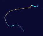
The disturbance from which Viola developed formed on 7 December about 600 km (375 mi) northwest of Cocos. A tropical depression developed on 9 December, moved slowly southwestward, and strengthened into Cyclone Viola two days later. It then moved westward under the influence of an easterly middle level flow north of the sub-tropical ridge, and attained its maximum intensity on 16 December 1979, with a maximum mean wind speed of about 205 km/h (125 mph) and an estimated central pressure of 930 mbar (27.46 inHg). Early on 18 December, Viola crossed 90º E and was renamed Claudette.
Severe Tropical Cyclone Wilf–Danitza
| Category 3 severe tropical cyclone (Australian scale) | |
| Category 1 tropical cyclone (SSHWS) | |
  | |
| Duration | 23 December – 2 January (Crossed 80°E) |
|---|---|
| Peak intensity | 130 km/h (80 mph) (10-min); 973 hPa (mbar) |
The depressional phase of Wilf began about 300 km of the Cocos Island on December 23, 1979. Estimated from satellite pictures, Wilf was recorded as a tropical cyclone early Christmas Day. Wilf began a period of rapid intensification and reached its peak on December 28. Wilf began to weaken as shear from the northwest began to tear the storm apart. While its convection did weaken a lot, it was still able to maintain tropical cyclone status. The storm crossed into the Southwest Indian Ocean on the first day of 1980, being renamed to Danitza.
Tropical Cyclone Paul
| Category 1 tropical cyclone (Australian scale) | |
| Tropical storm (SSHWS) | |
  | |
| Duration | 2 January – 12 January |
|---|---|
| Peak intensity | 85 km/h (50 mph) (10-min); 990 hPa (mbar) |
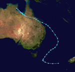
On 2 January, the BoM reported that a tropical depression had developed in the Southwest Gulf of Carpentaria. During that day the depression moved towards the southwest and developed early signs of having a cyclonic circulation, however before it could intensify into a tropical cyclone, the system made landfall near the Northern Territory border with Queensland at 135°E. Over the next couple of days the depression weakened slightly, as it moved in a general east-southeast direction across the Carpentaria and Central Coast districts of Queensland. On 7 January, the depression moved out into the Coral Sea just to the south of Sarina with a central pressure of 995 hPa. During that day the depression developed gale-force windspeeds and was named as Paul by TCWC Brisbane. Before later that day, Paul reached its peak intensity as a tropical cyclone with 10-minute sustained windspeeds of 75 km/h (45 mph) and its lowest central pressure of 989 hPa as it moved rapidly towards the southeast. This southeastern movement continued until 1200 UTC on 8 January when it slowed down and started to move to the southwest as it developed a cold core and became extratropical. The extratropical remnants of Paul subsequently lingered in the Australian region and peaked with stronger windspeeds than when it was a tropical cyclone. The US Navy's analysis of this system shows that they would have considered Paul a tropical storm with peak 1-minute sustained windspeeds of 110 km/h (70 mph). As a tropical depression, Paul forced a strong area of convergence in the moist airstream onto the tropical Queensland coast. As a result of the moisture, very heavy rain caused one of the highest floods of the 20th Century down the Don River through Bowen. In its lower reaches the river changed its course and washed away two homes and caused several million Australian dollars worth of damage to the market garden industry.
Severe Tropical Cyclone Amy
| Category 5 severe tropical cyclone (Australian scale) | |
| Category 5 tropical cyclone (SSHWS) | |
  | |
| Duration | 4 January – 12 January |
|---|---|
| Peak intensity | 215 km/h (130 mph) (10-min); 915 hPa (mbar) |
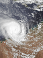
What would form into Amy began on January 3, 1980 as a collection of clouds located over the Timor Sea, and would drift west-southwest as it reached tropical cyclone status on January 5. Amy sped towards the south on the 7th, towards Port Headland. As it approached landfall, it continued to switch direction. Amy made landfall the morning of January 10 about 110km east of Port Headland. Amy passed close to the town of Goldsworthy and caused extensive damage. In total, Amy caused around $25 million dollars in damages. No injuries or deaths were reported.
Severe Tropical Cyclone Brian
| Category 4 severe tropical cyclone (Australian scale) | |
| Category 4 tropical cyclone (SSHWS) | |
  | |
| Duration | 18 January – 27 January |
|---|---|
| Peak intensity | 185 km/h (115 mph) (10-min); 930 hPa (mbar) |
Brian began as a depression located east of Bathurst Island on January 18, 1980. The system moved west-southwest as it began to rapidly intensify late January 19. Winds of 110 km/h (70 mph) were recorded 50 km from the eye. Continuing to intensify, Brian reached its peak intensity on January 23 of 185 km/h (115 mph). Brian began to move southwest before dissipating on January 27.
Tropical Cyclone Clara
| Category 2 tropical cyclone (Australian scale) | |
| Tropical storm (SSHWS) | |
  | |
| Duration | 21 January – 29 January |
|---|---|
| Peak intensity | 110 km/h (70 mph) (10-min); 980 hPa (mbar) |
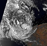
Clara began as a tropical depression located about 1000 km west-northwest of Cocos Island. Clara moved southwest before being named late on January 21. However, Clara was located close to Cyclone Brian and rapidly weaken due to shear from Brian. Clara regained tropical cyclone status on January 24 with peak intensity occurring 2 days later on January 26. Strong winds traveling northwest in the troposphere ripped Clara up, causing her to dissipate on January 29.
Severe Tropical Cyclone Dean
| Category 5 severe tropical cyclone (Australian scale) | |
| Category 4 tropical cyclone (SSHWS) | |
  | |
| Duration | 27 January – 4 February |
|---|---|
| Peak intensity | 205 km/h (125 mph) (10-min); 930 hPa (mbar) |
Tropical Cyclone Ruth
| Category 2 tropical cyclone (Australian scale) | |
| Category 1 tropical cyclone (SSHWS) | |
  | |
| Duration | 11 February – 18 February |
|---|---|
| Peak intensity | 100 km/h (65 mph) (10-min); 980 hPa (mbar) |
Severe Tropical Cyclone Enid
| Category 5 severe tropical cyclone (Australian scale) | |
| Category 4 tropical cyclone (SSHWS) | |
  | |
| Duration | 12 February – 18 February |
|---|---|
| Peak intensity | 205 km/h (125 mph) (10-min); 930 hPa (mbar) |
Severe Tropical Cyclone Fred
| Category 4 severe tropical cyclone (Australian scale) | |
| Category 4 tropical cyclone (SSHWS) | |
  | |
| Duration | 20 February – 28 February |
|---|---|
| Peak intensity | 195 km/h (120 mph) (10-min); 930 hPa (mbar) |
On 19 February, TCWC Perth reported that a tropical depression had developed out of an active area of convection that was associated with a monsoonal shear line about midway between the Cocos and Christmas Islands.
Fred developed from an active area of convection associated with the monsoon shear line about midway between Cocos and Christmas Islands late on 19 February 1980. It reached tropical cyclone strength early on 21 February 1980 and attained its maximum intensity on the afternoon of 24 February 1980 when the central pressure was estimated to be near 930 hPa. Despite the small size of the cyclone it maintained this intensity with minor fluctuations until about 1200 UTC 25 February 1980. Early on 26 February the direction of movement changed from southwestward to southward as Fred came under the influence of a northwesterly upper-level flow. It weakened rapidly as it moved into a strong ridge of high pressure located at about latitude 33°S.
Severe Tropical Cyclone Simon
| Category 4 severe tropical cyclone (Australian scale) | |
| Category 3 tropical cyclone (SSHWS) | |
 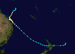 | |
| Duration | 21 February – 28 February (Crossed 160°E) |
|---|---|
| Peak intensity | 165 km/h (105 mph) (10-min); 950 hPa (mbar) |
Severe Tropical Cyclone Doris–Gloria
| Category 4 severe tropical cyclone (Australian scale) | |
| Category 3 tropical cyclone (SSHWS) | |
 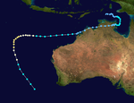 | |
| Duration | 14 March – 29 March |
|---|---|
| Peak intensity | 165 km/h (105 mph) (10-min); 955 hPa (mbar) |
Unnamed Tropical Cyclone (27P)
| Category 2 tropical cyclone (Australian scale) | |
| Tropical storm (SSHWS) | |
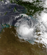  | |
| Duration | 27 March – 30 March |
|---|---|
| Peak intensity | 110 km/h (70 mph) (10-min); 998 hPa (mbar) |
On 27 March, TCWC Darwin reported that a tropical depression had developed in the Gulf of Carpentaria about 300 km (190 mi) to the southwest of Wallaby island. During that day the system intensified enough to produce localized and intermittent gale-force winds, over the northeast Arnhem land as it moved into the Arafura sea. Early on 28 March, TCWC Darwin reported that despite the depression having reached cyclone intensity of 65 km/h (40 mph), it was not a tropical cyclone as the system had not developed a "deep convective warm cored structure". However, during post storm analysis TCWC Darwin reported that the depression had become a tropical cyclone at 0000 UTC (0800 WST) on 28 March. During 28 March, the system moved towards the north, before during the next day as the cyclone turned towards the west and moved into the Arafura sea it reached its lowest central pressure of 998 hPa (29.47 inHg). As the system moved further into the Arafura sea, a very strong amount of vertical windshear and an intrusion of dry air made the cyclone rapidly weaken into a tropical depression before the residual depression dissipated on 31 March just to the north of the Cobourg peninsular. The Cyclone caused no deaths and only minor damage was reported to have occurred.
Other systems
During 9 March the precursor tropical low to Severe Tropical Cyclone Sina, moved south-westwards into the region of the South Pacific. The system subsequently developed into a tropical cyclone and was named Sina by the BoM, before it moved south-eastwards out of the region early the next day.
Seasonal effects
| Name | Dates | Peak intensity | Areas affected | Damages (AU$) |
Damages (US$) |
Deaths | |||
|---|---|---|---|---|---|---|---|---|---|
| Category | Wind speed (km/h (mph)) |
Pressure (hPa) | |||||||
| Tony | 26–31 August | Category 2 tropical cyclone | 95 km/h (60 mph) | 990 hPa (29.23 inHg) | None | None | None | None | |
| Simon | 21–28 February 1980 | Category 4 severe tropical cyclone | 165 km/h (105 mph) | 950 hPa (28.05 inHg) | Queensland, New Zealand | Minor | Minor | None | |
See also
- Atlantic hurricane seasons: 1979, 1980
- Eastern Pacific hurricane seasons: 1979, 1980
- Western Pacific typhoon seasons: 1979, 1980
- North Indian Ocean cyclone seasons: 1979, 1980
References
- ^ Unattributed (2010). "Tropical Cyclone Tony 1979-80". Bureau of Meteorology. Retrieved 14 June 2011.
- Donque, G. "La saison cyclonique 1979-1980 a Madagascar" (PDF). Madagascar Rev. De Geo (in French). 38 (Janv-Juin 1981). Direction de la Meteorologie Service de La Réunion: 115–120. Archived from the original (PDF) on 22 July 2011. Retrieved 14 June 2011.
- Bath, Michael (23 July 2010). "Southern Hemisphere Tropical Cyclone Season 1979-1980". Australian Severe Weather. Retrieved 14 June 2011.
- Severe Tropical Cyclone Viola (Report). Melbourne, Victoria: Bureau of Meteorology. Retrieved 19 September 2022.
- ^ Unattributed (2010). "Tropical Cyclone Paul 1979-80". Bureau of Meteorology. Retrieved 14 June 2011.
- "Tropical Cyclone Fred". Melbourne, Victoria: Australian Government Bureau of Meteorology. Retrieved 11 January 2022.
- ^ Crane, Geoff D. "The Australian tropical cyclone season 1979–80" (PDF). Australian Meteorological Magazine. 29: 41–53. Retrieved 1 May 2016.
- "Severe Tropical Cyclone Simon". Bureau of Meteorology. 2010. Retrieved 11 December 2011.
| 1970–1979 Australian region cyclone seasons | |
|---|---|
| Tropical cyclones in 1979 and 1980 | |
|---|---|
| Cyclones |
|
| Hurricanes | |
| Typhoons | |
| Non-seasonal lists | |