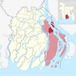
| Daulatkhan দৌলতখান | |
|---|---|
| Upazila | |
 | |
| Coordinates: 22°36.4′N 90°44.1′E / 22.6067°N 90.7350°E / 22.6067; 90.7350 | |
| Country | |
| Division | Barisal Division |
| District | Bhola District |
| Area | |
| • Total | 316.99 km (122.39 sq mi) |
| Elevation | 7 m (23 ft) |
| Population | |
| • Total | 181,813 |
| • Density | 570/km (1,500/sq mi) |
| • Male | 87,464 |
| • Female | 94,345 |
| Time zone | UTC+6 (BST) |
| Postal code | 8310 |
| Area code | 04924 |
| Website | Official Map of the Daulatkhan Upazila |
Daulatkhan (Bengali: দৌলতখান) is an upazila of Bhola District in the Division of Barisal, Bangladesh.
Geography
Daulatkhan is located at 22°36′25″N 90°44′09″E / 22.6069°N 90.7358°E / 22.6069; 90.7358. It has 29,233 households and its total area is 316.99 km (122.39 sq mi). It is bounded by Bhola sadar and Lakshmipur sadar upazilas on the north, Burhanuddin and Tazumuddin upazilas on the south, Ramgati upazila on the east, and Bhola Sadar upazila on the west.
Demographics
| Religions in Daulatkhan Upazila (2022) | ||||
|---|---|---|---|---|
| Religion | Percent | |||
| Islam | 97.82% | |||
| Hinduism | 2.17% | |||
| Other or not stated | 0.01% | |||
As of the 2011 Census of Bangladesh, Daulatkhan has a population of 168,567 living in 34,670 households. 45,544 (24.38%) were under 10 years of age. Daulatkhan has an average literacy rate of 41.60% (7+ years) and a sex ratio of 1022 females per 1000 males. 16,728 (9.92%) of the population lives in urban areas.
Par the 2001 Bangladesh census, Daulatkhan had a population of 173253, including male 90670, female 82583; Muslim 168823, Hindu 4401 and others 29.
According to the 1991 Bangladesh census, Daulatkhan had a population of 153,458, of whom 69,112 were aged 18 or older. Males constituted 52.54% of the population, and females 47.46%. Daulatkhan had an average literacy rate of 24.5% (7+ years), against the national average of 32.4%.
Administration

Daulatkhan Thana was formed in 1872 and it was turned into an upazila on 1 August 1983.
Daulatkhan Upazila is divided into Daulatkhan Municipality and nine union parishads: Char Khalifa, Charpata, Dakshin Joynagar, Hazipur, Madanpur, Madua, Sayedpur, Uttar Joynagar, and Vhovanipur. The union parishads are subdivided into 25 mauzas and 25 villages.
Daulatkhan Municipality is subdivided into 9 wards and 9 mahallas.
Notable people
- Azizuddin Ahmad (1897–1968), former Pakistan Minister for Minority Affairs
- Mostafa Kamal (1947–1971), sepoy and freedom fighter
See also
References
- "Geographic coordinates of Bhola Bangladesh". DATEANDTIME.INFO. Retrieved October 3, 2024.
- ^ National Report (PDF). Population and Housing Census 2022. Vol. 1. Dhaka: Bangladesh Bureau of Statistics. November 2023. p. 395. ISBN 978-9844752016.
- "Bangladesh Postal Code". Dhaka: Bangladesh Postal Department under the Department of Posts and Telecommunications of the Ministry of Posts, Telecommunications and Information Technology of the People's Republic of Bangladesh. 21 October 2024.
- "Bangladesh Area Code". China: Chahaoba.com. 18 October 2024.
- ^ Syed Mujtaba Ahmed Khan (2012). "Daulatkhan Upazila". In Sirajul Islam and Ahmed A. Jamal (ed.). Banglapedia: National Encyclopedia of Bangladesh (Second ed.). Asiatic Society of Bangladesh.
- Population and Housing Census 2022 - District Report: Bhola (PDF). District Series. Dhaka: Bangladesh Bureau of Statistics. June 2024. ISBN 978-984-475-250-4.
- "Bangladesh Population and Housing Census 2011 Zila Report – Bhola" (PDF). bbs.gov.bd. Bangladesh Bureau of Statistics.
- "Population Census Wing, BBS". Archived from the original on 2005-03-27. Retrieved November 10, 2006.
- ^ "District Statistics 2011: Bhola" (PDF). Bangladesh Bureau of Statistics. Archived from the original (PDF) on 13 November 2014. Retrieved 14 July 2014.
| Bhola District | ||
|---|---|---|
| Capital: Bhola | ||
| Upazilas | ||
| Constituencies | ||
| Attractions and sites | ||
| Inhabited areas |
| |
| Educational institutions | ||
| See also | ||
| Capital: Barisal | ||
| Barguna District |  | |
| Barisal District | ||
| Bhola District | ||
| Jhalokati District | ||
| Patuakhali District | ||
| Pirojpur District | ||
This Barisal Division location article is a stub. You can help Misplaced Pages by expanding it. |