| This article needs additional citations for verification. Please help improve this article by adding citations to reliable sources. Unsourced material may be challenged and removed. Find sources: "Dinard–Pleurtuit–Saint-Malo Airport" – news · newspapers · books · scholar · JSTOR (January 2024) (Learn how and when to remove this message) |
| Dinard–Pleurtuit–Saint-Malo Airport Aéroport de Dinard – Pleurtuit – Saint-Malo | |||||||||||||||||||
|---|---|---|---|---|---|---|---|---|---|---|---|---|---|---|---|---|---|---|---|
 | |||||||||||||||||||
| Summary | |||||||||||||||||||
| Airport type | Public | ||||||||||||||||||
| Operator | CCI du Pays de Saint-Malo | ||||||||||||||||||
| Serves | Saint-Malo | ||||||||||||||||||
| Location | Pleurtuit | ||||||||||||||||||
| Elevation AMSL | 219 ft / 67 m | ||||||||||||||||||
| Coordinates | 48°35′16″N 002°04′48″W / 48.58778°N 2.08000°W / 48.58778; -2.08000 | ||||||||||||||||||
| Website | Official website | ||||||||||||||||||
| Map | |||||||||||||||||||
  | |||||||||||||||||||
| Runways | |||||||||||||||||||
| |||||||||||||||||||
| Statistics (2017) | |||||||||||||||||||
| |||||||||||||||||||
| Source: French AIP | |||||||||||||||||||
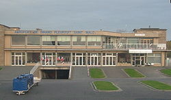
Dinard–Pleurtuit–Saint-Malo Airport or Aéroport de Dinard – Pleurtuit – Saint-Malo (IATA: DNR, ICAO: LFRD) is an airport serving the city of Saint-Malo, France. It is located 5 km (3.1 mi) south-southwest of Dinard in Pleurtuit, a commune of the département of Ille-et-Vilaine. It was the base of regional operator Rousseau Aviation [fr]
In 2017, Dinard-Pleurtuit-Saint-Malo airport handled 121.697 passengers, an increase of 10.2% over 2016.
Airlines and destinations
The following airlines operate regular scheduled and charter flights at Dinard–Pleurtuit–Saint-Malo Airport:
| Airlines | Destinations |
|---|
Statistics
| Graphs are unavailable due to technical issues. Updates on reimplementing the Graph extension, which will be known as the Chart extension, can be found on Phabricator and on MediaWiki.org. |
Côte d'Emeraude Flying Club
The flying club is located on the northeast of the 12/30 runway. It currently has four planes: a Robin DR400-180cv NM, a DR400-160cv HK, a DR221-100cv ZO and a Tecnam P2002JF CE. It is possible to get a PPL licence and an EASA LAPL (A) licence.
Access
The airport is located a short distance from the major tourist cities (by car):
- 15 minutes from Dinard city center.
- 20 minutes from Dinan.
- 25 minutes from Saint-Malo.
- 55 minutes from Rennes via the N137 dual carriageway.
Taxis and car rental are available from inside of the terminal.
References
- ^ LFRD – DINARD PLEURTUIT SAINT-MALO. AIP from French Service d'information aéronautique, effective 26 December 2024.
External links
- Dinard Aéroport Bretagne (official site) (in French)
- Dinard Brittany Airport (official site) (in English)
- Aéroport de Aéroport de Dinard – Pleurtuit – Saint-Malo (Union des Aéroports Français) (in French)
- Accident history for DNR at Aviation Safety Network
This French airport-related article is a stub. You can help Misplaced Pages by expanding it. |