| Eastham Airport | |
|---|---|
| Summary | |
| Operator | Private |
| Location | Eastham, Massachusetts |
| Built | Unknown |
| In use | Around 1946 |
| Occupants | Private |
| Elevation AMSL | 35 ft / 11 m |
| Coordinates | 41°51′3.15″N 69°59′36.04″W / 41.8508750°N 69.9933444°W / 41.8508750; -69.9933444 |
| Map | |
  | |
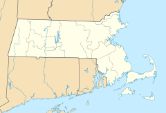
Eastham Airport was an airfield operational in the mid-20th century. The airfield was described as being located in a small field off Herring Brook Road in Eastham, Massachusetts.
References
- "Obituaries". Cape Cod Times. 13 December 2001. Archived from the original on 24 June 2013. Retrieved 22 June 2013.
- "Abandoned & Little-Known Airfields: Southeastern Massachusetts". Abandoned & Little-Known Airfields. 30 October 2014. Retrieved 18 April 2016.
| Airports in the Cape and Islands Area | |
|---|---|
| Primary | |
| Military | |
| General aviation | |
| Private |
|
| Heliports | |
| Seaplane bases | |
| Closed | |