Town in South Australia
| Ebenezer South Australia | |||||||||||||||
|---|---|---|---|---|---|---|---|---|---|---|---|---|---|---|---|
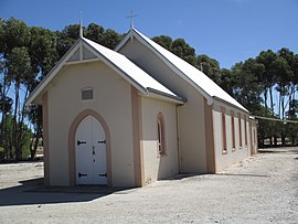
 Neukirch Lutheran church Neukirch Lutheran church | |||||||||||||||
 | |||||||||||||||
| Coordinates | 34°25′20″S 139°2′0″E / 34.42222°S 139.03333°E / -34.42222; 139.03333 | ||||||||||||||
| Population | 183 (SAL 2021) | ||||||||||||||
| Established | 1852 (sub-division) 16 March 2000 (locality) | ||||||||||||||
| Postcode(s) | 5355 | ||||||||||||||
| Location | |||||||||||||||
| LGA(s) | Light Regional Council | ||||||||||||||
| State electorate(s) | Stuart | ||||||||||||||
| Federal division(s) | Barker | ||||||||||||||
| |||||||||||||||
Ebenezer is a locality in the northern Barossa Valley of South Australia. It includes the historic Ebenezer settlement settled by 72 Wendish Lutherans who had migrated from Silesia in January 1852.
The modern locality of Ebenezer includes the nearby Neukirch settlement founded in 1854 by another group of Lutheran immigrants. Neukirch was renamed to Dimchurch in 1918 as part of the wholesale removal of German placenames in South Australia. The original name was restored in 1975.
In either 1868 or 1869, 56 German settlers left Ebenezer in 14 covered wagons and two spring carts to settle in the town of Walla Walla in the Riverina area of New South Wales.
Ebenezer originally started in 1851 a private sub-division in the cadastral unit of the Hundred of Belvidere. Boundaries were created for the “long established name” in 2000.
References
- Australian Bureau of Statistics (28 June 2022). "Ebenezer (SA) (suburb and locality)". Australian Census 2021 QuickStats. Retrieved 28 June 2022.

- "GEOGRAPHICAL NAMES ACT 1991, Notice to Assign Names and Boundaries to Places (within the District Council of Kapunda and Light )" (PDF). The South Australian Government Gazette. South Australian Government. 16 March 2000. p. 1433. Retrieved 6 March 2018.
- "Ebenezer Lutheran Church". Nuriootpa Lutheran Parish. Archived from the original on 6 February 2015. Retrieved 6 February 2015.
- "Neukirch Lutheran Church". Nuriootpa Lutheran Parish. Archived from the original on 6 February 2015. Retrieved 6 February 2015.
- "NEW PLACE NAMES". The Advertiser. Vol. LX, no. 18, 479. South Australia. 4 January 1918. p. 7. Retrieved 17 December 2021 – via National Library of Australia.
- "GEOGRAPHICAL NAMES ACT, 1969 (16)" (PDF). South Australian Government Gazette. Government of South Australia. 17 April 1975. p. 1594. Retrieved 18 December 2021 – via AustLII.
- "Walla Walla". Greater Hume Shire. Retrieved 9 February 2016.
- "Search result for " Ebenezer (LOCB)" (Record no SA0044754) with the following layers selected - "Suburbs and Localities" and " Place names (gazetteer)"". Property Location Browser. Government of South Australia. Archived from the original on 12 October 2016. Retrieved 8 August 2016.
| Towns and localities of the Light Regional Council | |
|---|---|
| Towns and localities |
|
| Geographic features | |
This South Australia geography article is a stub. You can help Misplaced Pages by expanding it. |