| El Papalon Airport San Miguel Regional Airport | |||||||||||
|---|---|---|---|---|---|---|---|---|---|---|---|
| Summary | |||||||||||
| Airport type | Public | ||||||||||
| Serves | San Miguel | ||||||||||
| Elevation AMSL | 285 ft / 87 m | ||||||||||
| Coordinates | 13°26′40″N 88°07′40″W / 13.44444°N 88.12778°W / 13.44444; -88.12778 | ||||||||||
| Map | |||||||||||
 | |||||||||||
| Runways | |||||||||||
| |||||||||||
| Source: Google Maps GCM | |||||||||||
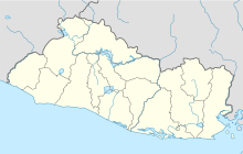
El Papalon Airport (ICAO: MSSM) is an airport serving the city of San Miguel in San Miguel Department, El Salvador. The runway is 5 kilometres (3.1 mi) southeast of the city, alongside the Pan American Highway.
The La Aramuaca Airport runway parallels the El Papalon runway, and is only 800 metres (2,600 ft) northeast.
See also
References
- Google Maps - El Papalon
- Airport information for El Papalon Airport at Great Circle Mapper.
- El Papalon and La Aramuaca
External links
This article about a Central American airport is a stub. You can help Misplaced Pages by expanding it. |
This El Salvador location article is a stub. You can help Misplaced Pages by expanding it. |