| Green Lake | |
|---|---|
| Ka Wai o Pele | |
 Green Lake, photographed in the 1890s Green Lake, photographed in the 1890s | |
  | |
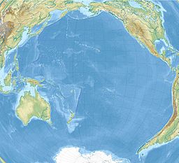
| Location | Hawaiʻi, United States |
| Coordinates | 19°30′08″N 154°50′22″W / 19.5023164°N 154.8393238°W / 19.5023164; -154.8393238 |
| Type | Volcanic crater lake |
| Basin countries | United States |
| Surface area | 0.5 ha (1.2 acres) |
| Max. depth | 61 m (200 ft) |
Green Lake (Hawaiian: Ka Wai o Pele) was a freshwater crater lake in Puʻu Kapoho crater on the island of Hawaiʻi. With a surface area of 0.8 hectares (2.0 acres) and a maximum depth of 61 metres (200 ft), it was the largest natural freshwater lake in the Hawaiian Islands, and, along with Lake Waiau, was one of two freshwater lakes on Hawaiʻi Island.
Hawaiian myths state that the lake was the first place visited by Pele, the volcano deity. The lake was a popular swimming spot for locals and tourists. Extensive vegetation, mainly Hibiscus tiliaceus, overhung the lake, shading about twenty percent of the lake's surface.
On June 2, 2018, the lake was destroyed when lava flowing from Kīlauea's lower Puna eruption boiled it away and completely filled the basin.
See also
References
- U.S. Geological Survey Geographic Names Information System: Green Lake
- Nicole Lautze, Donald Thomas, Nicholas Hinz, Garrett Apuzen-Ito, Neil Frazer, David Waller: Play fairway analysis of geothermal resources across the State of Hawaii: 1. Geological, geophysical, and geochemical datasets Archived 2023-09-19 at the Wayback Machine, in: Geothermics (article in press), URL https://dx.doi.org/10.1016/j.geothermics.2017.02.001, p. 10
- https://www.hawaiinewsnow.com/story/38346982/where-pele-first-visited-residents-react-to-the-loss-of-a-400-year-old-lake-due-to-lava/ (retrieved 2020-05-04)
- ^ Maciolek, J.A. (April 30, 1982). "Lakes and Lake-like Waters of the Hawaiian Archipelago" (PDF). Occasional Papers of Bernice P. Bishop Museum. 25 (1): 7, 11. Archived (PDF) from the original on August 1, 2019. Retrieved December 5, 2018.
- Ellis, William (1831). Polynesian Researches, Volume 4. London: Fisher, Son, & Jackson. p. 299. OCLC 935366901. Retrieved June 5, 2018 – via Internet Archive.
- Morris, Chris (June 5, 2018). "Lava Evaporates Hawaii's Largest Lake". Fortune. Archived from the original on June 5, 2018. Retrieved June 5, 2018.
- Peterkin, Olivia (June 4, 2018). "Into thin air: Lava flows claim Hawaii's largest lake in a matter of hours". Hawaii News Now. Archived from the original on February 22, 2023. Retrieved June 5, 2018.
- Comparison of satellite images on February 19 and August 6, 2018 Archived August 26, 2018, at the Wayback Machine (Planet Labs Inc.)
External links
- Peter T Young: Ka Wai O Pele
This Hawaiʻi state location article is a stub. You can help Misplaced Pages by expanding it. |

