| Halle Range | |
|---|---|
| Hallebjergene | |
 Map of Clavering Island (Eskimonaes) and neighbouring areas Map of Clavering Island (Eskimonaes) and neighbouring areas | |
| Highest point | |
| Peak | Bramsen Bjerg |
| Elevation | 1,272 m (4,173 ft) |
| Dimensions | |
| Length | 20 km (12 mi) NW/SE |
| Width | 15 km (9.3 mi) NE/SW |
| Area | 300 km (120 sq mi) |
| Geography | |
 | |
| Country | Greenland |
| Range coordinates | 74°14′N 21°45′W / 74.233°N 21.750°W / 74.233; -21.750 |
| Geology | |
| Rock age | Upper Carboniferous |
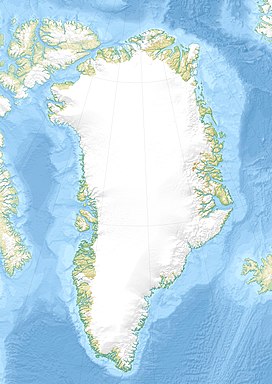
The Halle Range or Halle Mountains (Danish: Hallebjergene) is a mountain range in Clavering Island, King Christian X Land, northeastern Greenland. Administratively this range is part of the Northeast Greenland National Park zone.
The range was named by Lauge Koch during his 1929–30 expedition after Thore Gustav Halle (1884–1964), a professor at the University of Stockholm who had worked on the plant samples brought by the expedition. Formerly it had been also known as Joh. H. Andresenfjellet.
Geography
The Halle Range is an up to 1200 m high little glaciated mountain massif located in the southwest part of Clavering Island (Clavering Ø). Its average elevation is 912 m and the highest point of the range is 1272 m high Bramsen Bjerg. The Vildbækdalen is a valley in the heart of the range. The area of the Halle mountains is uninhabited.
 |
Mountains
- Bramsen Bjerg
- Brinkley Bjerg
- Dunken
- Eiger
- Forposten
- Gedderyggen
- Hjertet
- Højnålen
- Kisbjerg
- Langelinie
- Moltke Bjerg
- Monucleus
- Ortlerspids
- Pladen
- Skårene
- Steinmannspids
- Trinucleus
- Vestmar Bjerg
- Vesttinden
- Østtinden
See also
References
- Druid Wilson,Geologic Names of North America, Parts 1-2, p. 610
- "Hallebjergene". Mapcarta. Retrieved 22 June 2016.
- "Catalogue of place names in northern East Greenland". Geological Survey of Denmark. Retrieved 18 June 2016.
- Google Earth
This Greenland location article is a stub. You can help Misplaced Pages by expanding it. |