| Jesenice | |
|---|---|
| Municipality | |
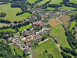
 Aerial view Aerial view | |
 Flag Flag Coat of arms Coat of arms | |
 | |
| Coordinates: 49°36′28″N 14°28′41″E / 49.60778°N 14.47806°E / 49.60778; 14.47806 | |
| Country | |
| Region | Central Bohemian |
| District | Příbram |
| First mentioned | 1352 |
| Area | |
| • Total | 12.91 km (4.98 sq mi) |
| Elevation | 373 m (1,224 ft) |
| Population | |
| • Total | 555 |
| • Density | 43/km (110/sq mi) |
| Time zone | UTC+1 (CET) |
| • Summer (DST) | UTC+2 (CEST) |
| Postal code | 264 01 |
| Website | www |
Jesenice is a municipality and village in Příbram District in the Central Bohemian Region of the Czech Republic. It has about 600 inhabitants.
Administrative division
Jesenice consists of nine municipal parts (in brackets population according to the 2021 census):
- Jesenice (241)
- Boudy (54)
- Dobrošovice (59)
- Dolce (4)
- Doublovičky (68)
- Hulín (26)
- Martinice (24)
- Mezné (42)
- Vršovice (9)
Etymology
The name is derived from the adjective jesenná (from jasan, i.e. 'ash') and originally denoted a meadow between ash trees or water flowing between ash trees.
Geography
Jesenice is located about 35 kilometres (22 mi) east of Příbram and 47 km (29 mi) south of Prague. It lies in the Vlašim Uplands. The highest point is at 555 m (1,821 ft) above sea level. The stream Sedlecký potok flows through the municipality.
History
The first written mention of Jesenice is from 1352.
Demographics
|
|
| ||||||||||||||||||||||||||||||||||||||||||||||||||||||
| Source: Censuses | ||||||||||||||||||||||||||||||||||||||||||||||||||||||||
Transport
There are no railways or major roads passing through the municipality.
Sights

The main landmark of Jesenice is the Church of the Holy Trinity. It was originally an early Gothic church from the second half of the 13th century. In 1799, it was rebuilt in the Baroque style, but the tower and part of the perimeter walls from the original church were preserved.
References
- "Population of Municipalities – 1 January 2024". Czech Statistical Office. 2024-05-17.
- "Public Census 2021 – basic data". Public Database (in Czech). Czech Statistical Office. 2022.
- ^ Profous, Antonín (1949). Místní jména v Čechách II: CH–L (in Czech). pp. 130–131.
- "Historický lexikon obcí České republiky 1869–2011" (in Czech). Czech Statistical Office. 2015-12-21.
- "Population Census 2021: Population by sex". Public Database. Czech Statistical Office. 2021-03-27.
- "Kostel Nejsvětější Trojice" (in Czech). National Heritage Institute. Retrieved 2024-08-12.