| This article includes a list of general references, but it lacks sufficient corresponding inline citations. Please help to improve this article by introducing more precise citations. (July 2024) (Learn how and when to remove this message) |
| Kaning'ina, Mzuzu | |
|---|---|
 | |
| Coordinates: 11°24′16″S 33°59′11″E / 11.40444°S 33.98639°E / -11.40444; 33.98639 | |
| Country | Malawi |
| Region | Northern Region, Malawi |
| Municipality | Mzuzu |
| Established | 1890 |
| Government | |
| • Type | Unitary presidential republic |
| Area | |
| • Total | 39.00 km (15.06 sq mi) |
| Population | |
| • Total | 13,924 |
| • Density | 360/km (920/sq mi) |
| Racial makeup (2018) | |
| • Black African | 94.0% |
| • Asian | 1.4% |
| • White | 1.3% |
| • Mixed | 1.1% |
| • Other | 1.1% |
| First languages (2018) | |
| • Tumbuka | 97.6% |
| • Tonga | 3.1% |
| • Ngonde | 0.2% |
| • Other | 2.1% |
| Time zone | UTC+2 (CAT) |
Kaning'ina is a residential town in Mzuzu in the northern region of Malawi. The town has a rich history dating back to the pre-colonial era, when it was a small village inhabited by the Tumbuka people. The town is home to the Kaning'ina Lions Football Club.
History
Establishments
Kaning'ina was established as a short-lived mission by Robert Laws and William Koyi in 1878. Attempting to convert the Ngoni people to Christianity, the station would only last a year.
A trading post by the British colonial administration in the early 20th century was established. It became a major commercial center in the region with increased development around Mzuzu.
Location
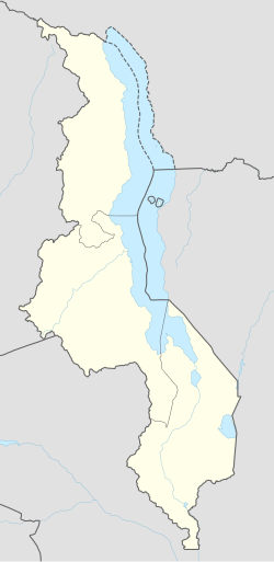
Kaning'ina is located in the Mzimba district of Malawi, in the northern region of the country. It is situated approximately 30 kilometers north of the town of Mzuzu, and about 10 kilometers south of the town of Ekwendeni. The town is nestled in a valley, surrounded by rolling hills and mountains.
Latitudes and longitudes
Kaning'ina is located at latitudes 11.10° S and longitudes 33.40° E.
Demographics
Kaning'ina has a population of approximately 2,500 people, who are predominantly from the Tumbuka ethnic group.
Economy
The economy of Kaning'ina is primarily based on agriculture, with many residents engaged in small-scale farming. The town is also home to a number of small businesses, including shops, restaurants, and lodges.
See also
References
- "Police arrest Mzuzu Prophet for encroaching Kaning'ina Mountain top - Malawi Nyasa Times - News from Malawi about Malawi". www.nyasatimes.com. 2021-09-15. Retrieved 2024-05-27.
- "Kaning'ina | DOPA Explorer". dopa-explorer.jrc.ec.europa.eu. Retrieved 2024-05-28.
- "Kaning'ina | DOPA Explorer". dopa-explorer.jrc.ec.europa.eu. Retrieved 2024-05-27.
- "Red Lions prey on Kaning'ina Lions - Malawi Nyasa Times - News from Malawi about Malawi". www.nyasatimes.com. 2022-06-26. Retrieved 2024-05-27.
- "Kaning'ina lions fall again - Malawi Nyasa Times - News from Malawi about Malawi". www.nyasatimes.com. 2022-04-27. Retrieved 2024-05-27.
- Thompson, Jack (1986). "TRUE LOVE AND ROOTS: A centenary re-assessment of the work of William Koyi among the Ngoni". The Society of Malawi Journal. 39 (2): 15–25. ISSN 0037-993X.
- https://unilia.ac.mw/kaningina/
- Magalasi, Chikondi (2017-06-17). "Kaning'ina Lions wary of Bankers Malawi 24 | Latest News from Malawi". Malawi 24. Retrieved 2024-05-27.
| Communities of Mzimba District, Northern Region, Malawi | |||||||||||||
|---|---|---|---|---|---|---|---|---|---|---|---|---|---|
| Seat: Mzimba | |||||||||||||
| Major cities and towns | |||||||||||||
| Mzimba District |
| ||||||||||||
