| Kranzberg | |
|---|---|
| Municipality | |
 Church of Saint Quirinus in Kranzberg Church of Saint Quirinus in Kranzberg | |
 Coat of arms Coat of arms | |
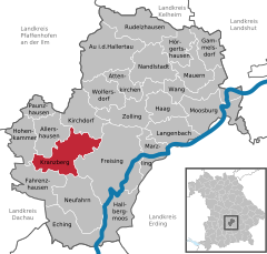
Location of Kranzberg within Freising district
 | |
  | |
| Coordinates: 48°24′N 11°37′E / 48.400°N 11.617°E / 48.400; 11.617 | |
| Country | Germany |
| State | Bavaria |
| Admin. region | Oberbayern |
| District | Freising |
| Government | |
| • Mayor (2020–26) | Hermann Hammerl (FW) |
| Area | |
| • Total | 39.50 km (15.25 sq mi) |
| Elevation | 483 m (1,585 ft) |
| Population | |
| • Total | 4,263 |
| • Density | 110/km (280/sq mi) |
| Time zone | UTC+01:00 (CET) |
| • Summer (DST) | UTC+02:00 (CEST) |
| Postal codes | 85402 |
| Dialling codes | 08166 |
| Vehicle registration | FS |
| Website | www.kranzberg.de |
Kranzberg is a municipality in the district of Freising in Bavaria in Germany.

At Bernstorf, a part within the municipality of Kranzberg, a Bronze Age fortification was found in 1904 by local historian Josef Wenzl. It was dated at around 1360 B.C. and is the largest known Bronze Age settlement north of the Alps. Most significant were finds of gold and amber objects which contained writings in Mycenaean Greek Linear B. These objects were found by amateur archaeologists Manfred Moosauer and Traudl Bachmair in 1998. The objects are now kept in the national Bavarian archaeological collection in Munich.
References
- Liste der ersten Bürgermeister/Oberbürgermeister in kreisangehörigen Gemeinden, Bayerisches Landesamt für Statistik, 15 July 2021.
- Genesis Online-Datenbank des Bayerischen Landesamtes für Statistik Tabelle 12411-003r Fortschreibung des Bevölkerungsstandes: Gemeinden, Stichtag (Einwohnerzahlen auf Grundlage des Zensus 2011).
- Karl Heinz Rieder und Rupert Gephard, Zwei Bronzezeitliche Bernsteinobjekte mit Bild- und Schriftzeichen aus Bernstorf (Lkr. Freising). Germania 80, 115-133
| Towns and municipalities in Freising (district) | ||
|---|---|---|
This Freising district location article is a stub. You can help Misplaced Pages by expanding it. |
