You can help expand this article with text translated from the corresponding article in German. (March 2009) Click for important translation instructions.
|
| Lalling | |
|---|---|
| Municipality | |
 Lalling Lalling | |
 Coat of arms Coat of arms | |
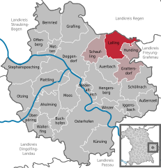
Location of Lalling within Deggendorf district
 | |
  | |
| Coordinates: 48°51′N 13°8′E / 48.850°N 13.133°E / 48.850; 13.133 | |
| Country | Germany |
| State | Bavaria |
| Admin. region | Niederbayern |
| District | Deggendorf |
| Municipal assoc. | Lalling |
| Government | |
| • Mayor (2020–26) | Michael Reitberger (CSU) |
| Area | |
| • Total | 27.94 km (10.79 sq mi) |
| Elevation | 446 m (1,463 ft) |
| Population | |
| • Total | 1,652 |
| • Density | 59/km (150/sq mi) |
| Time zone | UTC+01:00 (CET) |
| • Summer (DST) | UTC+02:00 (CEST) |
| Postal codes | 94551 |
| Dialling codes | 09904 |
| Vehicle registration | DEG |
| Website | www.lalling.de |
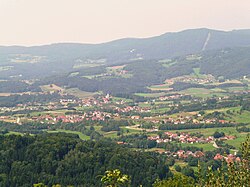
Lalling is a municipality in the Lower Bavarian district of Deggendorf in Germany. It is a nationally recognized resort town.
Geography
Lalling is located along the Danube in the south of the Bavarian Forest, specifically in what is called the Lallinger angle.
History
Lalling and its community were first mentioned in a letter of protection from Pope Eugene III in 1148. From the early 13th Century until 1803 the Niederaltaich Abbey was its largest landlord. Lalling was considered part of the lands held by the Electorate of Bavaria. In the course of administrative reform in Bavaria, it became municipality in 1818.
Attractions
- the Tithe barn at Niederalteich Abbey
References
- Liste der ersten Bürgermeister/Oberbürgermeister in kreisangehörigen Gemeinden, Bayerisches Landesamt für Statistik, 15 July 2021.
- Genesis Online-Datenbank des Bayerischen Landesamtes für Statistik Tabelle 12411-003r Fortschreibung des Bevölkerungsstandes: Gemeinden, Stichtag (Einwohnerzahlen auf Grundlage des Zensus 2011).
| Towns and municipalities in Deggendorf (district) | ||
|---|---|---|
This Deggendorf district location article is a stub. You can help Misplaced Pages by expanding it. |
