| Lel Лель | |
|---|---|
| Settlement | |
  | |
| Coordinates: 60°39′N 54°34′E / 60.650°N 54.567°E / 60.650; 54.567 | |
| Country | Russia |
| Region | Perm Krai |
| District | Gaynsky District |
| Time zone | UTC+5:00 |
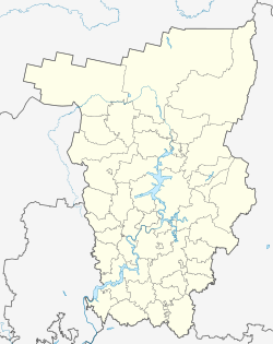
Lel (Russian: Лель) is a rural locality (a settlement) in Verkhnestaritskoye Rural Settlement, Gaynsky District, Perm Krai, Russia. The population was 163 as of 2010. There are 3 streets.
Geography
Lel is located 76 km northeast of Gayny (the district's administrative centre) by road. Lunym is the nearest rural locality.
References
- Карта Гайнского района Пермского края
- "численность населения городских округов, муниципальных районов, городских и сельских поселений, городских населенных пунктов, сельских населенных пунктов Пермского края по итогам Всероссийской переписи населения 2010 года". Archived from the original on 2014-09-10. Retrieved 2019-04-01.
- Расстояние от Леля до Гайнов
This Gaynsky District location article is a stub. You can help Misplaced Pages by expanding it. |