Village in Munster, Ireland
| Lemybrien Irish: Léim Uí Bhriain | |
|---|---|
| Village | |
 Shop and post office in Lemybrien Shop and post office in Lemybrien | |
 | |
| Coordinates: 52°10′06″N 7°31′16″W / 52.16825°N 7.52119°W / 52.16825; -7.52119 | |
| Country | Ireland |
| Province | Munster |
| County | County Waterford |
| Population | 192 |
| Time zone | UTC+0 (WET) |
| • Summer (DST) | UTC-1 (IST (WEST)) |
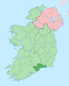
Lemybrien (Irish: Léim Uí Bhriain, meaning 'O'Brien's leap') is a small village and townland in County Waterford, Ireland. It is on the N25 Cork to Waterford City road. Lemybrien is in the foothills of the Comeragh Mountains, in an area of County Waterford known as "The Déise". As of the 2016 census, the village had a population of 192 people, of whom 104 were male and 88 female.
Sport
Stage 2 of the 1998 Tour de France passed through the area. Kilrossanty GAA sports club is based in Lemybrien.
Archeology
Drumlohan Souterrain and Ogham Stones, a national monument dating to the 5th–9th centuries AD, lies 4 km (2½ mi) to the east.
References
- ^ "Sapmap Area: Settlements Lemybrien". Census 2016. Central Statistics Office. 2016. Archived from the original on 14 February 2018. Retrieved 24 September 2021.
- "Placenames Database of Ireland". Dublin City University. Archived from the original on 24 September 2021. Retrieved 10 September 2015.
- "Kilrossanty GAA Club". Archived from the original on 9 January 2015. Retrieved 9 January 2015.
This article related to the geography of County Waterford, Ireland is a stub. You can help Misplaced Pages by expanding it. |
