| Rank
|
Stream name
|
Tributary of
|
Length
|
Drainage basin
|
Mouth elevation
|
Mouth Location
|
Mouth coordinates
|
Source location
|
Source coordinates
|
GNIS ID, References, Notes
|
| mi
|
km
|
ft
|
m
|
| 112†
|
Pigeon River
|
Lake Superior
|
31.2
|
50.2
|
Lake Superior
|
602
|
183
|
Cook County/Ontario, Pigeon Point
|
47°59′57″N 89°34′10″W / 47.9991667°N 89.5694444°W / 47.9991667; -89.5694444 (Pigeon River Mouth)
|
Cook County/Ontario, South Fowl Lake
|
48°02′23″N 89°59′47″W / 48.0396086°N 89.9964786°W / 48.0396086; -89.9964786 (Pigeon River Source)
|
657824
|
| 93
|
Brule River
|
Lake Superior
|
40
|
65
|
Lake Superior
|
602
|
183
|
Cook County, Marr Island
|
47°49′00″N 90°03′00″W / 47.8165587°N 90.0500980°W / 47.8165587; -90.0500980 (Brule River Mouth)
|
Cook County, Hungry Jack Lake
|
48°00′25″N 90°28′20″W / 48.0068342°N 90.4723229°W / 48.0068342; -90.4723229 (Brule River Source)
|
655530
|
| 97
|
Temperance River
|
Lake Superior
|
39
|
63
|
Lake Superior
|
602
|
183
|
Cook County, Tofte
|
47°33′12″N 90°52′25″W / 47.5532°N 90.8735°W / 47.5532; -90.8735 (Temperance River Mouth)
|
Cook County, Brule Lake
|
47°55′42″N 90°46′54″W / 47.9282453°N 90.7817286°W / 47.9282453; -90.7817286 (Temperance River Source)
|
658627
|
| 10†
|
St. Louis River
|
Lake Superior
|
192
|
309
|
Lake Superior
|
602
|
183
|
St. Louis County, West Duluth
|
46°45′N 92°06′W / 46.75°N 92.1°W / 46.75; -92.1 (Saint Louis River Mouth)
|
St. Louis County, Douglas County, Wisconsin
|
47°30′04″N 91°49′51″W / 47.5010312°N 91.8307225°W / 47.5010312; -91.8307225 (Saint Louis River Source)
|
662334
|
| 37
|
Cloquet River
|
St. Louis River
|
104
|
167
|
Lake Superior
|
1,201
|
366
|
St. Louis County
|
46°51′41″N 92°34′13″W / 46.86139°N 92.57028°W / 46.86139; -92.57028 (Cloquet River Mouth)
|
Lake County, Cloquet Lake
|
47°25′53″N 91°29′12″W / 47.4313058°N 91.4865513°W / 47.4313058; -91.4865513 (Cloquet River Source)
|
661012
|
| 109
|
Little Isabella River
|
Isabella River
|
33
|
53
|
Hudson Bay
|
1,503
|
458
|
Lake County
|
47°48′15″N 91°27′17″W / 47.8040688°N 91.4548569°W / 47.8040688; -91.4548569 (Little Isabella River Mouth)
|
Lake County
|
47°36′28″N 91°20′11″W / 47.6076855°N 91.3362608°W / 47.6076855; -91.3362608 (Little Isabella River Source)
|
657071
|
| 60
|
Whiteface River
|
St. Louis River
|
64
|
104
|
Lake Superior
|
1,250
|
381
|
St. Louis County, McCarty River
|
46°58′45″N 92°48′41″W / 46.9791082°N 92.8113096°W / 46.9791082; -92.8113096 (Whiteface River Mouth)
|
St. Louis County, Whiteface Reservoir
|
47°16′53″N 92°11′16″W / 47.2813186°N 92.187682°W / 47.2813186; -92.187682 (Whiteface River Source)
|
662794
|
| 88
|
West Swan River
|
East Swan River
|
42
|
68
|
Lake Superior
|
1,260
|
384
|
St. Louis County, Little Swan
|
47°15′04″N 92°49′06″W / 47.2510472°N 92.8182486°W / 47.2510472; -92.8182486 (West Swan River Mouth)
|
St. Louis County, Keewatin
|
47°24′49″N 93°00′28″W / 47.4135444°N 93.0076909°W / 47.4135444; -93.0076909 (West Swan River Source)
|
662774
|
| 74
|
Embarrass River
|
St. Louis River
|
51
|
81
|
Lake Superior
|
1,329
|
405
|
St. Louis County, Gilbert
|
47°41′46″N 91°59′50″W / 47.6960296°N 91.9971046°W / 47.6960296; -91.9971046 (Embarrass River Mouth)
|
St. Louis County, Babbitt
|
47°23′32″N 92°24′52″W / 47.3921512°N 92.4143509°W / 47.3921512; -92.4143509 (Embarrass River Source)
|
661216
|
| 101
|
Partridge River
|
St. Louis River
|
37
|
60
|
Lake Superior
|
1,394
|
425
|
St. Louis County, Turpela Lake
|
47°29′36″N 92°13′44″W / 47.4932590°N 92.2287889°W / 47.4932590; -92.2287889 (Partridge River Mouth)
|
St. Louis County, Babbitt
|
47°38′16″N 91°59′09″W / 47.6376974°N 91.9857185°W / 47.6376974; -91.9857185 (Partridge River Source)
|
662142
|
| 56†
|
Nemadji River
|
Lake Superior
|
71
|
114
|
Lake Superior
|
602
|
183
|
Douglas County, Wisconsin, Superior
|
46°24′03″N 92°30′29″W / 46.4007777°N 92.5079727°W / 46.4007777; -92.5079727 (Nemadji River Source)
|
Pine County, Minnesota, Nickerson
|
46°42′12″N 92°01′39″W / 46.7032730°N 92.0274122°W / 46.7032730; -92.0274122 (Nemadji River Mouth)
|
1570172
|
| 1†
|
Mississippi River
|
Gulf of Mexico
|
2,320
|
3,734
|
Mississippi River
|
0
|
0
|
Louisiana, Pilottown, Plaquemines Parish
|
29°09′04″N 89°15′12″W / 29.15111°N 89.25333°W / 29.15111; -89.25333 (Mississippi River Mouth)
|
Clearwater County, Itasca State Park
|
47°14′23″N 95°12′27″W / 47.23972°N 95.20750°W / 47.23972; -95.20750 (Mississippi River Source)
|
1629903
|
| 4
|
Minnesota River
|
Mississippi River
|
370
|
595
|
Mississippi River (Upper)
|
696
|
212
|
Ramsey County, St. Paul
|
44°53′49″N 93°08′57″W / 44.8969100°N 93.1491088°W / 44.8969100; -93.1491088 (Minnesota River Mouth)
|
Big Stone County, Ortonville
|
45°18′10″N 96°27′07″W / 45.3027427°N 96.4520012°W / 45.3027427; -96.4520012 (Minnesota River Source)
|
659759
|
| 13†
|
St. Croix River
|
Mississippi River
|
169
|
272
|
Mississippi River (Upper)
|
686
|
209
|
Dakota County, Hastings
|
44°44′45″N 92°48′10″W / 44.7458009°N 92.8027028°W / 44.7458009; -92.8027028 (St. Croix River Mouth)
|
Douglas County, Wisconsin, Upper St. Croix Lake
|
46°23′19″N 91°45′34″W / 46.38861°N 91.75944°W / 46.38861; -91.75944 (St. Croix River Source)
|
662324
|
| 2†
|
Red River of the North
|
Lake Winnipeg
|
550
|
885
|
Hudson Bay
|
715
|
218
|
Lake Winnipeg, Manitoba
|
50°24′01″N 96°48′00″W / 50.4002778°N 96.8000000°W / 50.4002778; -96.8000000 (Red River of the North Mouth)
|
Confluence of Bois de Sioux and Ottertail Rivers, Breckenridge
|
46°15′52″N 96°35′55″W / 46.2644033°N 96.5986848°W / 46.2644033; -96.5986848 (Red River of the North Source)
|
1035890
|
| 7†
|
Little Sioux River
|
Missouri River
|
258
|
415
|
Mississippi River (Lower)
|
1,010
|
308
|
Harrison County, Iowa
|
41°48′11″N 96°03′58″W / 41.803°N 96.066°W / 41.803; -96.066 (Little Sioux River Mouth)
|
Jackson County
|
43°39′52″N 95°18′53″W / 43.6644052°N 95.3147212°W / 43.6644052; -95.3147212 (Little Sioux River Source)
|
657126
|
| 65†
|
Ocheyedan River
|
Little Sioux River
|
58
|
93
|
Mississippi River (Lower)
|
1,306
|
398
|
Spencer, Clay County, Iowa
|
43°08′10″N 95°09′11″W / 43.136°N 95.153°W / 43.136; -95.153 (Ocheyedan River Mouth)
|
Ocheda Lake, Nobles County
|
43°32′49″N 95°38′17″W / 43.547°N 95.638°W / 43.547; -95.638 (Ocheyedan River Source)
|
459796
|
| 22†
|
Rock River
|
Big Sioux River
|
144
|
232
|
Mississippi River (Lower)
|
1,168
|
356
|
Sioux County, Iowa
|
43°04′58″N 96°27′16″W / 43.0827°N 96.4545°W / 43.0827; -96.4545 (Rock River Mouth)
|
Pipestone County
|
44°08′13″N 96°07′23″W / 44.1369°N 96.1231°W / 44.1369; -96.1231 (Rock River Source)
|
460744
|
| 71†
|
Split Rock Creek
|
Big Sioux River
|
55
|
89
|
Mississippi River (Lower)
|
1,280
|
390
|
Minnehaha County, South Dakota
|
43°32′59″N 96°35′51″W / 43.5496968°N 96.5975458°W / 43.5496968; -96.5975458 (Split Rock River Mouth)
|
Rock County
|
43°59′27″N 96°18′22″W / 43.9908036°N 96.3061447°W / 43.9908036; -96.3061447 (Split Rock River Source)
|
652403
|
| 72
|
Pipestone Creek
|
Split Rock Creek
|
53
|
86
|
Mississippi River (Lower)
|
1,506
|
459
|
Rock County
|
43°48′14″N 96°26′28″W / 43.80389°N 96.44111°W / 43.80389; -96.44111 (Split Rock Creek Mouth)
|
Pipestone County
|
44°01′52″N 96°17′25″W / 44.031081°N 96.2903114°W / 44.031081; -96.2903114 (Split Rock Creek Source)
|
649528
|
| 90
|
Flandreau Creek
|
Big Sioux River
|
41
|
66
|
Mississippi River (Lower)
|
1,529
|
466
|
Moody County, South Dakota
|
44°03′30″N 96°33′16″W / 44.0583042°N 96.5544895°W / 44.0583042; -96.5544895 (Flandreau Creek Mouth)
|
Lincoln County
|
44°13′53″N 96°17′06″W / 44.2313571°N 96.2850383°W / 44.2313571; -96.2850383 (Flandreau Creek Source)
|
643728
|
| 3†
|
Des Moines River
|
Mississippi River
|
525
|
845
|
Mississippi River (Lower)
|
597
|
182
|
Clark County, Missouri / Lee County, Iowa, near Keokuk, Iowa
|
40°22′52″N 91°25′21″W / 40.3812°N 91.4224°W / 40.3812; -91.4224 (Des Moines River Mouth)
|
Lyon County
|
44°05′02″N 95°41′17″W / 44.0839°N 95.6881°W / 44.0839; -95.6881 (Des Moines River Source)
|
465582
|
| 61†
|
Jack Creek
|
Des Moines River
|
64
|
103
|
Mississippi River (Lower)
|
1,401
|
427
|
Jackson County
|
43°46′02″N 95°17′09″W / 43.7671812°N 95.2858309°W / 43.7671812; -95.2858309 (Jack Creek Mouth)
|
Nobles County
|
43°47′40″N 95°49′54″W / 43.7944093°N 95.8316818°W / 43.7944093; -95.8316818 (Jack Creek Source)
|
645551
|
| 5†
|
Cedar River
|
Iowa River
|
338
|
544
|
Mississippi River (Lower)
|
594
|
181
|
Louisa County, Iowa
|
41°16′59″N 91°20′49″W / 41.28306°N 91.34694°W / 41.28306; -91.34694 (Cedar River Mouth)
|
Dodge County
|
43°50′05″N 92°48′28″W / 43.8346852°N 92.8076868°W / 43.8346852; -92.8076868 (Cedar River Source)
|
465058
|
| 31†
|
Shell Rock River
|
Cedar River
|
113
|
182
|
Mississippi River (Lower)
|
869
|
265
|
Black Hawk County, Iowa
|
42°38′03″N 92°30′05″W / 42.6341488°N 92.5012982°W / 42.6341488; -92.5012982 (Shell Rock River Mouth)
|
Albert Lea Lake,Freeborn County
|
43°36′42″N 93°17′37″W / 43.6116242°N 93.2935403°W / 43.6116242; -93.2935403 (Shell Rock River Source)
|
461563
|
| 48†
|
Little Cedar River
|
Cedar River
|
82
|
133
|
Mississippi River (Lower)
|
945
|
288
|
Chickasaw County, Iowa
|
42°57′02″N 92°31′39″W / 42.95056°N 92.52750°W / 42.95056; -92.52750 (Little Cedar River Mouth)
|
Mower County, Brownsdale
|
43°39′16″N 92°45′22″W / 43.65444°N 92.75611°W / 43.65444; -92.75611 (Little Cedar River Source)
|
458453
|
| 17†
|
Upper Iowa River
|
Mississippi River
|
156
|
251
|
Mississippi River (Lower)
|
620
|
189
|
Allamakee County, Iowa
|
43°27′58″N 91°14′02″W / 43.466°N 91.234°W / 43.466; -91.234 (Upper Iowa River Mouth)
|
Mower County
|
43°37′16″N 92°37′23″W / 43.621°N 92.623°W / 43.621; -92.623 (Upper Iowa River Source)
|
462496
|
| 6†
|
Wapsipinicon River
|
Mississippi River
|
300
|
482
|
Mississippi River (Lower)
|
574
|
175
|
Scott County, Iowa
|
41°43′47″N 90°19′11″W / 41.72972°N 90.31972°W / 41.72972; -90.31972 (Wapsipinicon River Mouth)
|
Mower County
|
43°32′55″N 92°38′40″W / 43.54861°N 92.64444°W / 43.54861; -92.64444 (Wapsipinicon River Source)
|
462671
|
| 51
|
Root River
|
Mississippi River
|
80
|
129
|
Mississippi River (Lower)
|
630
|
192
|
Houston County
|
43°45′43″N 91°15′06″W / 43.7619120°N 91.2518017°W / 43.7619120; -91.2518017 (Root River Mouth)
|
Fillmore County, Chatfield
|
43°48′24″N 92°10′14″W / 43.8066305°N 92.1704397°W / 43.8066305; -92.1704397 (Root River Source)
|
650249
|
| 59
|
Zumbro River
|
Mississippi River
|
65
|
104
|
Mississippi River (Lower)
|
666
|
203
|
Wabasha County
|
44°17′30″N 91°55′41″W / 44.2916319°N 91.9279396°W / 44.2916319; -91.9279396 (Zumbro River Mouth)
|
Olmsted County
|
44°09′10″N 92°28′02″W / 44.1527433°N 92.4671246°W / 44.1527433; -92.4671246 (Zumbro River Source)
|
654509
|
| 33
|
Cannon River
|
Mississippi River
|
112
|
180
|
Mississippi River (Lower)
|
666
|
203
|
Goodhue County
|
44°35′09″N 92°33′25″W / 44.5858009°N 92.5568581°W / 44.5858009; -92.5568581 (Cannon River Mouth)
|
Le Sueur County
|
44°21′31″N 93°26′51″W / 44.3585743°N 93.4474458°W / 44.3585743; -93.4474458 (Cannon River Source)
|
640874
|
| 114
|
Little Cannon River
|
Cannon River
|
31
|
49
|
Mississippi River (Lower)
|
781
|
238
|
Goodhue County
|
44°30′44″N 92°54′20″W / 44.5121892°N 92.9054840°W / 44.5121892; -92.9054840 (Little Cannon River Mouth)
|
Rice County
|
44°19′04″N 93°04′43″W / 44.3177425°N 93.0785435°W / 44.3177425; -93.0785435 (Little Cannon River Source)
|
646775
|
| 69
|
Straight River
|
Cannon River
|
56
|
89
|
Mississippi River (Lower)
|
961
|
293
|
Rice County
|
44°18′36″N 93°16′13″W / 44.3099637°N 93.2702162°W / 44.3099637; -93.2702162 (Straight River Mouth)
|
Freeborn County
|
44°30′44″N 92°54′20″W / 44.5121892°N 92.9054840°W / 44.5121892; -92.9054840 (Straight River Source)
|
652708
|
| 64
|
Vermillion River
|
Mississippi River
|
60
|
96
|
Mississippi River (Lower)
|
676
|
206
|
Goodhue County
|
44°30′44″N 92°54′20″W / 44.5121892°N 92.9054840°W / 44.5121892; -92.9054840 (Vermillion River Mouth)
|
Scott County
|
44°37′14″N 92°40′01″W / 44.6205230°N 92.6668629°W / 44.6205230; -92.6668629 (Vermillion River Source)
|
653634
|
| 95
|
Vermilion River
|
Rainy River
|
40
|
64
|
Hudson Bay
|
1,112
|
339
|
St. Louis County
|
48°16′33″N 92°30′23″W / 48.2757°N 92.5065°W / 48.2757; -92.5065 (Vermilion River Mouth)
|
St. Louis County
|
47°57′40″N 92°28′33″W / 47.9610236°N 92.4757155°W / 47.9610236; -92.4757155 (Vermilion River Source)
|
662718
|
| 98
|
Sunrise River
|
St. Croix River
|
39
|
63
|
St. Croix River
|
768
|
234
|
Chisago County
|
45°34′00″N 92°51′46″W / 45.5666269°N 92.8627138°W / 45.5666269; -92.8627138 (Sunrise River Mouth)
|
Washington County
|
45°17′24″N 92°58′28″W / 45.2899669°N 92.9743847°W / 45.2899669; -92.9743847 (Sunrise River Source)
|
652846
|
| 38
|
Snake River
|
St. Croix River
|
104
|
167
|
St. Croix River
|
797
|
243
|
Pine County
|
45°49′27″N 92°45′53″W / 45.8241202°N 92.7646490°W / 45.8241202; -92.7646490 (Snake River Mouth)
|
Aitkin County
|
46°17′17″N 93°06′43″W / 46.2880017°N 93.1118814°W / 46.2880017; -93.1118814 (Snake River Source)
|
658321
|
| 96
|
Groundhouse River
|
Snake River
|
40
|
64
|
St. Croix River
|
948
|
289
|
Kanabec County
|
45°48′39″N 93°15′44″W / 45.8107936°N 93.2621676°W / 45.8107936; -93.2621676 (Groundhouse River Mouth)
|
Mille Lacs County
|
45°58′31″N 93°34′03″W / 45.9752372°N 93.5674621°W / 45.9752372; -93.5674621 (Groundhouse River Source)
|
644496
|
| 46
|
Kettle River
|
St. Croix River
|
84
|
135
|
St. Croix River
|
810
|
247
|
Pine County
|
45°51′28″N 92°44′11″W / 45.8577304°N 92.7363141°W / 45.8577304; -92.7363141 (Kettle River Mouth)
|
Carlton County
|
46°41′14″N 92°47′17″W / 46.6871686°N 92.7879778°W / 46.6871686; -92.7879778 (Kettle River Source)
|
646128
|
| 111
|
Willow River
|
Kettle River
|
31
|
51
|
St. Croix River
|
1,020
|
311
|
Pine County
|
46°19′11″N 92°50′48″W / 46.3196683°N 92.8465896°W / 46.3196683; -92.8465896 (Willow River Mouth)
|
Pine County
|
46°21′54″N 92°28′26″W / 46.3649439°N 92.4738062°W / 46.3649439; -92.4738062 (Willow River Source)
|
654205
|
| 105
|
Moose Horn River
|
Kettle River
|
36
|
59
|
St. Croix River
|
1,020
|
311
|
Carlton County
|
46°21′54″N 92°28′26″W / 46.3649439°N 92.4738062°W / 46.3649439; -92.4738062 (Moose Horn River Mouth)
|
Carlton County
|
46°40′15″N 92°36′26″W / 46.6707782°N 92.6071382°W / 46.6707782; -92.6071382 (Moose Horn River Source)
|
648090
|
| 87
|
Sand Creek
|
St. Croix River
|
43
|
70
|
St. Croix River
|
853
|
260
|
Pine County
|
45°56′03″N 92°38′25″W / 45.9341168°N 92.6401989°W / 45.9341168; -92.6401989 (Sand Creek Mouth)
|
Pine County
|
46°16′34″N 92°31′56″W / 46.2760554°N 92.5321405°W / 46.2760554; -92.5321405 (Sand Creek Source)
|
651137
|
| 99
|
Lower Tamarack River
|
St. Croix River
|
39
|
63
|
St. Croix River
|
876
|
267
|
Pine County
|
46°01′39″N 92°25′10″W / 46.0274455°N 92.4193612°W / 46.0274455; -92.4193612 (Lower Tamarack River Mouth)
|
Pine County
|
46°18′56″N 92°25′44″W / 46.3154989°N 92.4288065°W / 46.3154989; -92.4288065 (Lower Tamarack River Source)
|
647267
|
| 113
|
Upper Tamarack River
|
St. Croix River
|
31
|
50
|
St. Croix River
|
886
|
270
|
Pine County
|
46°04′13″N 92°19′09″W / 46.0702214°N 92.3190826°W / 46.0702214; -92.3190826 (Upper Tamarack River Mouth)
|
Douglas County, Wisconsin
|
46°20′00″N 92°05′11″W / 46.3332747°N 92.0863024°W / 46.3332747; -92.0863024 (Upper Tamarack River Source)
|
1815030
|
| 104
|
Sand Creek
|
Minnesota River
|
37
|
59
|
Minnesota River
|
696
|
212
|
Scott County
|
44°44′53″N 93°36′50″W / 44.7480183°N 93.6138459°W / 44.7480183; -93.6138459 (Sand Creek Mouth)
|
Le Sueur County
|
44°28′44″N 93°33′26″W / 44.4788522°N 93.5571747°W / 44.4788522; -93.5571747 (Sand Creek Source)
|
651135
|
| 57
|
High Island Creek
|
Minnesota River
|
69
|
112
|
Minnesota River
|
722
|
220
|
Sibley County
|
44°35′08″N 93°54′05″W / 44.5855190°N 93.9013551°W / 44.5855190; -93.9013551 (High Island Creek Mouth)
|
Renville County
|
44°38′58″N 94°42′12″W / 44.6494065°N 94.7033228°W / 44.6494065; -94.7033228 (High Island Creek Source)
|
644939
|
| 35
|
Blue Earth River
|
Minnesota River
|
108
|
174
|
Minnesota River
|
751
|
229
|
Blue Earth County
|
44°09′51″N 94°02′13″W / 44.1641329°N 94.0369007°W / 44.1641329; -94.0369007 (Blue Earth River Mouth)
|
Faribault County
|
43°34′20″N 94°06′11″W / 43.5721775°N 94.1030157°W / 43.5721775; -94.1030157 (Blue Earth River Source)
|
640285
|
| 34
|
Le Sueur River
|
Blue Earth River
|
111
|
178
|
Minnesota River
|
764
|
233
|
Blue Earth County
|
44°07′36″N 94°02′52″W / 44.1266324°N 94.0477339°W / 44.1266324; -94.0477339 (Le sueur River Mouth)
|
Freeborn County
|
43°46′03″N 93°28′13″W / 43.7674575°N 93.4702153°W / 43.7674575; -93.4702153 (Le sueur River Source)
|
646550
|
| 50
|
Maple River
|
Le Sueur River
|
80
|
129
|
Minnesota River
|
814
|
248
|
Blue Earth County
|
44°05′14″N 94°00′55″W / 44.0871877°N 94.0152326°W / 44.0871877; -94.0152326 (Maple River Mouth)
|
Freeborn County
|
43°47′05″N 93°38′28″W / 43.7846792°N 93.6410551°W / 43.7846792; -93.6410551 (Maple River Source)
|
647499
|
| 53
|
Cobb River
|
Le Sueur River
|
79
|
126
|
Minnesota River
|
810
|
247
|
Blue Earth County
|
44°04′39″N 94°00′03″W / 44.0774656°N 94.0007877°W / 44.0774656; -94.0007877 (Cobb River Mouth)
|
Freeborn County
|
43°45′16″N 93°34′48″W / 43.7544007°N 93.5799416°W / 43.7544007; -93.5799416 (Cobb River Source)
|
641371
|
| 102
|
Little Cobb River
|
Cobb River
|
37
|
60
|
Minnesota River
|
974
|
297
|
Blue Earth County
|
43°59′31″N 93°55′16″W / 43.9919099°N 93.9210631°W / 43.9919099; -93.9210631 (Little Cobb River Mouth)
|
Waseca Countyformat=dms|
|
43°52′47″N 93°39′29″W / 43.8796832°N 93.6580007°W / 43.8796832; -93.6580007 (Little Cobb River Source)
|
646783
|
| 30
|
Watonwan River
|
Blue Earth River
|
113
|
182
|
Minnesota River
|
869
|
265
|
Blue Earth County
|
44°04′13″N 94°07′35″W / 44.0702421°N 94.1263464°W / 44.0702421; -94.1263464 (Watonwan River Mouth)
|
Cottonwood County
|
44°01′30″N 95°13′12″W / 44.024957°N 95.2199936°W / 44.024957; -95.2199936 (Watonwan River Source)
|
653842
|
| 100
|
Perch Creek
|
Watonwan River
|
37
|
60
|
Minnesota River
|
938
|
286
|
Blue Earth County
|
44°00′07″N 94°16′54″W / 44.0019059°N 94.2816268°W / 44.0019059; -94.2816268 (Perch Creek Mouth)
|
Martin County
|
43°48′16″N 94°28′23″W / 43.8044001°N 94.4730254°W / 43.8044001; -94.4730254 (Perch Creek Source)
|
649278
|
| 43
|
Elm Creek
|
Blue Earth River
|
90
|
144
|
Minnesota River
|
1,014
|
309
|
Faribault County
|
43°45′17″N 94°11′48″W / 43.7546770°N 94.1966295°W / 43.7546770; -94.1966295 (Elm Creek Mouth)
|
Jackson County
|
43°47′05″N 95°02′34″W / 43.7846795°N 95.0427685°W / 43.7846795; -95.0427685 (Elm Creek Source)
|
643295
|
| 47
|
Little Cottonwood River
|
Minnesota River
|
83
|
133
|
Minnesota River
|
778
|
237
|
Blue Earth County
|
44°15′05″N 94°19′47″W / 44.2513537°N 94.3296889°W / 44.2513537; -94.3296889 (Little Cottwood River Mouth)
|
Cottonwood County
|
44°02′28″N 95°11′35″W / 44.0410682°N 95.1930488°W / 44.0410682; -95.1930488 (Little Cottwood River Source)
|
646788
|
| 19
|
Cottonwood River
|
Minnesota River
|
152
|
245
|
Minnesota River
|
694
|
212
|
Brown County
|
44°17′05″N 94°24′55″W / 44.2846855°N 94.4152485°W / 44.2846855; -94.4152485 (Cottwood River Mouth)
|
Lyon County
|
44°12′06″N 95°56′06″W / 44.2016305°N 95.9350221°W / 44.2016305; -95.9350221 (Cottwood River Source)
|
641538
|
| 73
|
Sleepy Eye Creek
|
Cottonwood River
|
52
|
83
|
Minnesota River
|
961
|
293
|
Brown County
|
44°15′12″N 94°46′22″W / 44.2532937°N 94.7727618°W / 44.2532937; -94.7727618 (Sleepy Eye Creek Mouth)
|
Redwood County
|
44°24′12″N 95°31′08″W / 44.4032896°N 95.5188984°W / 44.4032896; -95.5188984 (Sleepy Eye Creek Source)
|
652151
|
| 107
|
Plum Creek
|
Cottonwood River
|
35
|
57
|
Minnesota River
|
1,076
|
328
|
Redwood County
|
44°16′52″N 95°22′44″W / 44.2810674°N 95.3788910°W / 44.2810674; -95.3788910 (Plum Creek Mouth)
|
Murray County
|
44°10′33″N 95°36′08″W / 44.1757923°N 95.6022311°W / 44.1757923; -95.6022311 (Plum Creek Source)
|
649592
|
| 25
|
Redwood River
|
Minnesota River
|
127
|
205
|
Minnesota River
|
830
|
253
|
Redwood County
|
44°34′16″N 95°05′18″W / 44.5710710°N 95.0883313°W / 44.5710710; -95.0883313 (Redwood River Mouth)
|
Pipestone
|
44°10′03″N 96°10′18″W / 44.1674676°N 96.1716987°W / 44.1674676; -96.1716987 (Redwood River Source)
|
658010
|
| 62
|
Hawk Creek
|
Minnesota River
|
62
|
100
|
Minnesota River
|
869
|
265
|
Renville County
|
44°44′10″N 95°25′21″W / 44.7360690°N 95.4225136°W / 44.7360690; -95.4225136 (Hawk Creek Mouth)
|
Kandiyohi County
|
45°07′28″N 95°04′30″W / 45.1244072°N 95.0750102°W / 45.1244072; -95.0750102 (Hawk Creek Source)
|
644736
|
| 36
|
Yellow Medicine River
|
Minnesota River
|
107
|
173
|
Minnesota River
|
666
|
203
|
Yellow Medicine County
|
44°44′21″N 95°25′43″W / 44.7391245°N 95.4286250°W / 44.7391245; -95.4286250 (Yellow Medicine River Mouth)
|
Lincoln County
|
44°24′41″N 96°21′05″W / 44.4113543°N 96.3514318°W / 44.4113543; -96.3514318 (Yellow Medicine River Source)
|
654416
|
| 108
|
Spring Creek
|
Yellow Medicine River
|
33
|
54
|
Minnesota River
|
1,030
|
314
|
Yellow Medicine County
|
44°42′38″N 95°40′23″W / 44.7105131°N 95.6730778°W / 44.7105131; -95.6730778 (Spring Creek Mouth)
|
Yellow Medicine County
|
44°47′25″N 96°08′07″W / 44.7902397°N 96.1353171°W / 44.7902397; -96.1353171 (Spring Creek Source)
|
652432
|
| 18
|
Chippewa River
|
Minnesota River
|
153
|
246
|
Minnesota River
|
919
|
280
|
Chippewa County
|
44°56′05″N 95°44′00″W / 44.9346792°N 95.7333596°W / 44.9346792; -95.7333596 (Chippewa River Mouth)
|
Douglas County
|
45°59′17″N 95°38′44″W / 45.9880164°N 95.6456011°W / 45.9880164; -95.6456011 (Chippewa River Source)
|
641167
|
| 79
|
Shakopee Creek
|
Chipppewa River
|
49
|
78
|
Minnesota River
|
919
|
280
|
Swift County
|
45°12′17″N 95°39′49″W / 45.2046818°N 95.6636445°W / 45.2046818; -95.6636445 (Shakopee Creek Mouth)
|
Kandiyohi County
|
45°18′13″N 95°02′50″W / 45.3035753°N 95.0472367°W / 45.3035753; -95.0472367 (Shakopee Creek Source)
|
651899
|
| 91
|
Little Chippewa River
|
Chippewa River
|
41
|
66
|
Minnesota River
|
1,106
|
337
|
Pope County
|
45°35′33″N 95°41′00″W / 45.5924605°N 95.6833783°W / 45.5924605; -95.6833783 (Little Chippew River Mouth)
|
Pope County
|
45°43′48″N 95°30′59″W / 45.7299601°N 95.5164312°W / 45.7299601; -95.5164312 (Little Chippew River Source)
|
641167
|
| 28
|
Lac qui Parle River
|
Minnesota River
|
118
|
190
|
Minnesota River
|
935
|
285
|
Lac qui Parle County
|
45°35′33″N 95°41′00″W / 45.5924605°N 95.6833783°W / 45.5924605; -95.6833783 (Lac qui Parle River Mouth)
|
Lincoln County
|
44°30′17″N 96°26′06″W / 44.5046858°N 96.4350466°W / 44.5046858; -96.4350466 (Lac qui Parle River Source)
|
646304
|
| 26
|
Pomme de Terre River
|
Minnesota River
|
125
|
200
|
Minnesota River
|
942
|
287
|
Swift County
|
45°10′33″N 96°05′13″W / 45.1757955°N 96.0869905°W / 45.1757955; -96.0869905 (Pomme de Terre River Mouth)
|
Otter Tail County
|
46°11′55″N 95°51′20″W / 46.1985714°N 95.8556069°W / 46.1985714; -95.8556069 (Pomme de Terre River Source)
|
649622
|
| 55†
|
Little Minnesota River
|
Minnesota River
|
71
|
115
|
Minnesota River
|
968
|
295
|
Big Stone County
|
45°33′14″N 96°47′43″W / 45.5538503°N 96.7953497°W / 45.5538503; -96.7953497 (Little Minnesota River Mouth)
|
Roberts County, South Dakota
|
45°50′09″N 97°21′21″W / 45.8357909°N 97.3559275°W / 45.8357909; -97.3559275 (Little Minnesota River Source)
|
646859
|
| 20
|
Rum River
|
Mississippi River
|
151
|
243
|
Mississippi River (Upper)
|
827
|
252
|
Anoka County
|
45°11′23″N 93°23′26″W / 45.1896872°N 93.3905092°W / 45.1896872; -93.3905092 (Rum River Mouth)
|
Mille Lacs County
|
46°07′47″N 93°46′52″W / 46.1296824°N 93.7810846°W / 46.1296824; -93.7810846 (Rum River Source)
|
650382
|
| 16
|
North Fork Crow River
|
Crow River
|
158
|
253
|
Mississippi River (Upper)
|
906
|
276
|
Wright County
|
45°04′53″N 93°45′45″W / 45.0813519°N 93.7624663°W / 45.0813519; -93.7624663 (North Fork Crow River Mouth)
|
Pope County
|
45°36′07″N 95°10′16″W / 45.601908°N 95.1711377°W / 45.601908; -95.1711377 (North Fork Crow River Source)
|
648637
|
| 83
|
Middle Fork Crow River
|
Crow River
|
45
|
73
|
Mississippi River (Upper)
|
1,099
|
335
|
Meeker County
|
45°15′09″N 94°36′08″W / 45.2524633°N 94.6022187°W / 45.2524633; -94.6022187 (Middle Fork Crow River Mouth)
|
Stearns County
|
45°26′05″N 94°59′11″W / 45.4346872°N 94.9864041°W / 45.4346872; -94.9864041 (Middle Fork Crow River Source)
|
647809
|
| 29
|
South Fork Crow River
|
Crow River
|
116
|
187
|
Mississippi River (Upper)
|
614
|
187
|
Wright County
|
45°04′53″N 93°45′45″W / 45.0813519°N 93.7624663°W / 45.0813519; -93.7624663 (South Fork Crow River Mouth)
|
Kandiyohi County
|
45°03′26″N 94°55′18″W / 45.057185°N 94.9216698°W / 45.057185; -94.9216698 (South Fork Crow River Source)
|
663175
|
| 44
|
Buffalo Creek
|
South Fork Crow River
|
84
|
136
|
Mississippi River (Upper)
|
948
|
289
|
Carver County
|
44°51′16″N 93°59′52″W / 44.8544067°N 93.9977485°W / 44.8544067; -93.9977485 (Buffalo Creek Mouth)
|
Kandiyohi County
|
44°55′07″N 94°59′25″W / 44.918573°N 94.9902796°W / 44.918573; -94.9902796 (Buffalo Creek Source)
|
663168
|
| 45
|
Elk River
|
Mississippi River
|
84
|
135
|
Mississippi River (Upper)
|
850
|
259
|
Sherburne County
|
45°17′53″N 93°34′21″W / 45.2980205°N 93.5724605°W / 45.2980205; -93.5724605 (Elk River Mouth)
|
Benton County
|
45°49′09″N 93°55′40″W / 45.8191331°N 93.9277579°W / 45.8191331; -93.9277579 (Elk River Source)
|
643267
|
| 52
|
St. Francis River
|
Elk River
|
79
|
127
|
Mississippi River (Upper)
|
915
|
279
|
Sherburne County
|
45°21′33″N 93°44′14″W / 45.3591318°N 93.7371913°W / 45.3591318; -93.7371913 (St. Francis River Mouth)
|
Benton County
|
45°48′29″N 93°53′31″W / 45.8080222°N 93.8919224°W / 45.8080222; -93.8919224 (St. Francis River Source)
|
650587
|
| 86
|
Clearwater River
|
Mississippi River
|
43
|
70
|
Mississippi River
|
938
|
286
|
Stearns County
|
45°25′22″N 94°02′57″W / 45.4227433°N 94.0491499°W / 45.4227433; -94.0491499 (Clearwater River Mouth)
|
Meeker County
|
45°21′22″N 94°25′43″W / 45.3560748°N 94.4286045°W / 45.3560748; -94.4286045 (Clearwater River Source)
|
641322
|
| 27
|
Sauk River
|
Mississippi River
|
122
|
196
|
Mississippi River (Upper)
|
991
|
302
|
Stearns County
|
45°35′30″N 94°10′35″W / 45.5916320°N 94.1763793°W / 45.5916320; -94.1763793 (Sauk River Mouth)
|
Todd County
|
45°53′45″N 95°05′45″W / 45.8957971°N 95.0958619°W / 45.8957971; -95.0958619 (Sauk River Source)
|
651237
|
| 70
|
Platte River
|
Mississippi River
|
55
|
89
|
Mississippi River (Upper)
|
1,020
|
311
|
Benton County
|
45°46′45″N 94°16′45″W / 45.7791320°N 94.2791638°W / 45.7791320; -94.2791638 (Platte River Mouth)
|
Crow Wing County
|
46°12′02″N 93°54′13″W / 46.2005171°N 93.9035922°W / 46.2005171; -93.9035922 (Platte River Source)
|
649544
|
| 106
|
Skunk River
|
Patte River
|
36
|
58
|
Mississippi River (Upper)
|
1,099
|
335
|
Morrison County
|
45°56′09″N 94°13′24″W / 45.9357989°N 94.2233296°W / 45.9357989; -94.2233296 (Skunk River Mouth)
|
Morrison County
|
46°07′35″N 93°51′42″W / 46.1263505°N 93.8616448°W / 46.1263505; -93.8616448 (Skunk River Source)
|
652139
|
| 103
|
Swan River
|
Mississippi River
|
37
|
60
|
Mississippi River (Upper)
|
1,083
|
330
|
Morrison County
|
45°55′10″N 94°23′08″W / 45.9194099°N 94.3855582°W / 45.9194099; -94.3855582 (Swan River Mouth)
|
Todd County
|
45°54′27″N 94°44′46″W / 45.9074651°N 94.7461281°W / 45.9074651; -94.7461281 (Swan River Source)
|
652909
|
| 82
|
Nokasippi River
|
Mississippi River
|
47
|
75
|
Mississippi River (Upper)
|
1,142
|
348
|
Crow Wing County, Clear Water Lake
|
46°10′39″N 94°21′53″W / 46.1774666°N 94.3647254°W / 46.1774666; -94.3647254 (Nokasippi River Mouth)
|
Crow Wing County, Fort Ripley
|
46°24′47″N 93°54′41″W / 46.4130171°N 93.9113703°W / 46.4130171; -93.9113703 (Nokasippi River Source)
|
648568
|
| 32
|
Crow Wing River
|
Mississippi River
|
113
|
182
|
Mississippi River (Upper)
|
1,148
|
350
|
Cass County
|
46°16′16″N 94°20′23″W / 46.2710781°N 94.3397242°W / 46.2710781; -94.3397242 (Crow Wing River Mouth)
|
Hubbard County
|
47°00′07″N 94°44′29″W / 47.0019027°N 94.7413962°W / 47.0019027; -94.7413962 (Crow Wing River Source)
|
655896
|
| 40
|
Long Prairie River
|
Crow Wing River
|
96
|
154
|
Mississippi River (Upper)
|
1,204
|
367
|
Morrison County
|
46°19′27″N 94°36′46″W / 46.3241320°N 94.6127907°W / 46.3241320; -94.6127907 (Long Prairie River Mouth)
|
Douglas County
|
45°58′58″N 95°19′59″W / 45.9827403°N 95.3330922°W / 45.9827403; -95.3330922 (Long Prairie River Source)
|
647141
|
| 110
|
Partridge River
|
Crow Wing River
|
33
|
52
|
Mississippi River (Upper)
|
1,240
|
378
|
Wadena County
|
46°25′11″N 94°49′36″W / 46.4196848°N 94.8266853°W / 46.4196848; -94.8266853 (Partridge River Mouth)
|
Todd County
|
46°12′22″N 95°02′49″W / 46.2060742°N 95.0469714°W / 46.2060742; -95.0469714 (Partridge River Source)
|
649176
|
| 85
|
Leaf River
|
Crow Wing River
|
44
|
70
|
Mississippi River (Upper)
|
1,240
|
378
|
Wadena County
|
46°25′47″N 94°48′51″W / 46.4296848°N 94.8141848°W / 46.4296848; -94.8141848 (Leaf River Mouth)
|
Otter Tail County
|
46°24′08″N 95°25′36″W / 46.4021831°N 95.4267044°W / 46.4021831; -95.4267044 (Leaf River Source)
|
646564
|
| 54
|
Redeye River
|
Leaf River
|
73
|
117
|
Mississippi River (Upper)
|
1,260
|
384
|
Wadena County
|
46°29′10″N 94°53′06″W / 46.4860730°N 94.8850195°W / 46.4860730; -94.8850195 (Redeye River Mouth)
|
Becker County
|
46°49′17″N 95°25′06″W / 46.8213487°N 95.418367°W / 46.8213487; -95.418367 (Redeye River Source)
|
649894
|
| 80
|
Wing River
|
Leaf River
|
48
|
78
|
Mississippi River (Upper)
|
1,280
|
390
|
Wadena County
|
46°28′48″N 94°58′49″W / 46.4799615°N 94.9803002°W / 46.4799615; -94.9803002 (Wing River Mouth)
|
Otter Tail County
|
46°14′33″N 95°17′31″W / 46.2424622°N 95.291978°W / 46.2424622; -95.291978 (Wing River Source)
|
654255
|
| 81
|
Shell River
|
Crow Wing River
|
48
|
77
|
Mississippi River (Upper)
|
1,362
|
415
|
Wadena County
|
46°48′26″N 94°53′16″W / 46.8071809°N 94.8877934°W / 46.8071809; -94.8877934 (Shell River Mouth)
|
Becker County
|
46°56′50″N 95°24′39″W / 46.9471824°N 95.4108645°W / 46.9471824; -95.4108645 (Shell River Source)
|
651945
|
| 67
|
Pine River
|
Mississippi River
|
57
|
92
|
Mississippi River (Upper)
|
1,175
|
358
|
Crow Wing County
|
46°33′50″N 94°02′12″W / 46.5638521°N 94.0366509°W / 46.5638521; -94.0366509 (Pine River Mouth)
|
Cass County
|
46°48′17″N 94°31′26″W / 46.8046817°N 94.5238884°W / 46.8046817; -94.5238884 (Pine River Source)
|
659997
|
| 66
|
Rice River
|
Mississippi River
|
57
|
92
|
Mississippi River (Upper)
|
1,194
|
364
|
Aitkin County
|
46°35′23″N 93°38′04″W / 46.5896779°N 93.6344116°W / 46.5896779; -93.6344116 (Rice River Mouth)
|
Aitkin County
|
46°22′58″N 93°19′03″W / 46.3827266°N 93.3174544°W / 46.3827266; -93.3174544 (Rice River Source)
|
650053
|
| 84
|
Willow River
|
Mississippi River
|
45
|
72
|
Mississippi River (Upper)
|
1,201
|
366
|
Aitkin County
|
46°40′22″N 93°35′33″W / 46.6727327°N 93.5924630°W / 46.6727327; -93.5924630 (Willow River Mouth)
|
Cass County
|
47°05′27″N 93°50′44″W / 47.0907859°N 93.8455095°W / 47.0907859; -93.8455095 (Willow River Source)
|
659024
|
| 63
|
Swan River
|
Mississippi River
|
60
|
97
|
Mississippi River (Upper)
|
1,227
|
374
|
Aitkin County
|
47°00′33″N 93°15′50″W / 47.0091092°N 93.2638256°W / 47.0091092; -93.2638256 (Swan River Mouth)
|
Itasca County
|
47°17′21″N 93°11′54″W / 47.2891043°N 93.1982563°W / 47.2891043; -93.1982563 (Swan River Source)
|
658570
|
| 8†
|
Roseau River
|
Red River of the North
|
214
|
344
|
Red River of the North
|
758
|
231
|
Kittson County
|
49°09′00″N 97°14′59″W / 49.1499898°N 97.2497753°W / 49.1499898; -97.2497753 (Roseau River Mouth)
|
Lake of the Woods County
|
48°31′44″N 95°12′17″W / 48.5288662°N 95.2046877°W / 48.5288662; -95.2046877 (Roseau River Source)
|
659936
|
| 49
|
Tamarac River
|
Red River of the North
|
82
|
132
|
Red River of the North
|
771
|
235
|
Marshall County
|
48°29′23″N 97°07′50″W / 48.4897059°N 97.1306254°W / 48.4897059; -97.1306254 (Tamarac River Mouth)
|
Marshall County
|
48°30′10″N 96°27′23″W / 48.5027531°N 96.4564286°W / 48.5027531; -96.4564286 (Tamarac River Source)
|
652994
|
| 42
|
Snake River
|
Red River of the North
|
91
|
146
|
Red River of the North
|
771
|
235
|
Marshall County
|
48°25′59″N 97°07′26″W / 48.4330392°N 97.1239588°W / 48.4330392; -97.1239588 (Snake River Mouth)
|
Polk County
|
48°21′21″N 96°27′40″W / 48.3558077°N 96.4611568°W / 48.3558077; -96.4611568 (Snake River Source)
|
652198
|
| 89
|
Grand Marais Creek
|
Red River of the North
|
41
|
66
|
Red River of the North
|
794
|
242
|
Polk County
|
48°04′12″N 97°05′49″W / 48.0699820°N 97.0970192°W / 48.0699820; -97.0970192 (Grand Marais River Mouth)
|
Polk County
|
47°49′09″N 96°48′20″W / 47.8191409°N 96.8056287°W / 47.8191409; -96.8056287 (Grand Marais River Source)
|
644325
|
| 9
|
Red Lake River
|
Red River of the North
|
193
|
311
|
Red River of the North
|
797
|
243
|
Polk County
|
47°55′21″N 97°01′17″W / 47.9224787°N 97.0214657°W / 47.9224787; -97.0214657 (Red Lake River Mouth)
|
Beltrami County
|
47°57′35″N 95°16′28″W / 47.9596794°N 95.2744491°W / 47.9596794; -95.2744491 (Red Lake River Source)
|
649867
|
| 21
|
Clearwater River
|
Red Lake River
|
147
|
237
|
Red River of the North
|
948
|
289
|
Red Lake County
|
47°53′38″N 96°16′58″W / 47.8938569°N 96.2828256°W / 47.8938569; -96.2828256 (Clearwater River Mouth)
|
Mahnomen County
|
47°28′50″N 95°34′08″W / 47.4805135°N 95.5689108°W / 47.4805135; -95.5689108 (Clearwater River Source)
|
641321
|
| 39
|
Sand Hill River
|
Red River of the North
|
101
|
163
|
Red River of the North
|
840
|
256
|
Polk County
|
47°35′55″N 96°51′21″W / 47.5985855°N 96.8559126°W / 47.5985855; -96.8559126 (Sand Hill River Mouth)
|
Mahnomen County
|
47°30′55″N 95°44′52″W / 47.5152371°N 95.7478052°W / 47.5152371; -95.7478052 (Sand Hill River Source)
|
655066
|
| 77
|
Marsh River
|
Red River of the North
|
50
|
80
|
Red River of the North
|
827
|
252
|
Norman County
|
47°28′12″N 96°51′37″W / 47.4699744°N 96.8603585°W / 47.4699744; -96.8603585 (Marsh River Mouth)
|
Norman County
|
47°17′23″N 96°28′18″W / 47.2896883°N 96.4717336°W / 47.2896883; -96.4717336 (Marsh River Source)
|
647559
|
| 12
|
Wild Rice River
|
Red River of the North
|
183
|
295
|
Red River of the North
|
850
|
259
|
Norman County
|
47°19′05″N 96°50′14″W / 47.3180288°N 96.8373018°W / 47.3180288; -96.8373018 (Wild Rice River Mouth)
|
Clearwater County
|
47°23′03″N 95°18′30″W / 47.3841234°N 95.3083507°W / 47.3841234; -95.3083507 (Wild Rice River Source)
|
654136
|
| 23
|
Buffalo River
|
Red River of the North
|
139
|
224
|
Red River of the North
|
853
|
260
|
Clay County
|
47°05′17″N 96°48′58″W / 47.0880232°N 96.8161908°W / 47.0880232; -96.8161908 (Buffalo River Mouth)
|
Becker County
|
46°55′11″N 95°41′06″W / 46.9196814°N 95.6850401°W / 46.9196814; -95.6850401 (Buffalo River Source)
|
660006
|
| 11
|
Otter Tail River
|
Red River of the North
|
192
|
309
|
Red River of the North
|
951
|
290
|
Wilkin County
|
46°15′52″N 96°35′55″W / 46.2644033°N 96.5986848°W / 46.2644033; -96.5986848 (Otter Tail River Mouth)
|
Becker County
|
47°01′39″N 95°32′40″W / 47.0274599°N 95.5444777°W / 47.0274599; -95.5444777 (Otter Tail River Source)
|
657701
|
| 92†
|
Bois de Sioux River
|
Red River of the North
|
41
|
66
|
Red River of the North
|
951
|
290
|
Wilkin County
|
46°15′52″N 96°35′55″W / 46.2644033°N 96.5986848°W / 46.2644033; -96.5986848 (Bois de Sioux River Mouth)
|
Roberts County, South Dakota
|
45°51′42″N 96°34′23″W / 45.8616269°N 96.5731247°W / 45.8616269; -96.5731247 (Bois de Sioux River Source)
|
640348
|
| 24†
|
Rainy River
|
Lake of the Woods
|
137
|
220
|
Lake of the Woods
|
1,060
|
323
|
Lake of the Woods County
|
48°50′55″N 94°41′30″W / 48.8485930°N 94.6916009°W / 48.8485930; -94.6916009 (Rainy River Mouth)
|
Koochiching County
|
48°36′54″N 93°21′12″W / 48.6149353°N 93.3532024°W / 48.6149353; -93.3532024 (Rainy River Source)
|
657974
|
| 14
|
Big Fork River
|
Rainy River
|
168
|
270
|
Lake of the Woods
|
1,079
|
329
|
Koochiching County
|
48°31′00″N 93°43′01″W / 48.5166163°N 93.7168319°W / 48.5166163; -93.7168319 (Big Fork River Mouth)
|
Itasca County
|
47°45′23″N 94°02′32″W / 47.7563401°N 94.0421593°W / 47.7563401; -94.0421593 (Big Fork River Source)
|
655362
|
| 15
|
Little Fork River
|
Rainy River
|
160
|
257
|
Lake of the Woods
|
1,083
|
330
|
Koochiching County
|
48°31′39″N 93°35′17″W / 48.5274451°N 93.5879362°W / 48.5274451; -93.5879362 (Little Fork River Mouth)
|
Saint Louis County
|
47°49′13″N 92°27′59″W / 47.8201962°N 92.4662798°W / 47.8201962; -92.4662798 (Little Fork River Source)
|
661740
|
| 41
|
Middle River
|
Snake River
|
96
|
154
|
Red River of the North
|
794
|
242
|
Marshall County
|
48°22′17″N 97°04′47″W / 48.3713718°N 97.0797915°W / 48.3713718; -97.0797915 (Middle River Mouth)
|
Marshall County
|
48°24′44″N 96°00′54″W / 48.4121932°N 96.0150143°W / 48.4121932; -96.0150143 (Middle River Source)
|
647817
|
| 75
|
Prairie River
|
Mississippi River
|
50
|
80
|
Mississippi River
|
1,243
|
379
|
Itasca County
|
47°12′54″N 93°28′57″W / 47.2149433°N 93.4824358°W / 47.2149433; -93.4824358 (Prairie River Mouth)
|
Itasca County
|
47°35′39″N 93°10′52″W / 47.5940994°N 93.181022°W / 47.5940994; -93.181022 (Prairie River Source)
|
657937
|
| 68
|
Rapid River
|
Rainy River
|
56
|
90
|
Rainy River
|
1,063
|
324
|
Lake of the Woods County
|
48°41′41″N 94°26′10″W / 48.6946919°N 94.4360337°W / 48.6946919; -94.4360337 (Rapid River Mouth)
|
Koochiching County
|
48°22′12″N 95°08′42″W / 48.3699716°N 95.1449754°W / 48.3699716; -95.1449754 (Rapid River Source)
|
659998
|
| 78
|
Turtle River
|
Mississippi River
|
49
|
79
|
Mississippi River
|
1,302
|
397
|
Beltrami County
|
47°29′46″N 94°32′08″W / 47.4960638°N 94.5355285°W / 47.4960638; -94.5355285 (Turtle River Mouth)
|
Beltrami County
|
47°38′18″N 94°57′34″W / 47.6382874°N 94.9594423°W / 47.6382874; -94.9594423 (Turtle River Source)
|
658778
|
| 76
|
Caldwell Brook
|
Mississippi River
|
50
|
80
|
Mississippi River
|
1,214
|
370
|
Koochiching County
|
47°58′50″N 93°49′06″W / 47.9805039°N 93.8182481°W / 47.9805039; -93.8182481 (Caldwell Brook Mouth)
|
Itasca County
|
47°52′36″N 94°13′23″W / 47.8766222°N 94.2229994°W / 47.8766222; -94.2229994 (Caldwell Brook Source)
|
655592
|
| 58
|
Mustinka River
|
Lake Traverse
|
68
|
109
|
Hudson Bay
|
978
|
298
|
Traverse County
|
45°45′54″N 96°37′03″W / 45.7650°N 96.6176°W / 45.7650; -96.6176 (Mustanka River Mouth)
|
Otter Tail County
|
46°12′45″N 96°06′16″W / 46.2124597°N 96.1045034°W / 46.2124597; -96.1045034 (Mustanka River Mouth)
|
648407
|
| 94
|
Thief River
|
Red Lake River
|
40
|
65
|
Hudson bay
|
115
|
35
|
Marshall County
|
48°07′27″N 96°10′10″W / 48.1243°N 96.1695°W / 48.1243; -96.1695 (Thief River Mouth)
|
Pennington County
|
48°29′18″N 95°57′00″W / 48.488305°N 95.9500073°W / 48.488305; -95.9500073 (Thief River Source)
|
653128
|

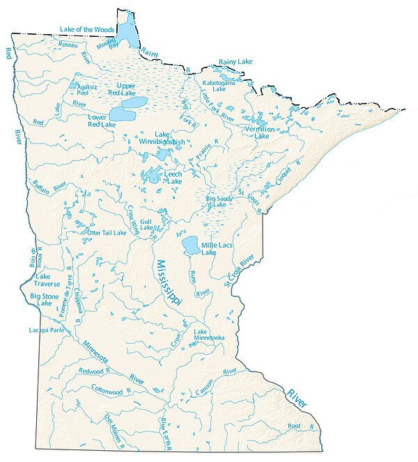
Topographic map of Minnesota streams, lakes and rivers in blue
 Bois de Sioux River below Lake Traverse dam. Roberts County, South Dakota is at left, and Traverse County, Minnesota is at right.
 Buffalo River in Buffalo River State Park
 Cannon River in Northfield
 Cedar River near Austin, Minnesota
 Clearwater River (Mississippi River tributary)
 Cobb River in Blue Earth County
 Cottonwood River in Flandrau State Park
 Crow Wing River in Oylen, Wadena County, Minnesota
 Embarrass River in Winter
 Le Sueur River near Red Jacket trail
 Little Cannon River near Sogn, Minnesota
 Minnesota River Mendota Heights bridge
 Mississippi River source at Lake Itasca
 Mississippi River and Minnesota River confluence near Fort Snelling State Park
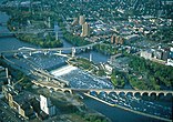 Mississippi River at St. Anthony Falls in Minneapolis
 Mustinka River straightened and re-routed section in Redpath Township of Traverse County
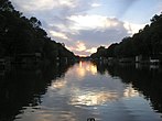 Otter Tail River and sunset near Otter Tail Lake and Ottertail, Minnesota
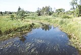 Partridge River at Bartlett Township, Todd County, Minnesota
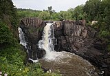 Pigeon River High Falls at Grand Portage State Park
 Red River of the North as viewed from Fargo, North Dakota
 Rum River in Princeton, Minnesota
 St. Croix River viewed in Wisconsin
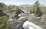 St. Louis River at Thomson, Minnesota
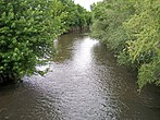 Straight River near Owatonna, Minnesota
 Vermilion River in St. Louis County