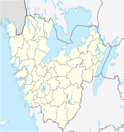
| Mölnlycke | |
|---|---|
 Central Mölnlycke Central Mölnlycke | |
  | |
| Coordinates: 57°40′N 12°07′E / 57.667°N 12.117°E / 57.667; 12.117 | |
| Country | Sweden |
| Province | Västergötland |
| County | Västra Götaland County |
| Municipality | Härryda Municipality and Mölndal Municipality |
| Area | |
| • Total | 8.10 km (3.13 sq mi) |
| Population | |
| • Total | 18,392 |
| • Density | 2,300/km (5,900/sq mi) |
| Time zone | UTC+1 (CET) |
| • Summer (DST) | UTC+2 (CEST) |
Mölnlycke is a small town nearby Greater Gothenburg, a locality and the seat of Härryda Municipality, Västra Götaland County, Sweden. It had 17,499 inhabitants in 2019. The urban area stretches over two municipalities. Mölndal Municipality is the second.
| Municipality | Population | Other urban areas |
Other | Total | % of municipality population |
|---|---|---|---|---|---|
| Härryda | 13,585 | 12,262 | 4,429 | 30,276 | 44.87 |
| Mölndal | 90 | 53,389 | 2,658 | 56,137 | 0.16 |
| Total | 13,675 | 65,651 | 7,087 | 86,413 | 15.83 |
History
The first people to settle in the area that would later become Mölnlycke came there during the Stone Age. At this time there were five lakes, which today are formed into one single lake. The lake shore is one of the places where many ancient remains have been found. It is speculated that when people learned to farm, this population moved out of the region to an area better for farming. The next known human settlement was during the Middle Ages, and this is also when the first Råda Church was built. During the Middle Ages, the border with Denmark went through what is today Mölnlycke and therefore the area was much affected by war between Denmark and Sweden.
The first time the name Mölnlycke was mentioned that we know of was 1576. The name was originally made up of the two Old Swedish words “mölna” and “lycka”, literally meaning mill field. It probably came from a mill built at the location of today's Mölnlycke Fabriker during the Middle Ages.
In 1849, Gustaf Ferdinand Hennig founded Mölnlycke Väfveri AB, a textile manufacturer, which has had a big impact on Mölnlycke. In addition to attracting many workers to the city, it also led to the building of the railway between Gothenburg and Borås, which today still has a stop in Mölnlycke. Today the company is called Mölnlycke Health Care.
Geography
Mölnlycke is located at a height of 91 meters above sea level and is about 10 km from Gothenburg, the second largest city in Sweden. The short distance to Gothenburg is probably one of the factors of the quick expansion of the city that started during the 20th century, when many people started commuting between Mölnlycke and Gothenburg.
Culture
Mölnlycke Kulturhus, located in the center of Mölnlycke, contains Mölnlycke library, a cinema and a café.


References
- "Tätorternas landareal, folkmängd och invånare per km 2005 och 2010" (in Swedish). Statistics Sweden. 14 December 2011. Archived from the original on 27 January 2012. Retrieved 10 January 2012.
- "Statistiska tätorter 2020, befolkning, landareal, befolkningstäthet". Statistics Sweden. 31 December 2020. Retrieved 2 June 2024.
- "Statistik invånare - Härryda kommun". www.harryda.se (in Swedish). Retrieved 2020-06-15.
- ^ Korn, Dan (1983). Mölnlyckeboken - Ett samhälles historia genom tvåhundra år. pp. 6, 12, 51.
- "Trakten.se". Archived from the original on 2013-12-07. Retrieved 2013-12-12.
- "Nationalencyklopedin". Retrieved 2007-12-12.
- "Härryda.se". Archived from the original on 2013-04-18. Retrieved 2008-12-12.
| Localities in Härryda Municipality, Västra Götaland County, Sweden | |
|---|---|
| Localities |
|
| Localities in Mölndal Municipality, Västra Götaland County, Sweden | |
|---|---|
| Localities |
|