| This article relies largely or entirely on a single source. Relevant discussion may be found on the talk page. Please help improve this article by introducing citations to additional sources. Find sources: "Majengo, Mombasa" – news · newspapers · books · scholar · JSTOR (May 2024) |
| Majengo | |
|---|---|
 | |
 | |
| Coordinates: 4°2′55″S 39°40′14″E / 4.04861°S 39.67056°E / -4.04861; 39.67056 | |
| Country | |
| County | Mombasa County |
| Population | |
| • Total | 38,800 (est.) |
| Time zone | UTC+3 (EAT) |
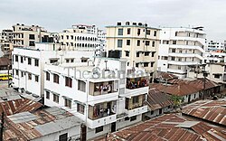
Majengo is a ward of Mombasa city, Kenya, located on Mombasa Island. It is estimated to have a population of 38,800 in 2011.
It is divided between in the Kisauni and Mvita electoral constituencies.
References
- "INDEPENDENT ELECTORAL AND BOUNDARIES COMMISSION ACT – No. 9" (PDF). Kenya National Council for Law Reporting (revised ed.). 2012. p. 34-35. Archived (PDF) from the original on 26 April 2022. Retrieved 12 May 2024.
| Mombasa | |
|---|---|
| Main topics | |
| Geography | |
This Coast Province location article is a stub. You can help Misplaced Pages by expanding it. |