| This article needs additional citations for verification. Please help improve this article by adding citations to reliable sources. Unsourced material may be challenged and removed. Find sources: "Meenuliyan Para" – news · newspapers · books · scholar · JSTOR (December 2012) (Learn how and when to remove this message) |
| Meenuliyanpara | |
|---|---|
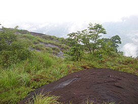
 View from top of Meenuliyanpara View from top of Meenuliyanpara | |
| Highest point | |
| Elevation | 1,220 m (4,000 ft) |
| Coordinates | 10°00′08″N 76°51′34″E / 10.002335°N 76.859363°E / 10.002335; 76.859363 |
| Geography | |
 | |
| Parent range | Western Ghats |
| Climbing | |
| Easiest route | Hike |
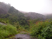
Meenuliyan Para is a prominent mountain peak located near Thodupuzha in the Idukki district of Kerala, India. Characterized by a massive rock formation that rises over 4000 feet, the mountain is named for the fish-scale appearance of its rocky surface. The peak hosts approximately two acres of evergreen forest at its summit.
Situated around 47 kilometers from Muvattupuzha and 51 kilometers from Thodupuzha, Meenuliyan Para is accessible only by a 3 kilometer pedestrian trail starting from Pattayakkudy in Vannappuram Panchayat. Clear weather offers expansive views of the surrounding landscape, including the Periyar region, Bhoothathankettu dam, and parts of Ernakulam and Thrissur districts.

References
- "Archived copy" (PDF). Archived from the original (PDF) on 11 February 2014. Retrieved 4 January 2012.
{{cite web}}: CS1 maint: archived copy as title (link)