| Mimess ميمس | |
|---|---|
| Municipality | |
 | |
| Coordinates: 33°25′11″N 35°42′51″E / 33.41972°N 35.71417°E / 33.41972; 35.71417 | |
| Country | |
| Governorate | Nabatieh Governorate |
| District | Hasbaya District |
| Elevation | 800 m (2,600 ft) |
| Time zone | UTC+2 (EET) |
| • Summer (DST) | UTC+3 (EEST) |
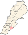
Mimess (Arabic: ميمس) is a municipality the Hasbaya District in Lebanon.
History
In 1838, during the Ottoman era, Eli Smith noted the population of Mimis as being Druze and "Greek" Christians.
In 1875 Victor Guérin noted: "At nine hours fifteen minutes, I crossed the Wadi Mimas, which leads to the Wadi et-Teim. Beyond, to the north, rises, on a hill, the village of the same name. It is inhabited by Druses and schismatic Greeks. Some ruins on a mound next to this village, on the west side, are called Kharbet Ras A'ly".
Demographics
In 2014 Druze made up 82.14% and Christians made up 16.25% of registered voters in Mimess. 13.93% of the voters were Greek Orthodox.
References
- Robinson and Smith, 1841, vol 3, 2nd appendix, p. 138
- Guérin, 1880, p. 299
- https://lub-anan.com/المحافظات/النبطية/حاصبيا/ميمس/المذاهب/
Bibliography
- Guérin, V. (1880). Description Géographique Historique et Archéologique de la Palestine (in French). Vol. 3: Galilee, pt. 2. Paris: L'Imprimerie Nationale.
- Robinson, E.; Smith, E. (1841). Biblical Researches in Palestine, Mount Sinai and Arabia Petraea: A Journal of Travels in the year 1838. Vol. 3. Boston: Crocker & Brewster.
External links
- Mimess, Localiban
| Capital | Hasbaya |  |
|---|---|---|
| Towns and villages | ||
| Other | ||