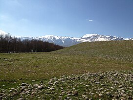
| Munzur Mountains | |
|---|---|
 Munzur Mountains from Ovacık Munzur Mountains from Ovacık | |
| Highest point | |
| Elevation | 3,300 m (10,800 ft) |
| Coordinates | 39°26′42″N 39°02′02″E / 39.445°N 39.034°E / 39.445; 39.034 |
| Geography | |
 | |
| Location | Tunceli Province, Erzincan Province, Bingöl Province, Turkey |
Munzur Mountains (Turkish: Munzur Dağları), is a mountain range in Eastern Anatolia Region, Turkey. It is located on the border of Tunceli and Erzincan provinces. There is Munzur Valley National Park in the Munzur Mountains.
Geology and geomorphology
Munzur Mountains covers the south of Erzincan and the north of Tunceli and ends on the Bingöl Provincial border. The steep walls that do not give passages other than the valleys opened by the streams continue until the peaks of the area. Lake Karagöl is one of the main lakes in the Munzur Mountains. Others are Lake Çinili and Lake Baraların.
References
- "Mercan (Munzur) Dağları" (PDF). dogadernegi.org. Doğa Derneği. p. 1.
- "Munzur Dağları'ndaki Karagöl, doğal güzelliğiyle doğaseverleri ağırlıyor". aa.com.tr (in Turkish). Retrieved 2022-08-02.
- "Ovacık Ovası (Tunceli) ve çevresinin jeomorfolojisi" (in Turkish). Istanbul University, Sosyal Bilimler Enstitüsü, Coğrafya Anabilim Dalı. 2006. p. 40.
This article about an Eastern Anatolia Region of Turkey location is a stub. You can help Misplaced Pages by expanding it. |