| This article is an orphan, as no other articles link to it. Please introduce links to this page from related articles; try the Find link tool for suggestions. (August 2024) |
| Mwanda Peak | |
|---|---|
 | |
| Highest point | |
| Elevation | 2,148 m (7,047 ft) |
| Coordinates | 10°42′18″S 33°34′03″E / 10.70500°S 33.56750°E / -10.70500; 33.56750 |
| Geography | |
| Location | Zambia |
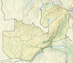
Mwanda Peak is the highest topographical point in the border of Zambia. It is located near the border with Malawi in the thin northeastern arm of Eastern Province, and sits in the Nyika Plateau.
External links
This Zambia location article is a stub. You can help Misplaced Pages by expanding it. |