| Noppenspitze | |
|---|---|
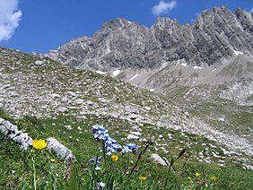
 Alpine flowers in front of the Noppenspitze's southwestern flank Alpine flowers in front of the Noppenspitze's southwestern flank | |
| Highest point | |
| Elevation | 2,594 m (AA) (8,510 ft) |
| Prominence | 124 m ↓ Col between the Sattelkarspitze & Wolekleskarspitze |
| Isolation | 1.7 km → Bretterspitze |
| Coordinates | 47°19′33″N 10°26′28″E / 47.32583°N 10.44111°E / 47.32583; 10.44111 |
| Geography | |
 | |
| Parent range | Hornbach chain, Allgäu Alps |
| Geology | |
| Rock type | main dolomite |
| Climbing | |
| First ascent | 16 August 1890 Anton Spiehler and Johann Schiffer |
The Noppenspitze is a rocky summit, 2,594 metres high, in the central part of the Hornbach chain of the Allgäu Alps.
Location and surroundings
The mountain's southeastern arête, with its jagged teeth and rock slabs, separates the cirques of the Sattelkar and Noppenkar and forks behind the Luxnach Saddle where the grassy ridge of the Häselgehrberg branches off. To the north a steep rock face drops 300 metres into the dark, wooded Hornbach valley.
First ascent
The Noppenspitze was first climbed on 16 August 1890 by Anton Spiehler and his guide, Johann Schiffer. Approaching the main crest of the Hornbach chain from the Noppenkar to the south, the two mountaineers crossed below the wild precipices to the north and completed their ascent to the summit from that direction.
Ascent
The Noppenspitze is a rarely climbed mountain. According to the summit book in 2006, it was only being climbed about 5 - 15 times per year. In order to reach the highest point, a long approach and a climb through 1,500 metres of height is required. In addition, there are no tracks or paths to the summit and it requires sure-footedness and a head for heights as well as a good sense of direction in the trackless and confusing terrain. The technical climbing required on the normal route up the southwest flank is assessed as UIAA grade II.
Gallery
-
 The Noppenspitze from the Sattelkar betrachtet
-
 Typical terrain on the southwest flank
-
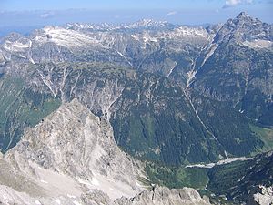
 View looking north from the top. Far right: the Hochvogel
Literature
- Dieter Seibert: Alpenvereinsführer Allgäuer und Ammergauer Alpen, 16th edition, Rother Bergverlag, 2004, ISBN 3-7633-1126-2
- Die Erschließung der Ostalpen, 1. Band, Die Nördlichen Kalkalpen, Verlag des Deutschen und Österreichischen Alpenvereins, Berlin, 1893
External links
 Media related to Noppenspitze at Wikimedia Commons