| Opogodo | |
|---|---|
  | |
| Coordinates: 5°2′59.6616″N 76°39′0.6012″W / 5.049906000°N 76.650167000°W / 5.049906000; -76.650167000 | |
| Country | |
| Department | Chocó |
| Municipality | Condoto Municipality |
| Elevation | 230 ft (70 m) |
| Time zone | UTC-5 (Colombia Standard Time) |
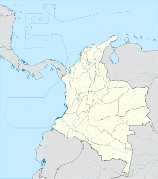
Opogodo is a village in Condoto Municipality, Chocó Department in Colombia.
Climate
Opogodo has an extremely wet tropical rainforest climate (Af).
| Climate data for Opogodo | |||||||||||||
|---|---|---|---|---|---|---|---|---|---|---|---|---|---|
| Month | Jan | Feb | Mar | Apr | May | Jun | Jul | Aug | Sep | Oct | Nov | Dec | Year |
| Mean daily maximum °C (°F) | 29.9 (85.8) |
29.8 (85.6) |
30.5 (86.9) |
30.3 (86.5) |
30.4 (86.7) |
30.2 (86.4) |
30.5 (86.9) |
30.5 (86.9) |
30.2 (86.4) |
29.7 (85.5) |
29.3 (84.7) |
29.6 (85.3) |
30.1 (86.1) |
| Daily mean °C (°F) | 26.7 (80.1) |
26.5 (79.7) |
27.0 (80.6) |
27.0 (80.6) |
27.0 (80.6) |
26.8 (80.2) |
26.9 (80.4) |
26.9 (80.4) |
26.7 (80.1) |
26.4 (79.5) |
26.2 (79.2) |
26.5 (79.7) |
26.7 (80.1) |
| Mean daily minimum °C (°F) | 23.5 (74.3) |
23.3 (73.9) |
23.6 (74.5) |
23.7 (74.7) |
23.6 (74.5) |
23.4 (74.1) |
23.4 (74.1) |
23.3 (73.9) |
23.3 (73.9) |
23.2 (73.8) |
23.2 (73.8) |
23.4 (74.1) |
23.4 (74.1) |
| Average rainfall mm (inches) | 654.9 (25.78) |
621.8 (24.48) |
611.3 (24.07) |
764.6 (30.10) |
809.2 (31.86) |
622.9 (24.52) |
677.2 (26.66) |
759.5 (29.90) |
683.7 (26.92) |
724.4 (28.52) |
654.6 (25.77) |
624.5 (24.59) |
8,208.6 (323.17) |
| Average rainy days | 16 | 14 | 16 | 17 | 17 | 16 | 18 | 18 | 17 | 17 | 17 | 16 | 199 |
| Source: | |||||||||||||
References
- "Data". www.ideam.gov.co. Retrieved 2020-06-26.
This Department of Chocó location article is a stub. You can help Misplaced Pages by expanding it. |