You can help expand this article with text translated from the corresponding article in Greek. (January 2021) Click for important translation instructions.
|
| This article needs additional citations for verification. Please help improve this article by adding citations to reliable sources. Unsourced material may be challenged and removed. Find sources: "Panayias Evaggelistrias" Kato Polemidia – news · newspapers · books · scholar · JSTOR (January 2021) (Learn how and when to remove this message) |
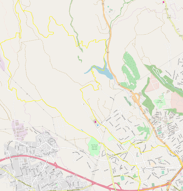
Panagias Evangelistrias is a district of the municipality of Kato Polemidia in Cyprus.
Location
To the south it borders with Apostolos Barnabas, to the southeast with Makarios III, to the east with Agia Fyla, to the north with Pano Polemidia and Palodia, and to the west with Ypsonas and Agios Nikolaos.

Government buildings
The Limassol General Hospital, the public hospital of Limassol that is divided in 2 different places in Limassol, is located in Panayia Evangelistria district of Kato Polemidia.
Religious sites
The sanctuary of the district is dedicated to the Virgin Mary. Construction began in 1908 and was completed in 1959. The inauguration took place in 1963. In Panagia Evangelistria area the Limassol General Hospital is located, the public hospital of Limassol.
References
- "Δήμος Κάτω Πολεμιδιών - Κοινοτάρχες". archive.is. 13 July 2018. Archived from the original on 13 July 2018. Retrieved 11 January 2021.
- Official Paphlet of Polemidia Municipality (1 July 2018). "Official Paphlet of Polemidia Municipality citing Panayia Evangelistria as one of the six sub-divisions of the municipality. Page 32 in the paphlet". Archived from the original on 1 July 2018. Retrieved 11 January 2021.
- Official Website of Limassol State Hospital, Showing Location Map inside Evangelistria Kato Polemidia (13 January 2021). "Evangelistrias Kato Polemidia". State Health Services Organisation (in Greek). Retrieved 12 January 2021.
- "Αψίδα | Church of Panayia Evaggelistria in Polemidia". archive.vn. 13 July 2018. Archived from the original on 13 July 2018. Retrieved 11 January 2021.
34°41′38″N 33°00′13″E / 34.69389°N 33.00361°E / 34.69389; 33.00361
Categories: