| Pic Verdaguer | |
|---|---|
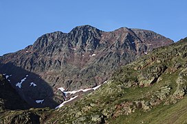
 Pic Verdaguer (left), Pica d'Estats (middle), Punta Gabarró (right) Pic Verdaguer (left), Pica d'Estats (middle), Punta Gabarró (right) | |
| Highest point | |
| Elevation | 3,129 m (10,266 ft) |
| Parent peak | Pica d'Estats (3143 m) |
| Listing | |
| Coordinates | 42°40′5.02″N 1°23′48.98″E / 42.6680611°N 1.3969389°E / 42.6680611; 1.3969389 |
| Geography | |
 | |
| Location | Ariège, France Pallars Sobirà, Spain |
| Protected area | Alt Pirineu Natural Park |
| Parent range | Montcalm Massif, Pyrenees |
| Geology | |
| Mountain type | Granite |
| Climbing | |
| First ascent | Unknown |
| Easiest route | From Vallferrera, Alins |
Pic Verdaguer or Pic de Verdaguer is a mountain of the Montcalm Massif. Located in the Pyrenees, at the border between France and Spain, it has an altitude of 3,129 metres (10,266 ft) above sea level.
This mountain is included in the Alt Pirineu Natural Park together with Pica d'Estats and Punta Gabarró.
References
- "Topographic map of Pic Verdaguer". opentopomap.org. Retrieved 2023-07-03.
- "Topographic maps of Catalonia". Institut Cartogràfic de Catalunya. Retrieved May 22, 2010.
External links
 Media related to Pic Verdaguer at Wikimedia Commons
- Pica d'Estats route through Canalbona. Includes Pic Verdaguer
This article about a location in Catalonia is a stub. You can help Misplaced Pages by expanding it. |
This Ariège geographical article is a stub. You can help Misplaced Pages by expanding it. |