Unincorporated community in Missouri, United States
| Richwoods, Missouri | |
|---|---|
| Unincorporated community | |
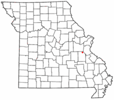
 Location of Richwoods, Missouri Location of Richwoods, Missouri | |
| Coordinates: 38°09′37″N 90°49′41″W / 38.16028°N 90.82806°W / 38.16028; -90.82806 | |
| Country | United States |
| State | Missouri |
| County | Washington |
| Settled | 1830 |
| Elevation | 810 ft (250 m) |
| ZIP code | 63071 |
| Area code | 573 |
| GNIS feature ID | 725284 |
Richwoods is an unincorporated community in northeastern Washington County, Missouri, United States. It is located on Missouri Route A one mile east of Missouri Route 47, approximately 15 miles west of De Soto and 19 miles south of St. Clair.
History
The first settlement at Richwoods was made ca. 1830. The community was named for the dense forest near the original town site. A post office has been in operation at Richwoods since 1832.

Education
The Richwoods area is served by the Richwoods School District (R-7). They offer pre-school and kindergarten through eighth grade. After the completion of the eighth grade, students may choose to attend high schools in the following areas: Potosi, Grandview, Kingston, DeSoto, St. Clair, or Sullivan.
Churches and cemeteries
- The Book of Acts Church
- Church Apostolic
- Richwoods 1st Free Will Baptist Church
- Cross Roads Baptist Church
- The Way of Life Tabernacle
- Horine Methodist church and cemetery
The St. Stephen Catholic Church parish and cemetery was established in 1841. St. Stephen Cemetery is located behind the church and rectory.
References
- ^ U.S. Geological Survey Geographic Names Information System: Richwoods, Missouri
- Richwoods, MO, 7.5 Minute Topographic Quadrangle, USGS, 1981
- "Washington County Place Names, 1928–1945". The State Historical Society of Missouri. Archived from the original on June 24, 2016. Retrieved December 30, 2016.
- Eaton, David Wolfe (1918). How Missouri Counties, Towns and Streams Were Named. The State Historical Society of Missouri. p. 370.
- "Post Offices". Jim Forte Postal History. Retrieved December 30, 2016.
- "Richwoods School District-Home of the Wildcats". Archived from the original on August 29, 2007. Retrieved September 30, 2007.
- http://www.mogenweb.org/washington/cemetery/horine.html
- "St. Stephen Church Richwoods". Archived from the original on July 28, 2011. Retrieved May 10, 2010.
External links
- Richwoods R-7 School District
- Richwoods Fire Protection District
- Bear Cove Enterprises
- St. Stephen Catholic Church
| Greater St. Louis | ||
|---|---|---|
| Topics |  | |
| Central city | ||
| Largest cities (over 50,000 in 2020) | ||
| Medium-sized cities (over 20,000 in 2020) | ||
| Largest towns and villages (over 10,000 in 2020) |
| |
| Missouri counties | ||
| Illinois counties | ||
| Subregions | ||
| Municipalities and communities of Washington County, Missouri, United States | ||
|---|---|---|
| County seat: Potosi | ||
| Cities |  | |
| Villages | ||
| Townships | ||
| Unincorporated communities |
| |
| Ghost towns | ||
| Footnotes | ‡This populated place also has portions in an adjacent county or counties | |