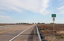
| Rush Creek | |
|---|---|
| Physical characteristics | |
| Source | |
| • location | Confluence of North Rush Creek and South Rush Creek |
| • coordinates | 38°48′06″N 103°27′02″W / 38.80167°N 103.45056°W / 38.80167; -103.45056 |
| Mouth | |
| • location | Confluence with Big Sandy Creek |
| • coordinates | 38°22′02″N 102°31′39″W / 38.36722°N 102.52750°W / 38.36722; -102.52750 |
| • elevation | 3,796 ft (1,157 m) |
| Basin size | 1,378 sq mi (3,570 km) |
| Basin features | |
| Progression | Big Sandy Creek— Arkansas—Mississippi |
Rush Creek is a 102-mile-long (164 km) tributary of Big Sandy Creek in Colorado. It starts at the confluence of South Rush Creek and North Rush Creek in Lincoln County. The creek flows through Cheyenne County before joining Big Sandy Creek in Kiowa County.

See also
References
- "Rush Creek". Geographic Names Information System. United States Geological Survey, United States Department of the Interior. Retrieved 2011-02-03.
- U.S. Geological Survey. National Hydrography Dataset high-resolution flowline data. The National Map, accessed March 31, 2011
This article related to a river in Colorado is a stub. You can help Misplaced Pages by expanding it. |