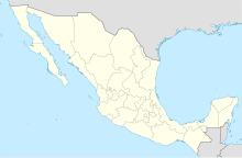
| San Ignacio Airfield Aeropuerto de San Ignacio | |||||||||||
|---|---|---|---|---|---|---|---|---|---|---|---|
| Summary | |||||||||||
| Airport type | Public | ||||||||||
| Serves | San Ignacio, Municipality of Mulegé, Baja California Sur, Mexico | ||||||||||
| Elevation AMSL | 244 m / 801 ft | ||||||||||
| Coordinates | 27°17′49″N 112°56′19″W / 27.29694°N 112.93861°W / 27.29694; -112.93861 | ||||||||||
| Map | |||||||||||
 | |||||||||||
| Runways | |||||||||||
| |||||||||||
| Source: GCM, STV. | |||||||||||
San Ignacio Airfield (IATA: SGM) (Spanish: Aeropuerto de San Ignacio) is a public paved airstrip located 4 kilometres (2.5 mi) northwest of San Ignacio, Municipality of Mulegé, Baja California Sur, Mexico. The airport is used solely for general aviation purposes. It is usually open during the whale watching season.
References
- Airport information for SGM at Great Circle Mapper.
- Airport information for San Ignacio Airfield at Transport Search website.
External links
This article about a Mexican airport is a stub. You can help Misplaced Pages by expanding it. |