| Schandorf Čemba | |
|---|---|
| Municipality | |
 Schandorf panoramic view Schandorf panoramic view | |
 Coat of arms Coat of arms | |
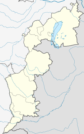
 Location within Oberwart district Location within Oberwart district | |
  | |
| Coordinates: 47°15′N 16°25′E / 47.250°N 16.417°E / 47.250; 16.417 | |
| Country | Austria |
| State | Burgenland |
| District | Oberwart |
| Government | |
| • Mayor | Josef Csencsics |
| Area | |
| • Total | 11.26 km (4.35 sq mi) |
| Elevation | 260 m (850 ft) |
| Population | |
| • Total | 276 |
| • Density | 25/km (63/sq mi) |
| Time zone | UTC+1 (CET) |
| • Summer (DST) | UTC+2 (CEST) |
| Postal code | 7472 |
| Website | www.schandorf.at |
Schandorf (Croatian: Čemba, Hungarian: Csém) is a village in the district of Oberwart in Burgenland in southeastern Austria.
History
The earliest record of the village's existence dates to 1244. In the first half of the 16th century, the region was devastated by attacking Turkish troops, and villages were depopulated. The Hungarian magnate Franz Batthyány arranged for Schandorf and other villages to be repopulated by immigrants from Croatia, and for centuries, the village was an island of Croatian language and culture, surrounded by speakers of Hungarian and German. A dialect of Croatian unique to the village gradually evolved, rich in loanword vocabulary from Hungarian. With ever-increasing outmigration and cosmopolitan influence of German, this dialect is today endangered.
For centuries the village was part of Hungary. Following the First World War, with the breakup of the old Austrian Empire, the division of the land between the new nation states of Austria and Hungary was accompanied by turmoil; for details, see "Burgenland". The final establishment of the boundary in 1921 had the unfortunate effect of separating Schandorf from nearby Croatian-speaking communities, which remained part of Hungary. The separation became extreme after the Second World War, when the Iron Curtain descended blocking almost all passage across the border. This would have been a particularly salient fact of life for residents of Schandorf, whose outskirts lie only about 400 metres (1,310 ft) from Hungarian territory.
Schandorf has not prospered in recent times; lack of economic opportunity has led to outmigration, particularly to the United States and Canada. Between 1900 and 2005 the population declined from 720 to 297. Municipal government was suspended in 1972, but restored in 1996.
Population
| Year | Pop. | ±% |
|---|---|---|
| 1869 | 641 | — |
| 1880 | 697 | +8.7% |
| 1890 | 670 | −3.9% |
| 1900 | 724 | +8.1% |
| 1910 | 719 | −0.7% |
| 1923 | 638 | −11.3% |
| 1934 | 624 | −2.2% |
| 1939 | 562 | −9.9% |
| 1951 | 536 | −4.6% |
| 1961 | 448 | −16.4% |
| 1971 | 409 | −8.7% |
| 1981 | 392 | −4.2% |
| 1991 | 342 | −12.8% |
| 2001 | 310 | −9.4% |
| 2011 | 299 | −3.5% |
Culture
Schandorf is the home of a tamburrizza orchestra, a reflection of its Croatian ethnic heritage. (The tamburizza is a traditional folk instrument, widely played in Croatia.) The orchestra performs frequently, often outside the village.
References
- "Dauersiedlungsraum der Gemeinden Politischen Bezirke und Bundesländer - Gebietsstand 1.1.2018". Statistics Austria. Retrieved 10 March 2019.
- "Einwohnerzahl 1.1.2018 nach Gemeinden mit Status, Gebietsstand 1.1.2018". Statistics Austria. Retrieved 9 March 2019.
- "Geschichte" ("History"), Schandorf.at, 2010, web: SDhist Archived 2009-05-12 at the Wayback Machine.
- "Kroaten", Schandorf.at, 2010, web: SD-kr Archived 2009-05-12 at the Wayback Machine
- ^ "Urspruenge", Schandorf.at, 2010, web: SD-ur.
- Source: Google maps
- "Tamburizza", Schandorf.at, 2010, web: SD-verein Archived 2009-06-29 at the Wayback Machine
External links
- www.schandorf.at - town website (in German/Croatian)
This Burgenland location article is a stub. You can help Misplaced Pages by expanding it. |