| Skhodnya | |
|---|---|
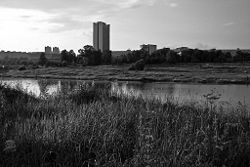
 Skhodnya River in Zelenograd (Large City Pond) Skhodnya River in Zelenograd (Large City Pond) | |
| Native name | Сходня (Russian) |
| Location | |
| Country | Russia |
| Physical characteristics | |
| Mouth | Moskva |
| • coordinates | 55°49′24″N 37°24′44″E / 55.8234°N 37.4122°E / 55.8234; 37.4122 |
| Length | 47 km (29 mi) |
| Basin size | 255 km (98 sq mi) |
| Basin features | |
| Progression | Moskva→ Oka→ Volga→ Caspian Sea |
The Skhodnya (Russian: Сходня, IPA: [ˈsxodʲnʲə]) is a river in the northwest of Moscow and Moscow Oblast, Russia. It is the second-largest tributary of the Moskva, after the Yauza. It is 47 kilometres (29 mi) long (of which 5 km in Moscow proper), and has a drainage basin of 255 square kilometres (98 sq mi). The Skhodnya originates near the village of Alabushevo (part of Zelenograd) and flows into the Moskva River near the Tushino Airfield. The Skhodnya is connected with a derivational canal, which supplies water from the Volga through the Khimki Reservoir [ru] (with the help of the Skhodnenskaya hydroelectric plant) to Moscow for sanitary irrigation.
Gallery
References
- «Река СХОДНЯ», Russian State Water Registry
This Moscow location article is a stub. You can help Misplaced Pages by expanding it. |
This article related to a river in Russia is a stub. You can help Misplaced Pages by expanding it. |


