| Slivnica pri Mariboru | |
|---|---|
 | |
 | |
| Coordinates: 46°28′28.93″N 15°39′16.76″E / 46.4747028°N 15.6546556°E / 46.4747028; 15.6546556 | |
| Country | |
| Traditional region | Styria |
| Statistical region | Drava |
| Municipality | Hoče–Slivnica |
| Area | |
| • Total | 3.28 km (1.27 sq mi) |
| Elevation | 279 m (915 ft) |
| Population | |
| • Total | 460 |
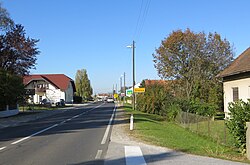
Slivnica pri Mariboru (pronounced [ˈslíːwnitsa pɾi ˈmáːɾibɔɾu]) is a settlement in the Municipality of Hoče–Slivnica in northeastern Slovenia. It lies under the eastern Pohorje Hills on the edge of the flatlands on the right bank of the Drava River south of Maribor. The A1 Motorway runs through the settlement and a major interchange with the A4 motorway is located just north of the settlement. The area is part of the traditional region of Lower Styria. The municipality is now included in the Drava Statistical Region.
The local parish church is dedicated to the Nativity of Mary (Slovene: Marijino Rojstvo) and belongs to the Roman Catholic Archdiocese of Maribor. It has a Romanesque nave dating to the 11th century and an early 16th-century Gothic sanctuary and belfry.
References
- Statistical Office of the Republic of Slovenia
- Hoče–Slivnica municipal site
- Slovenian Ministry of Culture register of national heritage reference number ešd 3372
External links
 Media related to Slivnica pri Mariboru at Wikimedia Commons
- Slivnica pri Mariboru on Geopedia
| Municipality of Hoče-Slivnica | ||
|---|---|---|
| Settlements | Administrative seat: Spodnje Hoče |  |
| Landmarks |
| |
This article about the Municipality of Hoče-Slivnica in Slovenia is a stub. You can help Misplaced Pages by expanding it. |