| This article does not cite any sources. Please help improve this article by adding citations to reliable sources. Unsourced material may be challenged and removed. Find sources: "Stratonis" castra – news · newspapers · books · scholar · JSTOR (May 2013) (Learn how and when to remove this message) |
| Stratonis | |
|---|---|
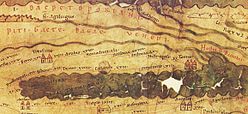
 In Tabula Peutingeriana In Tabula Peutingeriana | |
 | |
| Attested by | Tabula Peutingeriana |
| Place in the Roman world | |
| Province | Moesia |
| Administrative unit | Moesia Inferior |
| Directly connected to | |
| Location | |
| Coordinates | 44°01′31″N 28°39′08″E / 44.02526°N 28.65211°E / 44.02526; 28.65211 |
| Altitude | 22 m |
| Town | Tuzla |
| County | Constanța |
| Country | |
| Site notes | |
| Condition | Ruined |
Stratonis was a fort in the Roman province of Moesia. As Tabula Peutingeriana shows it is situated between Callatis and Tomis; 22 miles from Callatis and 12 miles from Tomis.
See also
External links
- Roman castra from Romania - Google Maps / Earth Archived 2012-12-05 at archive.today
Notes
This Dacia-related article is a stub. You can help Misplaced Pages by expanding it. |