| Sunnybrook State Park | |
|---|---|
 Madden Pond and surrounding wetlands in Connecticut's Sunny Brook State Park Madden Pond and surrounding wetlands in Connecticut's Sunny Brook State Park | |
  | |
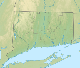
| Location | Torrington, Connecticut, United States |
| Coordinates | 41°50′09″N 73°07′13″W / 41.83583°N 73.12028°W / 41.83583; -73.12028 |
| Area | 464 acres (188 ha) |
| Elevation | 804 ft (245 m) |
| Established | 1970 |
| Administered by | Connecticut Department of Energy and Environmental Protection |
| Designation | Connecticut state park |
| Website | Official website |
Sunnybrook State Park is a public recreation area encompassing 464 acres (188 ha) in the town of Torrington, Connecticut. The state park is the southwestern terminus for the blue-blazed John Muir Trail which crosses Paugnut State Forest for two miles to the loop trail at Burr Pond State Park. Another park trail bears the name of former property owner Edwin Fadoir. In addition to hiking, the park offers picnicking, hunting, and fishing along the East Branch Naugatuck River. The park opened in 1970 and entered the state rolls in the 1971 edition of the Connecticut Register and Manual.
References
- ^ "East Branch Naugatuck River Reservoir". Geographic Names Information System. United States Geological Survey, United States Department of the Interior.
- ^ "Other State Parks and Forests". Connecticut Department of Energy and Environmental Protection. Retrieved August 2, 2024.
- "Paugnut State Forest: John Muir Trail" (PDF). Connecticut Department of Energy and Environmental Protection. Retrieved August 2, 2024.
- ^ Marteka, Peter (July 9, 2016). "The sunny disposition of a forgotten Torrington state park". Hartford Courant. Hartford, Conn. Retrieved October 12, 2017.
- "State Parks". State Register and Manual 1971. State of Connecticut. 1971. p. 200. Retrieved October 12, 2017.
External links
- Other State Parks and Forests Connecticut Department of Energy and Environmental Protection
- Sunnybrook State Park Map Connecticut Department of Energy and Environmental Protection
| Housatonic River Watershed | |||||
|---|---|---|---|---|---|
| Tributaries |
| ||||
| Lakes |
| ||||
| Lakes and ponds of Connecticut by drainage system | |||||||||||||||||||
|---|---|---|---|---|---|---|---|---|---|---|---|---|---|---|---|---|---|---|---|
| Lakes |
| ||||||||||||||||||
| Ponds |
| ||||||||||||||||||