| Surinam | |
|---|---|
| Village | |
 | |
| Coordinates: 20°30′50″S 57°30′40″E / 20.51389°S 57.51111°E / -20.51389; 57.51111 | |
| Country | |
| Districts | Savanne District |
| Elevation | 23 m (75 ft) |
| Population | |
| • Total | 10,507 |
| Time zone | UTC+4 (MUT) |
| Area code | 230 |
| ISO 3166 code | MU |
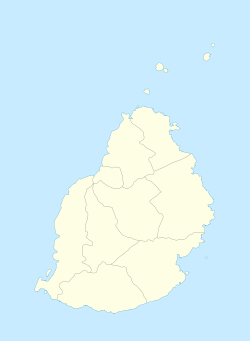
Surinam is a village located in the Savanne District of Mauritius. According to the 2011 census by Statistics Mauritius, the population was 10,507.
Nightingale College was a college in Surinam, Mauritius founded on 1 July 1964 by Seewooparsad Goolab. It was first located at Dr Sauzier's residence in Souillac. In 1965 it moved to L'Eglise St Jacques and in 1968 to a location near Souillac Hospital. It moved to Royal Road, Surinam in March 1970, where it remained until its takeover by the Ministry of Education.
See also
References
- ^ "Table G1 - Resident population by geographical location, whereabouts on census night and sex" (PDF). Statistics Mauritius. 2011: 1. Retrieved 8 September 2013.
{{cite journal}}: Cite journal requires|journal=(help)
This Mauritius location article is a stub. You can help Misplaced Pages by expanding it. |