| This article relies largely or entirely on a single source. Relevant discussion may be found on the talk page. Please help improve this article by introducing citations to additional sources. Find sources: "Tegla Kar" – news · newspapers · books · scholar · JSTOR (June 2015) |
| Tegla Kar | |
|---|---|
| Religion | |
| Affiliation | Tibetan Buddhism |
| Location | |
| Location | Burang County, Ngari Prefecture, Tibet, China |
| Country | China |
 | |
| Geographic coordinates | 30°17′34″N 81°10′34″E / 30.29278°N 81.17611°E / 30.29278; 81.17611 |
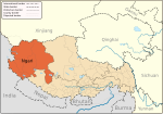
The Tegla Kar Dzong was a fort located on a cliff above the town of Burang (also called Taklakot) in Burang County, southwestern Tibet near the Nepalese border. It seems that the Tegla Kar was built during the Zhangzhung period which was conquered by the Tibetan King Songtsen Gampo in the beginning of 7th century. It became the main fort of the kingdom of Burang in the 10th century during the reign of King Kori. The kingdom disappeared during the 15th century. After the decline of the kingdom the Dzong was converted into a convent. Tegla Kar and the nearby Simbiling Monastery was completely destroyed by artillery in 1967 during the Chinese Cultural Revolution.
References
- Allen, Charles. (1999) The Search for Shangri-La: A Journey into Tibetan History, p. 55. Little, Brown and Company. Reprint: 2000 Abacus Books, London. ISBN 0-349-11142-1.
This Tibet-related article is a stub. You can help Misplaced Pages by expanding it. |
| Dzongs of Tibet | |
|---|---|
| Ngari Prefecture, Tibet | ||
|---|---|---|
| County-level divisions |  | |
| Towns and villages | ||
| Geography | ||
| Landmarks | ||
| Sciences | ||