(Redirected from Tetouan Province )
Province in the Moroccan region of Tanger-Tétouan-Al Hoceïma
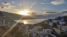
Tétouan (Arabic : تطوان) is a province in the Moroccan region of Tanger-Tétouan-Al Hoceïma . Its population in 2004 was 613,506.
The major cities and towns are:
Subdivisions
The province is divided administratively into the following:
Name
Geographic code
Type
Households
Population (2004)
Foreign population
Moroccan population
Notes
Oued Laou 571.01.07.
Municipality
1722
8383
5
8378
Tétouan 571.01.11.
Municipality
68821
320539
432
320107
Ain Lahsan 571.03.01.
Rural commune
1304
6552
0
6552
Bni Harchen 571.03.07.
Rural commune
1462
7646
0
7646
Jbel Lahbib 571.03.09.
Rural commune
818
4204
0
4204
1100 residents live in the center, called Karia ; 3104 residents live in rural areas.
Mallalienne 571.03.15.
Rural commune
1965
9970
1
9969
Saddina 571.03.17.
Rural commune
1265
6683
1
6682
Souk Kdim 571.03.19.
Rural commune
1378
7434
0
7434
Al Hamra 571.05.01.
Rural commune
1610
10156
0
10156
Al Khrroub 571.05.03.
Rural commune
570
3018
0
3018
Al Oued 571.05.05.
Rural commune
1719
11135
0
11135
Azla 571.05.07.
Rural commune
2364
12611
4
12607
Bghaghza 571.05.09.
Rural commune
1158
6457
0
6457
Bni Idder 571.05.11.
Rural commune
772
4620
0
4620
Bni Leit 571.05.13.
Rural commune
784
5364
0
5364
Bni Said 571.05.15.
Rural commune
1422
8219
0
8219
Dar Bni Karrich 571.05.17.
Rural commune
1351
6689
8
6681
4780 residents live in the center, called Dar Bni Karrich ; 1909 residents live in rural areas.
Oulad Ali Mansour 571.05.19.
Rural commune
828
5612
0
5612
Sahtryine 571.05.21.
Rural commune
1268
7402
0
7402
Zaitoune 571.05.23.
Rural commune
1595
8486
0
8486
Zaouiat Sidi Kacem 571.05.25.
Rural commune
1639
10495
0
10495
Zinat 571.05.27.
Rural commune
1120
6539
0
6539
References
"World Gazetteer: Tetouan - profile of geographical entity including n…" . World Gazetteer . Retrieved 3 January 2025."Recensement général de la population et de l'habitat de 2004" (PDF). Haut-commissariat au Plan, Lavieeco.com. Retrieved 27 April 2012.
35°34′00″N 5°22′00″W / 35.5667°N 5.3667°W / 35.5667; -5.3667
Categories :
Text is available under the Creative Commons Attribution-ShareAlike License. Additional terms may apply.
**DISCLAIMER** We are not affiliated with Wikipedia, and Cloudflare.
The information presented on this site is for general informational purposes only and does not constitute medical advice.
You should always have a personal consultation with a healthcare professional before making changes to your diet, medication, or exercise routine.
AI helps with the correspondence in our chat.
We participate in an affiliate program. If you buy something through a link, we may earn a commission 💕
↑
