| Valea Doftanei | |
|---|---|
| Commune | |
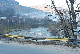
 The Doftana River in Teșila The Doftana River in Teșila | |
 Location in Prahova County Location in Prahova County | |
 | |
| Coordinates: 45°18′N 25°43′E / 45.300°N 25.717°E / 45.300; 25.717 | |
| Country | Romania |
| County | Prahova |
| Government | |
| • Mayor (2020–2024) | Lucian-Vileford Costea (PNL) |
| Area | 286.37 km (110.57 sq mi) |
| Population | 5,706 |
| • Density | 20/km (52/sq mi) |
| Time zone | EET/EEST (UTC+2/+3) |
| Postal code | 107640 |
| Vehicle reg. | PH |
| Website | www |
Valea Doftanei (Romanian for "Valley of the Doftana") is a commune in Prahova County, Muntenia, Romania. It is composed of two villages: Teșila (the commune centre) and Trăisteni.
The commune is located in the northern part of Prahova County, between the Prahova and Teleajen rivers, on the border with Brașov County. It has an area of 286.26 km (110.53 sq mi). Its population primarily inhabits the central and southern areas, with the north being taken up by mountainous terrain. The river Doftana flows through the commune for some 30 km (19 mi) from north to south before ending in the Paltinu Dam [ro] and reservoir.
Natives
- Ioan Apostol (born 1959), luger
- Gheorghe Vasile (born 1967), biathlete
References
- "Populaţia rezidentă după grupa de vârstă, pe județe și municipii, orașe, comune, la 1 decembrie 2021" (XLS). National Institute of Statistics.

This Prahova County location article is a stub. You can help Misplaced Pages by expanding it. |
